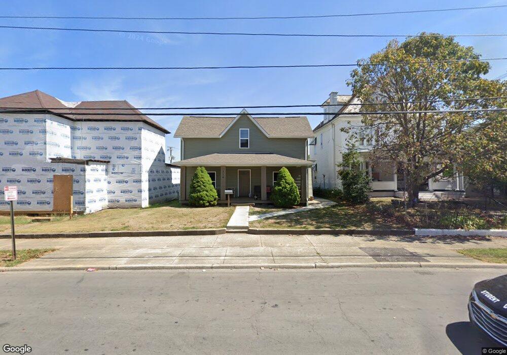
110 S Maple St Lancaster, OH 43130
Estimated Value: $189,000 - $278,000
3
Beds
2
Baths
2,389
Sq Ft
$97/Sq Ft
Est. Value
About This Home
This home is located at 110 S Maple St, Lancaster, OH 43130 and is currently estimated at $232,839, approximately $97 per square foot. 110 S Maple St is a home located in Fairfield County with nearby schools including Thomas Ewing Junior High School, Lancaster High School, and St Mary Elementary School.
Ownership History
Date
Name
Owned For
Owner Type
Purchase Details
Closed on
Mar 17, 2020
Sold by
Mccormick Michele and Lyons Jeffrey H
Bought by
The Creed Of Recovery Llc
Current Estimated Value
Home Financials for this Owner
Home Financials are based on the most recent Mortgage that was taken out on this home.
Original Mortgage
$40,000
Outstanding Balance
$35,048
Interest Rate
3.4%
Mortgage Type
Seller Take Back
Estimated Equity
$197,791
Purchase Details
Closed on
Oct 31, 2007
Sold by
Deutsche Bank National Trust Co
Bought by
Mccormick Michele
Home Financials for this Owner
Home Financials are based on the most recent Mortgage that was taken out on this home.
Original Mortgage
$45,000
Interest Rate
6.47%
Mortgage Type
Purchase Money Mortgage
Purchase Details
Closed on
Mar 23, 2007
Sold by
Cordle Frances L and Cordle Frances Lulu
Bought by
Deutsche Bank National Trust Co
Create a Home Valuation Report for This Property
The Home Valuation Report is an in-depth analysis detailing your home's value as well as a comparison with similar homes in the area
Home Values in the Area
Average Home Value in this Area
Purchase History
| Date | Buyer | Sale Price | Title Company |
|---|---|---|---|
| The Creed Of Recovery Llc | $80,000 | None Available | |
| Mccormick Michele | $50,000 | Attorney | |
| Deutsche Bank National Trust Co | $73,000 | None Available |
Source: Public Records
Mortgage History
| Date | Status | Borrower | Loan Amount |
|---|---|---|---|
| Open | The Creed Of Recovery Llc | $40,000 | |
| Previous Owner | Mccormick Michele | $45,000 |
Source: Public Records
Tax History
| Year | Tax Paid | Tax Assessment Tax Assessment Total Assessment is a certain percentage of the fair market value that is determined by local assessors to be the total taxable value of land and additions on the property. | Land | Improvement |
|---|---|---|---|---|
| 2025 | $5,083 | $85,810 | $18,820 | $66,990 |
| 2024 | $5,083 | $56,540 | $9,600 | $46,940 |
| 2023 | $2,107 | $56,720 | $9,600 | $47,120 |
| 2022 | $2,120 | $56,720 | $9,600 | $47,120 |
| 2021 | $1,816 | $45,550 | $9,600 | $35,950 |
| 2020 | $1,652 | $42,150 | $9,600 | $32,550 |
| 2019 | $1,741 | $42,150 | $9,600 | $32,550 |
| 2018 | $1,231 | $32,200 | $9,600 | $22,600 |
| 2017 | $1,232 | $32,930 | $11,230 | $21,700 |
| 2016 | $1,200 | $32,930 | $11,230 | $21,700 |
| 2015 | $1,232 | $32,810 | $11,230 | $21,580 |
| 2014 | $1,173 | $32,810 | $11,230 | $21,580 |
| 2013 | $1,173 | $32,810 | $11,230 | $21,580 |
Source: Public Records
Map
Nearby Homes
- 515 E Chestnut St
- 545 E Main St
- 534 E Wheeling St
- 342 E Chestnut St
- 414 E Walnut St
- 547 E Mulberry St
- 621 E Mulberry St
- 249 N Pearl Ave
- 154 E Main St
- 641 King St
- 517 N Maple St
- 846 E Main St
- 844 E Wheeling St
- 233 E 6th Ave
- 600 N High St
- 859 E Mulberry St
- 869 E Mulberry St
- 0 N Columbus St
- 311 E Allen St
- 736 E Allen St
- 114 S Maple St
- 106 S Maple St
- 510 E Main St
- 512 E Main St
- 502 E Main St
- 120 S Maple St
- 518 E Main St
- 109 S Maple St
- 124 S Maple St
- 115 S Maple St
- 444 E Main St
- 0 Us Highway 22 and 3
- 126 S Maple St
- 521 E Chestnut St
- 436 E Main St
- 501 E Main St
- 532 E Main St
- 123 S Maple St
- 531 E Chestnut St
- 127 S Maple St
Your Personal Tour Guide
Ask me questions while you tour the home.