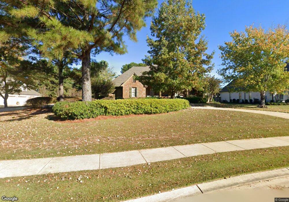
110 Wethersfield Dr Madison, MS 39110
Estimated Value: $636,837 - $1,029,000
Studio
--
Bath
5,462
Sq Ft
$149/Sq Ft
Est. Value
About This Home
This home is located at 110 Wethersfield Dr, Madison, MS 39110 and is currently estimated at $812,459, approximately $148 per square foot. 110 Wethersfield Dr is a home located in Madison County with nearby schools including Madison Avenue Upper Elementary School, Madison Avenue Elementary, and Madison Middle School.
Ownership History
Date
Name
Owned For
Owner Type
Purchase Details
Closed on
Feb 25, 2015
Sold by
Pettit Presley
Bought by
Pettit Melissa P
Current Estimated Value
Purchase Details
Closed on
Jun 29, 2007
Sold by
Pettit Builders Inc
Bought by
Pettit A Presley and Pettit Melissa P
Home Financials for this Owner
Home Financials are based on the most recent Mortgage that was taken out on this home.
Original Mortgage
$202,000
Outstanding Balance
$125,859
Interest Rate
6.62%
Mortgage Type
Purchase Money Mortgage
Estimated Equity
$686,600
Purchase Details
Closed on
Jan 8, 2007
Sold by
Ashton Park Llc
Bought by
Fettit Builders Inc
Create a Home Valuation Report for This Property
The Home Valuation Report is an in-depth analysis detailing your home's value as well as a comparison with similar homes in the area
Purchase History
| Date | Buyer | Sale Price | Title Company |
|---|---|---|---|
| Pettit Melissa P | -- | None Available | |
| Pettit A Presley | -- | None Available | |
| Fettit Builders Inc | -- | None Available |
Source: Public Records
Mortgage History
| Date | Status | Borrower | Loan Amount |
|---|---|---|---|
| Open | Pettit A Presley | $202,000 |
Source: Public Records
Tax History
| Year | Tax Paid | Tax Assessment Tax Assessment Total Assessment is a certain percentage of the fair market value that is determined by local assessors to be the total taxable value of land and additions on the property. | Land | Improvement |
|---|---|---|---|---|
| 2025 | $5,308 | $48,128 | $0 | $0 |
| 2024 | $5,308 | $48,128 | $0 | $0 |
| 2023 | $5,308 | $48,128 | $0 | $0 |
| 2022 | $5,308 | $48,128 | $0 | $0 |
| 2021 | $5,077 | $46,145 | $0 | $0 |
| 2020 | $5,114 | $46,464 | $0 | $0 |
| 2019 | $5,114 | $46,464 | $0 | $0 |
| 2018 | $5,114 | $46,464 | $0 | $0 |
| 2017 | $4,934 | $44,918 | $0 | $0 |
| 2016 | $4,934 | $44,918 | $0 | $0 |
| 2015 | $4,934 | $44,918 | $0 | $0 |
| 2014 | $5,246 | $47,596 | $0 | $0 |
Source: Public Records
Map
Nearby Homes
- 116 Carrington Dr
- 133 Oak Ridge Cir
- 112 Saddle Creek Cove
- 213 S Woodcreek Rd
- 116 Anna Cove
- 114 Anna Cove
- 101 Saddle Creek Cove
- 213 Ironwood Plantation Blvd
- 186 Ironwood Plantation Blvd
- 504 Ironwood Ct
- 441 W Oak Cir
- 268 Sundial Rd
- 106 Shadow Hill Dr
- 115 Shadow Hill Dr
- 133 Shadow Hill Dr
- 0 Cottesbrooke Cir Unit 4122984
- 102 Channel Ln
- 157 Quail Hollow
- 222 Trace Harbor Rd
- 202 Saint Pierre Cove
- 116 Wethersfield Dr
- 108 Wethersfield Dr
- 114 Wethersfield Dr
- 107 Wethersfield Dr
- 109 Wethersfield Dr
- 0 Wethersfield Dr Unit Lot 1
- 0 Wethersfield Dr Unit Lot 1 1179463
- 0 Wethersfield Dr Unit Lot 1 1188099
- 0 Wethersfield Dr Unit Lot 1 1179076
- 111 Wethersfield Dr
- 113 Wethersfield Dr
- 100 Winterbury Dr
- 104 Wethersfield Dr
- 102 Winterbury Dr
- 112 Winterbury Dr
- 114 Winterbury Dr
- 115 Wethersfield Dr
- 106 Winterbury Dr
- 134 Hart Place
- 116 Winterbury Dr
Your Personal Tour Guide
Ask me questions while you tour the home.