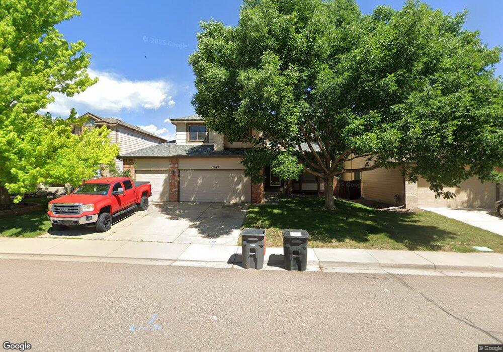
11047 W Roxbury Ave Littleton, CO 80127
Meadows NeighborhoodEstimated Value: $714,503 - $813,000
4
Beds
5
Baths
2,194
Sq Ft
$347/Sq Ft
Est. Value
About This Home
This home is located at 11047 W Roxbury Ave, Littleton, CO 80127 and is currently estimated at $761,626, approximately $347 per square foot. 11047 W Roxbury Ave is a home located in Jefferson County with nearby schools including Ute Meadows Elementary School, Deer Creek Middle School, and Chatfield High School.
Ownership History
Date
Name
Owned For
Owner Type
Purchase Details
Closed on
Feb 28, 2003
Sold by
Kellan Robert D and Kellan Lucy K
Bought by
Haines Patricia L
Current Estimated Value
Home Financials for this Owner
Home Financials are based on the most recent Mortgage that was taken out on this home.
Original Mortgage
$215,000
Outstanding Balance
$92,293
Interest Rate
5.86%
Estimated Equity
$669,333
Purchase Details
Closed on
Mar 20, 1998
Sold by
Thall Richard L and Thall Karen R
Bought by
Kellan Robert D and Kellan Lucy K
Home Financials for this Owner
Home Financials are based on the most recent Mortgage that was taken out on this home.
Original Mortgage
$180,000
Interest Rate
6.87%
Create a Home Valuation Report for This Property
The Home Valuation Report is an in-depth analysis detailing your home's value as well as a comparison with similar homes in the area
Home Values in the Area
Average Home Value in this Area
Purchase History
| Date | Buyer | Sale Price | Title Company |
|---|---|---|---|
| Haines Patricia L | $310,000 | -- | |
| Kellan Robert D | $227,900 | -- |
Source: Public Records
Mortgage History
| Date | Status | Borrower | Loan Amount |
|---|---|---|---|
| Open | Haines Patricia L | $215,000 | |
| Previous Owner | Kellan Robert D | $180,000 |
Source: Public Records
Tax History Compared to Growth
Tax History
| Year | Tax Paid | Tax Assessment Tax Assessment Total Assessment is a certain percentage of the fair market value that is determined by local assessors to be the total taxable value of land and additions on the property. | Land | Improvement |
|---|---|---|---|---|
| 2024 | $3,912 | $39,940 | $10,196 | $29,744 |
| 2023 | $3,912 | $39,940 | $10,196 | $29,744 |
| 2022 | $3,632 | $36,413 | $9,159 | $27,254 |
| 2021 | $3,679 | $37,461 | $9,422 | $28,039 |
| 2020 | $3,327 | $33,957 | $7,722 | $26,235 |
| 2019 | $3,286 | $33,957 | $7,722 | $26,235 |
| 2018 | $2,999 | $29,927 | $7,480 | $22,447 |
| 2017 | $2,737 | $29,927 | $7,480 | $22,447 |
| 2016 | $2,910 | $30,705 | $7,860 | $22,845 |
| 2015 | $2,584 | $30,705 | $7,860 | $22,845 |
| 2014 | $2,584 | $25,571 | $6,809 | $18,762 |
Source: Public Records
Map
Nearby Homes
- 7060 S Oak Ct
- 11412 W Roxbury Place
- 10656 W Rowland Ave
- 10675 W Rowland Ave
- 11434 W Roxbury Dr
- 7413 S Quail Cir Unit 1422
- 7413 S Quail Cir Unit 1435
- 7493 S Quail Cir Unit 926
- 7433 S Quail Cir Unit 1924
- 7462 S Quail Cir Unit 426
- 7339 S Gore Range Rd
- 7369 S Gore Range Rd Unit 208
- 11502 W Cooper Ave
- 10371 W Indore Dr
- 6616 S Oak Cir
- 6883 S Lee Ct
- 7454 S Alkire St Unit 301
- 7126 S Kline St
- 6588 S Oak Cir
- 7646 S Bear Mountain
- 11057 W Roxbury Ave
- 11037 W Roxbury Ave
- 11032 W Rowland Dr
- 11022 W Rowland Dr
- 11042 W Rowland Dr
- 11027 W Roxbury Ave
- 11077 W Roxbury Ave
- 7158 S Parfet Ct
- 11012 W Rowland Dr
- 11007 W Roxbury Ave
- 11097 W Roxbury Ave
- 11002 W Rowland Dr
- 7159 S Parfet Ct
- 7155 S Parfet St
- 7162 S Parfet Ct
- 11033 W Rowland Dr
- 7165 S Parfet St
- 11021 W Rowland Dr
- 11013 W Rowland Dr
- 11051 W Rowland Dr