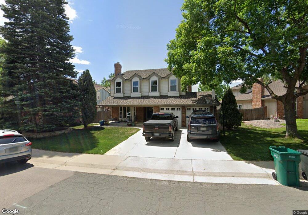
11072 Main Range Trail Littleton, CO 80127
Ken Caryl Ranch NeighborhoodEstimated Value: $767,840 - $872,000
4
Beds
7
Baths
2,551
Sq Ft
$315/Sq Ft
Est. Value
About This Home
This home is located at 11072 Main Range Trail, Littleton, CO 80127 and is currently estimated at $803,710, approximately $315 per square foot. 11072 Main Range Trail is a home located in Jefferson County with nearby schools including Shaffer Elementary School, Falcon Bluffs Middle School, and Chatfield High School.
Ownership History
Date
Name
Owned For
Owner Type
Purchase Details
Closed on
Dec 8, 2004
Sold by
Duffy Floyd A and Duffy Rita J
Bought by
Low Benjamin A and Low Elizabeth
Current Estimated Value
Home Financials for this Owner
Home Financials are based on the most recent Mortgage that was taken out on this home.
Original Mortgage
$280,000
Outstanding Balance
$68,460
Interest Rate
3.87%
Mortgage Type
Purchase Money Mortgage
Estimated Equity
$735,250
Create a Home Valuation Report for This Property
The Home Valuation Report is an in-depth analysis detailing your home's value as well as a comparison with similar homes in the area
Home Values in the Area
Average Home Value in this Area
Purchase History
| Date | Buyer | Sale Price | Title Company |
|---|---|---|---|
| Low Benjamin A | $350,000 | Land Title |
Source: Public Records
Mortgage History
| Date | Status | Borrower | Loan Amount |
|---|---|---|---|
| Open | Low Benjamin A | $280,000 | |
| Closed | Low Benjamin A | $35,000 |
Source: Public Records
Tax History Compared to Growth
Tax History
| Year | Tax Paid | Tax Assessment Tax Assessment Total Assessment is a certain percentage of the fair market value that is determined by local assessors to be the total taxable value of land and additions on the property. | Land | Improvement |
|---|---|---|---|---|
| 2024 | $4,996 | $46,669 | $10,909 | $35,760 |
| 2023 | $4,996 | $46,669 | $10,909 | $35,760 |
| 2022 | $4,281 | $39,105 | $8,806 | $30,299 |
| 2021 | $4,346 | $40,230 | $9,059 | $31,171 |
| 2020 | $3,911 | $36,319 | $7,445 | $28,874 |
| 2019 | $3,865 | $36,319 | $7,445 | $28,874 |
| 2018 | $3,444 | $31,257 | $6,877 | $24,380 |
| 2017 | $3,203 | $31,257 | $6,877 | $24,380 |
| 2016 | $3,346 | $30,900 | $8,429 | $22,471 |
| 2015 | $2,972 | $30,900 | $8,429 | $22,471 |
| 2014 | $2,972 | $25,861 | $6,685 | $19,176 |
Source: Public Records
Map
Nearby Homes
- 7747 Gunsight Pass
- 7825 Sand Mountain
- 10791 Trailrider Pass
- 11617 Elk Head Range Rd
- 10494 W Turtle Mountain
- 11703 Elk Head Range Rd
- 10866 W Half Moon Pass
- 10567 W Chautauga Mountain
- 7413 S Quail Cir Unit 1417
- 11104 W San Juan Range Rd
- 7418 S Quail Cir Unit 1315
- 11804 Elk Head Range Rd
- 10550 W Raspberry Mountain
- 11781 Elk Head Range Rd
- 10606 Park Mountain W
- 7474 S Alkire St Unit 203
- 10355 Red Mountain E
- 10351 Red Mountain E
- Willow Plan at Ken-Caryl Ranch - Luxury Villas at Deer Creek
- Ponderosa Plan at Ken-Caryl Ranch - Luxury Villas at Deer Creek
- 11042 Main Range Trail
- 11132 Main Range Trail
- 11022 Main Range Trail
- 11162 Main Range Trail
- 7726 Gold Dust Peak
- 7716 Gold Dust Peak
- 7653 Sunshine Peak
- 11182 Main Range Trail
- 11012 Main Range Trail
- 11071 Main Range Trail
- 11111 Main Range Trail
- 11131 Main Range Trail
- 11161 Main Range Trail
- 7643 Sunshine Peak
- 11002 Main Range Trail
- 7723 Gunsight Pass
- 7736 Gold Dust Peak
- 7715 Gold Dust Peak
- 7713 Gunsight Pass
- 7633 Sunshine Peak