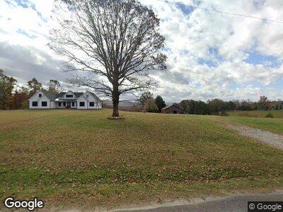
1108 Eastport Dock Rd Monroe, TN 38573
Estimated Value: $446,000 - $888,000
5
Beds
4
Baths
3,100
Sq Ft
$225/Sq Ft
Est. Value
About This Home
This home is located at 1108 Eastport Dock Rd, Monroe, TN 38573 and is currently estimated at $698,866, approximately $225 per square foot. 1108 Eastport Dock Rd is a home located in Overton County.
Ownership History
Date
Name
Owned For
Owner Type
Purchase Details
Closed on
Feb 9, 2022
Sold by
Nichols Lela H
Bought by
Davidson James M and Davidson Rachel
Current Estimated Value
Home Financials for this Owner
Home Financials are based on the most recent Mortgage that was taken out on this home.
Original Mortgage
$30,000
Interest Rate
3.56%
Mortgage Type
Construction
Purchase Details
Closed on
Apr 7, 2021
Sold by
Phillips Johnny Howard
Bought by
Daniels J Steve
Purchase Details
Closed on
Aug 25, 1984
Bought by
Nichols Lela
Create a Home Valuation Report for This Property
The Home Valuation Report is an in-depth analysis detailing your home's value as well as a comparison with similar homes in the area
Home Values in the Area
Average Home Value in this Area
Purchase History
| Date | Buyer | Sale Price | Title Company |
|---|---|---|---|
| Davidson James M | $167,000 | Officer Julie E | |
| Daniels J Steve | $1,000 | None Available | |
| Nichols Lela | -- | -- |
Source: Public Records
Mortgage History
| Date | Status | Borrower | Loan Amount |
|---|---|---|---|
| Open | Davidson James Manson | $540,000 | |
| Closed | Davidson James M | $30,000 |
Source: Public Records
Tax History Compared to Growth
Tax History
| Year | Tax Paid | Tax Assessment Tax Assessment Total Assessment is a certain percentage of the fair market value that is determined by local assessors to be the total taxable value of land and additions on the property. | Land | Improvement |
|---|---|---|---|---|
| 2024 | $3,717 | $165,275 | $6,150 | $159,125 |
| 2023 | $129 | $120,525 | $6,150 | $114,375 |
| 2022 | $129 | $6,525 | $6,150 | $375 |
| 2021 | $241 | $12,250 | $6,150 | $6,100 |
| 2020 | $242 | $12,250 | $6,150 | $6,100 |
| 2019 | $215 | $9,575 | $5,300 | $4,275 |
| 2018 | $215 | $9,575 | $5,300 | $4,275 |
| 2017 | $215 | $9,575 | $5,300 | $4,275 |
| 2016 | $215 | $9,575 | $5,300 | $4,275 |
| 2015 | $191 | $9,575 | $5,300 | $4,275 |
| 2014 | -- | $13,250 | $5,300 | $7,950 |
| 2013 | -- | $13,825 | $0 | $0 |
Source: Public Records
Map
Nearby Homes
- 1100 Eastport Dock Rd
- 1103 Boles Beaty Rd
- 0 Bolestown Loop
- 0 Bolestown Loop
- 00 Bolestown Loop
- 171 Deer Cliff Ln
- 2059 Bolestown Loop
- 2061 Bolestown Loop
- 7125 Bolestown Rd
- 400 Sabre Park Rd
- 5735 E East Port Rd
- Lot 11 Big Hollow Rd
- Lot 66 Big Hollow Rd
- 4986 Robbinstown Rd
- 118 Summer Ln
- 0 Milky Way Rd Unit RTC2806137
- 1108 Eastport Dock Rd
- 5255 Old Eastport Dock Rd
- 5055 Old Eastport Dock Rd
- 5112 Old Eastport Dock Rd
- 550 Jimmy Sells Rd
- 1025 Eastport Dock Rd
- 1022 Eastport Dock Rd
- 200 Bethsaida Rd
- 200 Bethsaida Rd
- 149 Victor Padgett Ln
- 0 Jimmy Sells Rd Unit 213200
- 0 Jimmy Sells Rd
- 1004 Eastport Dock Rd
- 3.5 AC Victor Padgett Ln
- 951 Eastport Dock Rd
- 951 Eastport Dock Rd
- 5045 Old Eastport Dock Rd
- 5222 Old Eastport Dock Rd
- 2100 Boles Beaty Rd
- 0 76 Ac Rue Des Rindler Rd Unit 1804815