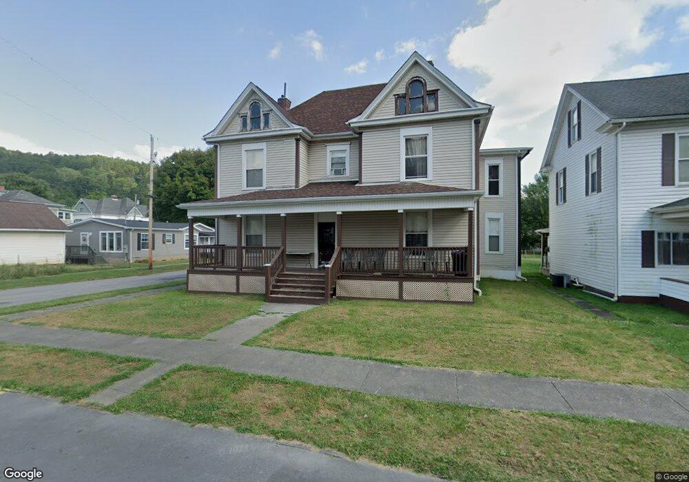
111 Locust St Mannington, WV 26582
Estimated Value: $83,000 - $115,000
8
Beds
4
Baths
4,160
Sq Ft
$24/Sq Ft
Est. Value
About This Home
This home is located at 111 Locust St, Mannington, WV 26582 and is currently estimated at $98,333, approximately $23 per square foot. 111 Locust St is a home with nearby schools including Mannington Middle School, Blackshere Elementary School, and North Marion High School.
Ownership History
Date
Name
Owned For
Owner Type
Purchase Details
Closed on
Apr 22, 2005
Sold by
Elliott Randall J and Elliott Linda D
Bought by
Wheeler Donald E and Wheeler Diana L
Current Estimated Value
Home Financials for this Owner
Home Financials are based on the most recent Mortgage that was taken out on this home.
Original Mortgage
$47,600
Interest Rate
6.01%
Mortgage Type
Future Advance Clause Open End Mortgage
Create a Home Valuation Report for This Property
The Home Valuation Report is an in-depth analysis detailing your home's value as well as a comparison with similar homes in the area
Purchase History
| Date | Buyer | Sale Price | Title Company |
|---|---|---|---|
| Wheeler Donald E | $38,000 | -- |
Source: Public Records
Mortgage History
| Date | Status | Borrower | Loan Amount |
|---|---|---|---|
| Closed | Wheeler Donald E | $47,600 |
Source: Public Records
Tax History
| Year | Tax Paid | Tax Assessment Tax Assessment Total Assessment is a certain percentage of the fair market value that is determined by local assessors to be the total taxable value of land and additions on the property. | Land | Improvement |
|---|---|---|---|---|
| 2025 | $1,936 | $65,460 | $6,240 | $59,220 |
| 2024 | $1,936 | $63,060 | $6,240 | $56,820 |
| 2023 | $1,864 | $60,660 | $6,240 | $54,420 |
| 2022 | $1,393 | $46,800 | $6,240 | $40,560 |
| 2021 | $1,702 | $57,780 | $6,300 | $51,480 |
| 2020 | $1,622 | $54,900 | $6,180 | $48,720 |
| 2019 | $1,594 | $53,100 | $7,200 | $45,900 |
| 2018 | $1,749 | $58,620 | $7,440 | $51,180 |
| 2017 | $1,694 | $57,360 | $7,200 | $50,160 |
| 2016 | $1,625 | $55,500 | $7,320 | $48,180 |
| 2015 | $1,596 | $54,300 | $8,520 | $45,780 |
| 2014 | $1,596 | $54,420 | $9,300 | $45,120 |
Source: Public Records
Map
Nearby Homes
- 0 Wyatt Rd Unit 11650775
- TBD Highland St
- 208 Jefferson St
- 413 James St
- 1008 E Main St
- 202 Meadow Ave
- 221 Meadow Ave
- TBD Pyles Ave
- TBD Sunshine Rd
- 29 Freeman St
- 223 Dudley Fork Rd
- 111 Brick Hill Rd
- 2561 Whetstone
- 0 Whetstone
- Lot 2 E Run Cir
- TBD Brush Run
- Lot 1 Huey Run
- 0 Husky Hwy
- Lot 1 State Fork Rd
- Lot 1 Huey Run Rd
- 302 Beatty Ave
- 113 Locust St
- 107 Locust St
- 304 Beatty Ave
- 115 Locust St
- 304 Beatty St
- 305 Furbee Ave
- 306 Beatty Ave
- 106 Locust St
- 302 Pleasant St
- 303B Beatty Ave
- 211 Beatty Ave
- 307 Furbee Ave
- 303 Beatty Ave
- 201 Locust St
- 304 Furbee Ave
- 300 Pleasant St
- 308 Beatty Ave
- 309 Furbee Ave
- 309 Beatty Ave Unit C
Your Personal Tour Guide
Ask me questions while you tour the home.