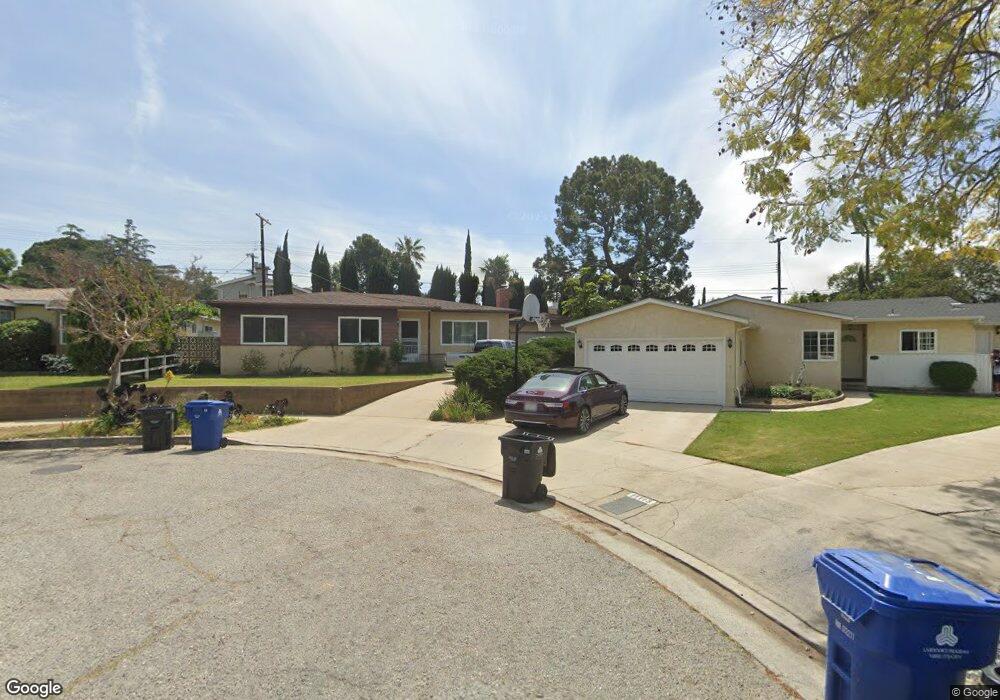
11109 Parr Ave Sunland, CA 91040
Sunland NeighborhoodEstimated Value: $807,764 - $964,000
3
Beds
2
Baths
1,374
Sq Ft
$640/Sq Ft
Est. Value
About This Home
This home is located at 11109 Parr Ave, Sunland, CA 91040 and is currently estimated at $878,691, approximately $639 per square foot. 11109 Parr Ave is a home located in Los Angeles County with nearby schools including Sunland Elementary School, Mt. Gleason Middle School, and Verdugo Hills Senior High School.
Ownership History
Date
Name
Owned For
Owner Type
Purchase Details
Closed on
Oct 18, 1996
Sold by
Hirose Robert K and Taira June N
Bought by
Norvell Theodore W and Norvell Jeanine A
Current Estimated Value
Home Financials for this Owner
Home Financials are based on the most recent Mortgage that was taken out on this home.
Original Mortgage
$145,350
Outstanding Balance
$13,405
Interest Rate
8.14%
Estimated Equity
$865,286
Create a Home Valuation Report for This Property
The Home Valuation Report is an in-depth analysis detailing your home's value as well as a comparison with similar homes in the area
Home Values in the Area
Average Home Value in this Area
Purchase History
| Date | Buyer | Sale Price | Title Company |
|---|---|---|---|
| Norvell Theodore W | $153,000 | Southland Title Corporation |
Source: Public Records
Mortgage History
| Date | Status | Borrower | Loan Amount |
|---|---|---|---|
| Open | Norvell Theodore W | $145,350 |
Source: Public Records
Tax History Compared to Growth
Tax History
| Year | Tax Paid | Tax Assessment Tax Assessment Total Assessment is a certain percentage of the fair market value that is determined by local assessors to be the total taxable value of land and additions on the property. | Land | Improvement |
|---|---|---|---|---|
| 2025 | $3,143 | $249,157 | $114,317 | $134,840 |
| 2024 | $3,143 | $244,273 | $112,076 | $132,197 |
| 2023 | $3,085 | $239,484 | $109,879 | $129,605 |
| 2022 | $2,946 | $234,789 | $107,725 | $127,064 |
| 2021 | $2,903 | $230,186 | $105,613 | $124,573 |
| 2019 | $2,818 | $223,361 | $102,482 | $120,879 |
| 2018 | $2,758 | $218,982 | $100,473 | $118,509 |
| 2016 | $2,623 | $210,480 | $96,572 | $113,908 |
| 2015 | $2,586 | $207,319 | $95,122 | $112,197 |
| 2014 | $2,601 | $203,259 | $93,259 | $110,000 |
Source: Public Records
Map
Nearby Homes
- 11034 Scoville Ave
- 12159 Oro Vista Ave
- 8110 Brownstone St
- 11009 Quill Ave
- 0 Rim Canyon Rd Unit SR25228396
- 8545 Forsythe St
- 10704 Oro Vista Ave
- 7844 Rim Canyon Rd
- 8230 Hillrose St
- 10799 Sherman Grove Ave
- 10799 Sherman Grove Ave Unit 18
- 10799 Sherman Grove Ave Unit 61
- 7848 Forsythe St
- 7815 Denivelle Rd
- 10711 Sherman Grove Ave Unit 26
- 10711 Sherman Grove Ave Unit 13
- 10711 Sherman Grove Ave Unit 36
- 11461 Riverwood Dr
- 10623 Woodward Ave
- 8720 Mulberry Dr
- 11113 Parr Ave
- 11108 Parr Ave
- 8257 Grove St
- 8259 Grove St
- 8247 Grove St
- 11112 Parr Ave
- 8241 Grove St
- 11116 Parr Ave
- 11064 Scoville Ave
- 11121 Parr Ave
- 11060 Scoville Ave
- 8237 Grove St
- 11109 Odell Ave
- 11056 Scoville Ave
- 11122 Parr Ave
- 11113 Odell Ave
- 11125 Parr Ave
- 8231 Grove St
- 11100 Scoville Ave
- 8250 Grove St