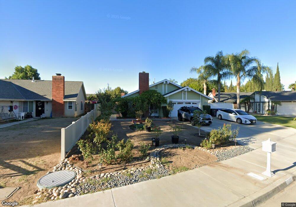
11115 Cameron Dr Riverside, CA 92505
La Sierra NeighborhoodEstimated Value: $651,000 - $678,000
3
Beds
2
Baths
1,448
Sq Ft
$458/Sq Ft
Est. Value
About This Home
This home is located at 11115 Cameron Dr, Riverside, CA 92505 and is currently estimated at $662,817, approximately $457 per square foot. 11115 Cameron Dr is a home located in Riverside County with nearby schools including S. Christa Mcauliffe Elementary School, Ysmael Villegas Middle School, and La Sierra High School.
Ownership History
Date
Name
Owned For
Owner Type
Purchase Details
Closed on
Nov 9, 2024
Sold by
Nguyen Vanessa Ngoc
Bought by
D3n Family Trust and Nguyen
Current Estimated Value
Purchase Details
Closed on
Oct 6, 2009
Sold by
Jones Valencia
Bought by
Nguyen Vanessa Ngoc
Home Financials for this Owner
Home Financials are based on the most recent Mortgage that was taken out on this home.
Original Mortgage
$175,500
Interest Rate
5.02%
Mortgage Type
New Conventional
Purchase Details
Closed on
Oct 19, 1995
Sold by
Wyman William T and Wyman Frances M
Bought by
Jones Valencia
Home Financials for this Owner
Home Financials are based on the most recent Mortgage that was taken out on this home.
Original Mortgage
$117,930
Interest Rate
7.42%
Mortgage Type
FHA
Create a Home Valuation Report for This Property
The Home Valuation Report is an in-depth analysis detailing your home's value as well as a comparison with similar homes in the area
Home Values in the Area
Average Home Value in this Area
Purchase History
| Date | Buyer | Sale Price | Title Company |
|---|---|---|---|
| D3n Family Trust | -- | First American Title | |
| Nguyen Vanessa Ngoc | $195,000 | First American Title Company | |
| Jones Valencia | $119,000 | Old Republic Title Company |
Source: Public Records
Mortgage History
| Date | Status | Borrower | Loan Amount |
|---|---|---|---|
| Previous Owner | Nguyen Vanessa Ngoc | $175,500 | |
| Previous Owner | Jones Valencia | $117,930 |
Source: Public Records
Tax History
| Year | Tax Paid | Tax Assessment Tax Assessment Total Assessment is a certain percentage of the fair market value that is determined by local assessors to be the total taxable value of land and additions on the property. | Land | Improvement |
|---|---|---|---|---|
| 2025 | $3,053 | $251,692 | $96,802 | $154,890 |
| 2023 | $3,053 | $241,920 | $93,044 | $148,876 |
| 2022 | $2,827 | $237,177 | $91,220 | $145,957 |
| 2021 | $2,789 | $232,528 | $89,432 | $143,096 |
| 2020 | $2,744 | $230,144 | $88,515 | $141,629 |
| 2019 | $2,709 | $225,632 | $86,780 | $138,852 |
| 2018 | $2,672 | $221,209 | $85,079 | $136,130 |
| 2017 | $2,623 | $216,872 | $83,411 | $133,461 |
| 2016 | $2,580 | $212,621 | $81,776 | $130,845 |
| 2015 | $2,543 | $209,430 | $80,549 | $128,881 |
| 2014 | $2,534 | $205,329 | $78,972 | $126,357 |
Source: Public Records
Map
Nearby Homes
- 4201 Ferguson Ct
- 11306 Trailstone Ct
- 4539 Rivergate Ct
- 11372 Riverpass Ct
- 11141 Gardenhurst Ct
- 11230 Reliance Dr
- 4674 Trailmore Ct
- 11390 Parkfield Ct
- 11116 Wayfield Rd
- 4878 Streambay Ct
- 0 Bushnell Ave
- 11499 Bridgeway Dr
- 11552 Brookrun Ct
- 10742 Jeri Dr
- 0 Rancho Corto Dr
- 4088 Lively St
- 3894 Polk St Unit E
- 10520 Cook Ave
- 0 Sunnyslope Ave
- 10920 Magnolia Ave
- 11121 Cameron Dr
- 11111 Cameron Dr
- 4425 Clarksdale Dr
- 11127 Cameron Dr
- 4419 Clarksdale Dr
- 11101 Cameron Dr
- 4431 Clarksdale Dr
- 4411 Clarksdale Dr
- 11118 Cameron Dr
- 11131 Cameron Dr
- 11112 Cameron Dr
- 11100 Cameron Dr
- 11124 Cameron Dr
- 4407 Clarksdale Dr
- 11106 Cameron Dr
- 4437 Clarksdale Dr
- 11130 Cameron Dr
- 11141 Cameron Dr
- 4401 Clarksdale Dr
- 4420 Clarksdale Dr
Your Personal Tour Guide
Ask me questions while you tour the home.