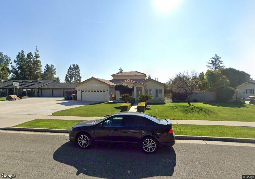
11117 Dee Dee Ct Bakersfield, CA 93312
Polo Grounds NeighborhoodEstimated Value: $538,000 - $610,000
4
Beds
3
Baths
1,974
Sq Ft
$288/Sq Ft
Est. Value
About This Home
This home is located at 11117 Dee Dee Ct, Bakersfield, CA 93312 and is currently estimated at $569,484, approximately $288 per square foot. 11117 Dee Dee Ct is a home located in Kern County with nearby schools including Rosedale-North Elementary School, Freedom Middle School, and Centennial High School.
Ownership History
Date
Name
Owned For
Owner Type
Purchase Details
Closed on
Aug 3, 2010
Sold by
Myers Shem A
Bought by
Myers Sharleen B
Current Estimated Value
Home Financials for this Owner
Home Financials are based on the most recent Mortgage that was taken out on this home.
Original Mortgage
$182,800
Outstanding Balance
$120,726
Interest Rate
4.52%
Mortgage Type
New Conventional
Estimated Equity
$448,758
Purchase Details
Closed on
Dec 5, 2002
Sold by
Barnhard Bruce G and Barnhard Kristi
Bought by
Myers Shem A and Myers Sharleen B
Home Financials for this Owner
Home Financials are based on the most recent Mortgage that was taken out on this home.
Original Mortgage
$203,700
Interest Rate
5.86%
Purchase Details
Closed on
May 8, 2002
Sold by
Lifquist Kenneth William and Lifquist Joyce Lanelle
Bought by
Barnhard Bruce G and Barnhard Kristi
Home Financials for this Owner
Home Financials are based on the most recent Mortgage that was taken out on this home.
Original Mortgage
$168,000
Interest Rate
6.89%
Mortgage Type
Construction
Purchase Details
Closed on
Dec 3, 2001
Sold by
Malson Donald and Malson Alice
Bought by
Lifquist Kenneth William and Lifquist Joyce Lanell
Purchase Details
Closed on
Feb 11, 1998
Sold by
Buckles Everett R and Buckles Mamie L
Bought by
Malson Donald and Malson Alice
Home Financials for this Owner
Home Financials are based on the most recent Mortgage that was taken out on this home.
Original Mortgage
$28,000
Interest Rate
7.06%
Mortgage Type
Seller Take Back
Purchase Details
Closed on
Apr 11, 1997
Sold by
Buckles Everett R and Buckles Mamie L
Bought by
Buckles Everett R and Buckles Mamie L
Create a Home Valuation Report for This Property
The Home Valuation Report is an in-depth analysis detailing your home's value as well as a comparison with similar homes in the area
Home Values in the Area
Average Home Value in this Area
Purchase History
We collect this data history from publicly available records. To have your information removed, we recommend requesting removal directly through your county’s website.
| Date | Buyer | Sale Price | Title Company |
|---|---|---|---|
| Myers Sharleen B | -- | Old Republic Title Company | |
| Myers Shem A | $165,500 | Fidelity | |
| Barnhard Bruce G | $47,500 | Fidelity National Title Co | |
| Lifquist Kenneth William | $30,079 | Chicago Title Co | |
| Malson Donald | $30,000 | Chicago Title Co | |
| Buckles Everett R | -- | -- |
Source: Public Records
Mortgage History
We collect this data history from publicly available records. To have your information removed, we recommend requesting removal directly through your county’s website.
| Date | Status | Borrower | Loan Amount |
|---|---|---|---|
| Open | Myers Sharleen B | $182,800 | |
| Closed | Myers Shem A | $203,700 | |
| Previous Owner | Barnhard Bruce G | $168,000 | |
| Previous Owner | Malson Donald | $28,000 |
Source: Public Records
Tax History
| Year | Tax Paid | Tax Assessment Tax Assessment Total Assessment is a certain percentage of the fair market value that is determined by local assessors to be the total taxable value of land and additions on the property. | Land | Improvement |
|---|---|---|---|---|
| 2025 | $4,143 | $323,511 | $69,508 | $254,003 |
| 2024 | $4,050 | $317,169 | $68,146 | $249,023 |
| 2023 | $4,050 | $310,951 | $66,810 | $244,141 |
| 2022 | $3,953 | $304,855 | $65,500 | $239,355 |
| 2021 | $3,832 | $298,878 | $64,216 | $234,662 |
| 2020 | $3,762 | $295,815 | $63,558 | $232,257 |
| 2019 | $3,704 | $295,815 | $63,558 | $232,257 |
| 2018 | $3,585 | $284,331 | $61,091 | $223,240 |
| 2017 | $3,548 | $278,758 | $59,894 | $218,864 |
| 2016 | $3,296 | $273,293 | $58,720 | $214,573 |
| 2015 | $3,256 | $269,189 | $57,838 | $211,351 |
| 2014 | $3,184 | $263,918 | $56,706 | $207,212 |
Source: Public Records
Map
Nearby Homes
- 11001 Aimee Way
- 3301 Beyers St
- 2500 Jewetta Ave Unit 85
- 3125 Silver Spur Way
- 3105 Silver Spur Way
- 3122 Campfire Dr Unit 2
- 3110 Campfire Dr
- 3106 Campfire Dr Unit 2
- 10617 Baron Ave
- 10512 Dee Ave
- 11808 Lone Oak Dr
- 0 Fruitvale Snow Rd Unit 202602724
- 3206 Aviary Way
- 3100 Woodstown St
- 11910 Compass Ave
- 3622 Azure Dr
- 10413 Lonon Ave
- 10500 Lonon Ave
- 10429 Enger St
- 10421 Enger St
- 11201 Dee Dee Ct
- 11109 Dee Dee Ct
- 11201 Dee Ct
- 11209 Dee Ct
- 11209 Dee Dee Ct
- 11116 Aimee Way
- 11101 Dee Dee Ct
- 11116 Dee Dee Ct
- 11200 Aimee Way
- 11200 Dee Dee Ct
- 11108 Dee Dee Ct
- 11200 Dee Ct
- 11100 Dee Ct
- 11100 Dee Dee Ct
- 11208 Aimee Way
- 11108 Aimee Way
- 11217 Dee Ct
- 11208 Dee Dee Ct
- 11100 Aimee Way
- 11217 Dee Dee Ct
Your Personal Tour Guide
Ask me questions while you tour the home.