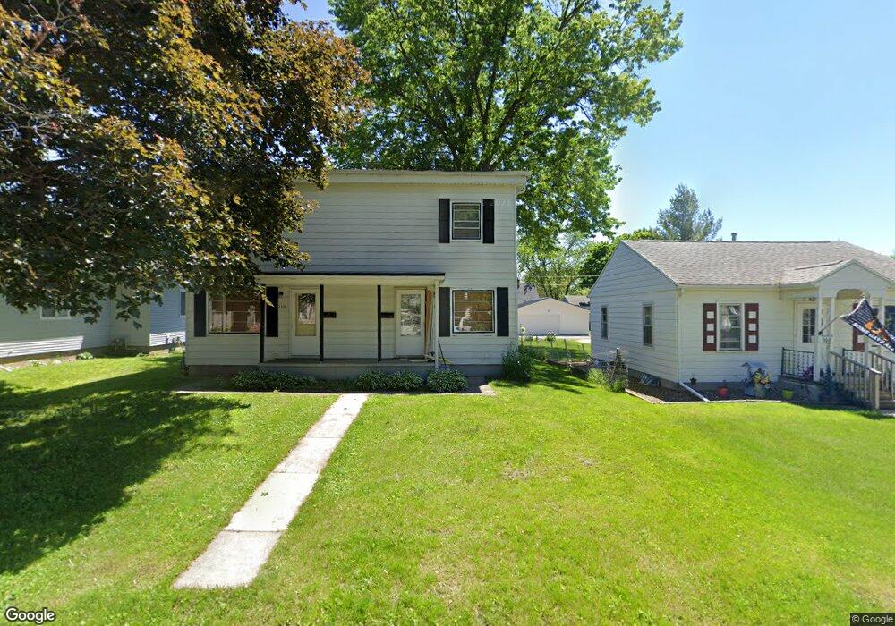
1112 Byron Ave Waterloo, IA 50702
Liberty Park NeighborhoodEstimated Value: $175,221 - $189,000
4
Beds
2
Baths
1,792
Sq Ft
$102/Sq Ft
Est. Value
About This Home
This home is located at 1112 Byron Ave, Waterloo, IA 50702 and is currently estimated at $183,555, approximately $102 per square foot. 1112 Byron Ave is a home located in Black Hawk County with nearby schools including Kittrell Elementary School, Hoover Middle School, and West High School.
Ownership History
Date
Name
Owned For
Owner Type
Purchase Details
Closed on
Feb 17, 2021
Sold by
Dedic Sanel and Dedic Alma
Bought by
Third Avenue Place Llc
Current Estimated Value
Purchase Details
Closed on
Nov 29, 2006
Sold by
Melick Properties Lc Iii
Bought by
Dedic Sanel and Dedic Alma
Home Financials for this Owner
Home Financials are based on the most recent Mortgage that was taken out on this home.
Original Mortgage
$126,100
Interest Rate
6.4%
Mortgage Type
New Conventional
Create a Home Valuation Report for This Property
The Home Valuation Report is an in-depth analysis detailing your home's value as well as a comparison with similar homes in the area
Home Values in the Area
Average Home Value in this Area
Purchase History
| Date | Buyer | Sale Price | Title Company |
|---|---|---|---|
| Third Avenue Place Llc | $130,000 | None Available | |
| Dedic Sanel | $130,000 | None Available |
Source: Public Records
Mortgage History
| Date | Status | Borrower | Loan Amount |
|---|---|---|---|
| Previous Owner | Dedic Sanel | $126,100 |
Source: Public Records
Tax History Compared to Growth
Tax History
| Year | Tax Paid | Tax Assessment Tax Assessment Total Assessment is a certain percentage of the fair market value that is determined by local assessors to be the total taxable value of land and additions on the property. | Land | Improvement |
|---|---|---|---|---|
| 2025 | $3,620 | $180,430 | $16,980 | $163,450 |
| 2024 | $3,620 | $166,900 | $16,980 | $149,920 |
| 2023 | $2,746 | $166,900 | $16,980 | $149,920 |
| 2022 | $2,674 | $125,070 | $16,980 | $108,090 |
| 2021 | $2,622 | $125,070 | $16,980 | $108,090 |
| 2020 | $2,580 | $115,740 | $13,340 | $102,400 |
| 2019 | $2,580 | $115,740 | $13,340 | $102,400 |
| 2018 | $2,580 | $115,740 | $13,340 | $102,400 |
| 2017 | $2,670 | $115,740 | $13,340 | $102,400 |
| 2016 | $2,638 | $116,300 | $13,340 | $102,960 |
| 2015 | $2,638 | $116,300 | $13,340 | $102,960 |
| 2014 | $2,556 | $110,580 | $13,340 | $97,240 |
Source: Public Records
Map
Nearby Homes
- 1101 Glenny Ave
- 1115 Hawthorne Ave
- 1415 W 9th St
- 1017 Forest Ave
- 2003 Randolph St
- 1125 Bertch Ave
- 1107 E Mitchell Ave
- 812 Hawthorne Ave
- 1207 Bertch Ave
- 1110 E Mitchell Ave
- 922 E Mitchell Ave
- 1147 Bourland Ave
- 710 Eureka St
- 805 E Mitchell Ave
- 826 Williston Ave
- 1229 W 7th St
- 611 Johnson St
- 1219 Hammond Ave
- 1201 Lyon Ave
- 236 Linwood Ave
- 1114 Byron Ave
- 1108 Byron Ave
- 1120 Byron Ave
- 1122 Byron Ave Unit 1124
- 1126 Byron Ave Unit 1128
- 1104 Byron Ave
- 1121 Byron Ave
- 1111 Byron Ave
- 1113 Glenny Ave
- 1115 Byron Ave
- 1125 Byron Ave
- 1107 Glenny Ave
- 1115 Glenny Ave
- 1105 Byron Ave
- 1129 Byron Ave
- 1121 Glenny Ave
- 1132 Byron Ave
- 1125 Glenny Ave
- 1139 Byron Ave
- 1131 Glenny Ave