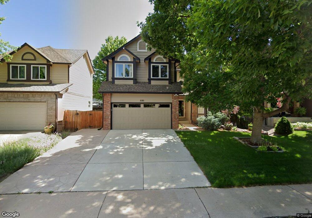
11181 W Frost Ave Littleton, CO 80127
Meadows NeighborhoodEstimated Value: $699,816 - $813,000
4
Beds
4
Baths
2,572
Sq Ft
$298/Sq Ft
Est. Value
About This Home
This home is located at 11181 W Frost Ave, Littleton, CO 80127 and is currently estimated at $765,704, approximately $297 per square foot. 11181 W Frost Ave is a home located in Jefferson County with nearby schools including Ute Meadows Elementary School, Deer Creek Middle School, and Chatfield High School.
Ownership History
Date
Name
Owned For
Owner Type
Purchase Details
Closed on
Mar 5, 2020
Sold by
Rojas Kevin A and Rojas Kelli N
Bought by
Fuhlenfdorf Stuart W and Fuhlenfdorf Patricia A
Current Estimated Value
Home Financials for this Owner
Home Financials are based on the most recent Mortgage that was taken out on this home.
Original Mortgage
$466,000
Outstanding Balance
$413,489
Interest Rate
3.6%
Mortgage Type
New Conventional
Estimated Equity
$352,215
Purchase Details
Closed on
Jul 10, 2017
Sold by
Ragan Jason A and Ragan Theresa J
Bought by
Rojas Kevin A and Rojas Kelli N
Home Financials for this Owner
Home Financials are based on the most recent Mortgage that was taken out on this home.
Original Mortgage
$451,250
Interest Rate
3.95%
Mortgage Type
New Conventional
Purchase Details
Closed on
Apr 28, 2011
Sold by
Felling Pamela S and Jakoubek Kristen
Bought by
Ragan Jason A and Ragan Theresa J
Home Financials for this Owner
Home Financials are based on the most recent Mortgage that was taken out on this home.
Original Mortgage
$315,065
Interest Rate
4.82%
Mortgage Type
VA
Purchase Details
Closed on
Aug 15, 2005
Sold by
Felling Pamela S
Bought by
Felling Pamela S and Jakoubek Kristen
Home Financials for this Owner
Home Financials are based on the most recent Mortgage that was taken out on this home.
Original Mortgage
$80,000
Interest Rate
5.5%
Mortgage Type
Unknown
Purchase Details
Closed on
May 30, 2003
Sold by
Griepentrog Keith A and Griepentrog Linda T
Bought by
Felling Pamela S
Home Financials for this Owner
Home Financials are based on the most recent Mortgage that was taken out on this home.
Original Mortgage
$208,000
Interest Rate
5.56%
Mortgage Type
Unknown
Purchase Details
Closed on
Nov 13, 1998
Sold by
Ruth Laurence P and Ruth Marie Anne
Bought by
Griepentrog Keith A and Griepentrog Linda T
Home Financials for this Owner
Home Financials are based on the most recent Mortgage that was taken out on this home.
Original Mortgage
$140,500
Interest Rate
6.55%
Create a Home Valuation Report for This Property
The Home Valuation Report is an in-depth analysis detailing your home's value as well as a comparison with similar homes in the area
Home Values in the Area
Average Home Value in this Area
Purchase History
| Date | Buyer | Sale Price | Title Company |
|---|---|---|---|
| Fuhlenfdorf Stuart W | $582,500 | None Available | |
| Rojas Kevin A | $475,000 | Land Title Guarantee Company | |
| Ragan Jason A | $305,000 | Land Title Guarantee Company | |
| Felling Pamela S | $130,000 | -- | |
| Felling Pamela S | $260,000 | American Liberty Title | |
| Griepentrog Keith A | $190,500 | First American Heritage Titl |
Source: Public Records
Mortgage History
| Date | Status | Borrower | Loan Amount |
|---|---|---|---|
| Open | Fuhlenfdorf Stuart W | $466,000 | |
| Previous Owner | Rojas Kevin A | $451,250 | |
| Previous Owner | Ragan Jason A | $315,065 | |
| Previous Owner | Felling Pamela S | $80,000 | |
| Previous Owner | Felling Pamela S | $208,000 | |
| Previous Owner | Griepentrog Keith A | $140,500 |
Source: Public Records
Tax History Compared to Growth
Tax History
| Year | Tax Paid | Tax Assessment Tax Assessment Total Assessment is a certain percentage of the fair market value that is determined by local assessors to be the total taxable value of land and additions on the property. | Land | Improvement |
|---|---|---|---|---|
| 2024 | $4,035 | $41,202 | $10,356 | $30,846 |
| 2023 | $4,035 | $41,202 | $10,356 | $30,846 |
| 2022 | $3,708 | $37,172 | $9,302 | $27,870 |
| 2021 | $3,755 | $38,241 | $9,569 | $28,672 |
| 2020 | $3,127 | $31,913 | $7,843 | $24,070 |
| 2019 | $3,088 | $31,913 | $7,843 | $24,070 |
| 2018 | $2,723 | $27,180 | $7,597 | $19,583 |
| 2017 | $2,486 | $27,180 | $7,597 | $19,583 |
| 2016 | $2,595 | $27,378 | $7,860 | $19,518 |
| 2015 | $2,226 | $27,378 | $7,860 | $19,518 |
| 2014 | $2,226 | $22,029 | $6,809 | $15,220 |
Source: Public Records
Map
Nearby Homes
- 7413 S Quail Cir Unit 1422
- 11434 W Roxbury Dr
- 11412 W Roxbury Place
- 7433 S Quail Cir Unit 1924
- 7462 S Quail Cir Unit 426
- 7339 S Gore Range Rd
- 7369 S Gore Range Rd Unit 208
- 10656 W Rowland Ave
- 7474 S Alkire St Unit 203
- 10675 W Rowland Ave
- 7646 S Bear Mountain
- 11673 Elk Head Range Rd
- 7359 S Mount Holy Cross
- 7409 S Alkire St Unit 304
- 11703 Elk Head Range Rd
- 7355 S Alkire St Unit 203
- 11235 San Joaquin Ridge
- 10371 W Indore Dr
- 11710 Elk Head Range Rd
- 6763 S Robb Ct
- 11207 W Frost Ave
- 11167 W Frost Ave
- 11141 W Frost Ave
- 11231 W Frost Ave
- 11144 W Fremont Place
- 11134 W Fremont Place
- 11154 W Fremont Place
- 11124 W Fremont Place
- 11127 W Frost Ave
- 11164 W Fremont Place
- 11257 W Frost Ave
- 11182 W Frost Ave
- 11168 W Frost Ave
- 11208 W Frost Ave
- 11174 W Fremont Place
- 11114 W Fremont Place
- 11142 W Frost Ave
- 11232 W Frost Ave
- 11271 W Frost Ave
- 11101 W Frost Ave