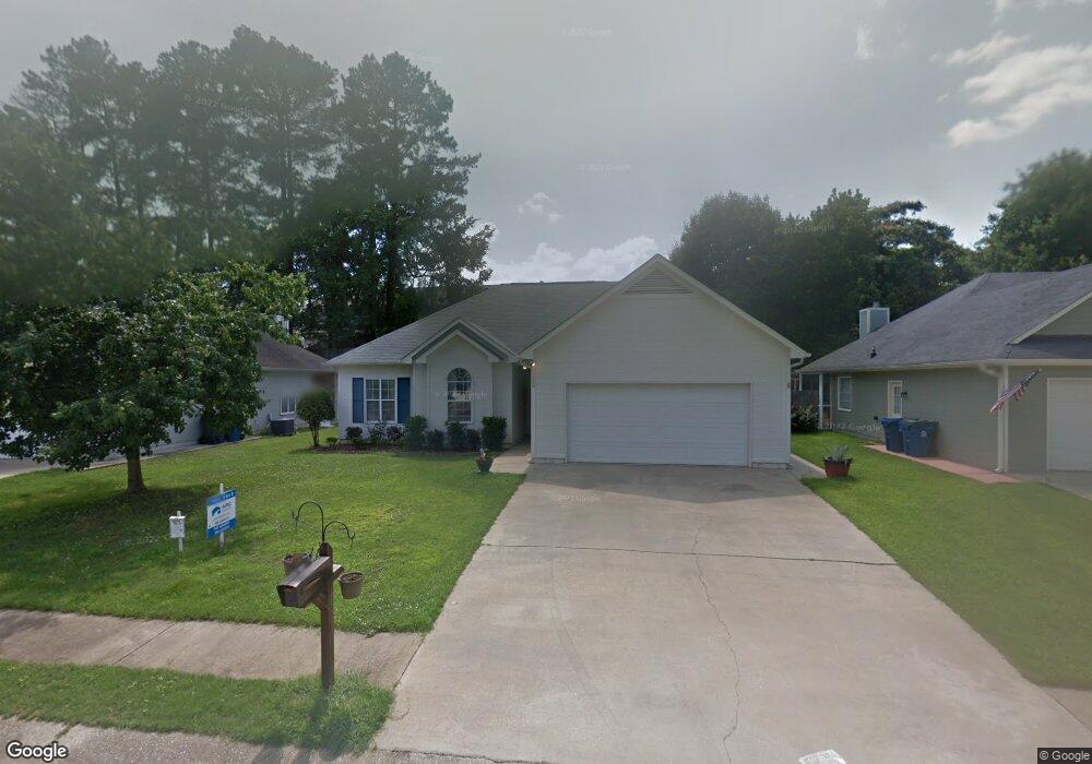
112 Cambridge Pointe Cir Alabaster, AL 35007
Estimated Value: $214,000 - $255,000
3
Beds
2
Baths
1,371
Sq Ft
$175/Sq Ft
Est. Value
About This Home
This home is located at 112 Cambridge Pointe Cir, Alabaster, AL 35007 and is currently estimated at $240,286, approximately $175 per square foot. 112 Cambridge Pointe Cir is a home located in Shelby County with nearby schools including Thompson Intermediate School, Thompson Middle School, and Thompson High School.
Ownership History
Date
Name
Owned For
Owner Type
Purchase Details
Closed on
Aug 26, 2020
Sold by
Paddock Meredith M and Mohd Sahiruddin Mohd
Bought by
Paddock Meredith M and Mohd Sabiruddin Mohd
Current Estimated Value
Home Financials for this Owner
Home Financials are based on the most recent Mortgage that was taken out on this home.
Original Mortgage
$122,400
Outstanding Balance
$108,622
Interest Rate
2.9%
Mortgage Type
New Conventional
Estimated Equity
$131,664
Purchase Details
Closed on
Nov 21, 2013
Sold by
Nielsen Daniel V
Bought by
Paddock Meredith
Purchase Details
Closed on
Apr 29, 2009
Sold by
Mckenzie Lori Sue and Mckenzie Jeffrey Thomas
Bought by
Nielsen Meredith M and Nielsen Daniel
Home Financials for this Owner
Home Financials are based on the most recent Mortgage that was taken out on this home.
Original Mortgage
$124,440
Interest Rate
4.86%
Mortgage Type
FHA
Create a Home Valuation Report for This Property
The Home Valuation Report is an in-depth analysis detailing your home's value as well as a comparison with similar homes in the area
Home Values in the Area
Average Home Value in this Area
Purchase History
| Date | Buyer | Sale Price | Title Company |
|---|---|---|---|
| Paddock Meredith M | -- | None Available | |
| Paddock Meredith | $59,000 | None Available | |
| Nielsen Meredith M | $126,752 | None Available |
Source: Public Records
Mortgage History
| Date | Status | Borrower | Loan Amount |
|---|---|---|---|
| Open | Paddock Meredith M | $122,400 | |
| Previous Owner | Nielsen Meredith M | $124,440 |
Source: Public Records
Tax History
| Year | Tax Paid | Tax Assessment Tax Assessment Total Assessment is a certain percentage of the fair market value that is determined by local assessors to be the total taxable value of land and additions on the property. | Land | Improvement |
|---|---|---|---|---|
| 2024 | $1,001 | $18,540 | $0 | $0 |
| 2023 | $947 | $18,300 | $0 | $0 |
| 2022 | $839 | $16,300 | $0 | $0 |
| 2021 | $761 | $14,860 | $0 | $0 |
| 2020 | $698 | $13,680 | $0 | $0 |
| 2019 | $690 | $13,540 | $0 | $0 |
| 2017 | $626 | $12,360 | $0 | $0 |
| 2015 | $593 | $11,740 | $0 | $0 |
| 2014 | $589 | $11,660 | $0 | $0 |
Source: Public Records
Map
Nearby Homes
- 1531 Applegate Ln
- 1557 Applegate Ln
- 116 Palm Dr
- 133 Park Place Ln
- 120 Sterling Gate Dr
- 1639 Caribbean Cir
- 164 Kentwood Dr
- 541 Warrior Dr
- 217 Kensington Ln
- 108 Kentwood Ln
- 316 Sterling Manor Cir
- 10589 Highway 119
- 521 13th St SW
- 280 Cedar Grove Pkwy
- 104 Kentwood Trail Cir
- 125 Mountain Pkwy
- 412 10th St SW
- 309 Cedar Grove Ct
- 549 Ramsgate Dr
- 305 Cedar Grove Ct
- 110 Cambridge Pointe Cir
- 114 Cambridge Pointe Cir
- 1404 Applegate Dr
- 1402 Applegate Dr
- 1406 Applegate Dr
- 1410 Applegate Dr
- 1408 Applegate Dr
- 118 Cambridge Pointe Cir
- 1300 Applegate Dr
- 1412 Applegate Dr
- 108 Cambridge Pointe Cir
- 105 Cambridge Pointe Cir
- 109 Cambridge Pointe Cir
- 1302 Applegate Dr
- 1416 Applegate Dr
- 1304 Applegate Dr
- 1414 Applegate Dr
- 113 Cambridge Pointe Cir
- 1418 Applegate Dr
- 106 Cambridge Pointe Cir
Your Personal Tour Guide
Ask me questions while you tour the home.