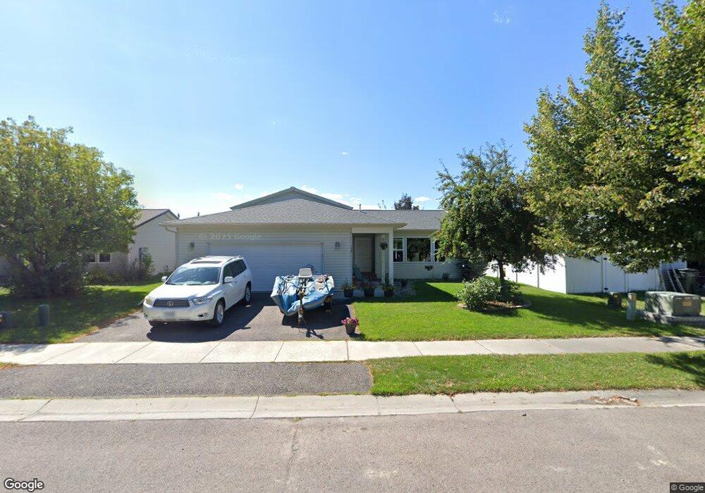
112 Hearst Dr Kalispell, MT 59901
Estimated Value: $474,176 - $523,000
3
Beds
2
Baths
1,178
Sq Ft
$422/Sq Ft
Est. Value
About This Home
This home is located at 112 Hearst Dr, Kalispell, MT 59901 and is currently estimated at $497,044, approximately $421 per square foot. 112 Hearst Dr is a home located in Flathead County with nearby schools including Edgerton School, Kalispell Middle School, and Glacier High School.
Ownership History
Date
Name
Owned For
Owner Type
Purchase Details
Closed on
Aug 31, 2015
Sold by
Eff Andrew J and Eff Jamie
Bought by
Owens John Brenton and Owens Maggie Roden
Current Estimated Value
Home Financials for this Owner
Home Financials are based on the most recent Mortgage that was taken out on this home.
Original Mortgage
$207,500
Outstanding Balance
$163,752
Interest Rate
4.05%
Mortgage Type
New Conventional
Estimated Equity
$333,292
Purchase Details
Closed on
Sep 13, 2013
Sold by
Eff Andrew E
Bought by
Eff Andrew J and Eff Jamie
Home Financials for this Owner
Home Financials are based on the most recent Mortgage that was taken out on this home.
Original Mortgage
$150,000
Interest Rate
4.36%
Mortgage Type
New Conventional
Purchase Details
Closed on
Aug 15, 2007
Sold by
Skye Inc
Bought by
Eff Andrew J
Home Financials for this Owner
Home Financials are based on the most recent Mortgage that was taken out on this home.
Original Mortgage
$151,560
Interest Rate
6.62%
Mortgage Type
New Conventional
Create a Home Valuation Report for This Property
The Home Valuation Report is an in-depth analysis detailing your home's value as well as a comparison with similar homes in the area
Purchase History
| Date | Buyer | Sale Price | Title Company |
|---|---|---|---|
| Owens John Brenton | -- | Insured Titles | |
| Eff Andrew J | -- | Atec | |
| Eff Andrew J | -- | Alliance Title |
Source: Public Records
Mortgage History
| Date | Status | Borrower | Loan Amount |
|---|---|---|---|
| Open | Owens John Brenton | $207,500 | |
| Previous Owner | Eff Andrew J | $150,000 | |
| Previous Owner | Eff Andrew J | $151,560 |
Source: Public Records
Tax History
| Year | Tax Paid | Tax Assessment Tax Assessment Total Assessment is a certain percentage of the fair market value that is determined by local assessors to be the total taxable value of land and additions on the property. | Land | Improvement |
|---|---|---|---|---|
| 2025 | $2,442 | $476,600 | $0 | $0 |
| 2024 | $2,906 | $373,200 | $0 | $0 |
| 2023 | $3,165 | $373,200 | $0 | $0 |
| 2022 | $2,892 | $287,800 | $0 | $0 |
| 2021 | $3,098 | $287,800 | $0 | $0 |
| 2020 | $2,900 | $241,200 | $0 | $0 |
| 2019 | $2,906 | $241,200 | $0 | $0 |
| 2018 | $2,679 | $211,000 | $0 | $0 |
| 2017 | $2,688 | $211,000 | $0 | $0 |
| 2016 | $2,219 | $170,100 | $0 | $0 |
| 2015 | $2,033 | $170,100 | $0 | $0 |
| 2014 | $1,961 | $98,156 | $0 | $0 |
Source: Public Records
Map
Nearby Homes
- 108 Hearst Dr
- 119 Barron Way
- 140 Barron Way
- 174 Empire Loop
- 90 Empire Loop
- 507 Northridge Dr
- 188 N Riding Rd
- 63 Empire Loop
- 38 Vanderbilt Dr
- 249 Three Mile Dr
- 17 Empire Loop
- 223 Northland Dr
- 405 Summit Ridge Dr
- 120 Garland St
- 28 Vista Loop
- 157 Meadow Vista Loop Unit A
- 408 Needlegrass Ln
- 417 Needlegrass Ln
- 145 Northridge Dr
- 1280 Quarter Horse Ln
Your Personal Tour Guide
Ask me questions while you tour the home.