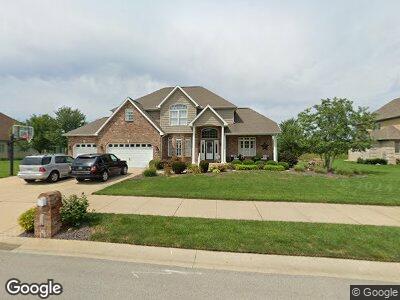
1120 Greenbrier Dr Forsyth, IL 62535
Estimated Value: $435,000 - $612,000
--
Bed
1
Bath
2,145
Sq Ft
$232/Sq Ft
Est. Value
About This Home
This home is located at 1120 Greenbrier Dr, Forsyth, IL 62535 and is currently estimated at $497,893, approximately $232 per square foot. 1120 Greenbrier Dr is a home located in Macon County with nearby schools including Maroa-Forsyth Grade School, Maroa-Forsyth Middle School, and Maroa-Forsyth Senior High School.
Ownership History
Date
Name
Owned For
Owner Type
Purchase Details
Closed on
Aug 3, 2005
Sold by
Kent Pope Buildrs Llc
Bought by
Harjung David R and Garner Harjung Kristi K
Current Estimated Value
Home Financials for this Owner
Home Financials are based on the most recent Mortgage that was taken out on this home.
Original Mortgage
$300,000
Interest Rate
5.71%
Mortgage Type
New Conventional
Purchase Details
Closed on
Mar 21, 2005
Sold by
Horve Developers Llc
Bought by
Kent Pope Builders Llc
Home Financials for this Owner
Home Financials are based on the most recent Mortgage that was taken out on this home.
Original Mortgage
$280,000
Interest Rate
5.64%
Mortgage Type
Construction
Create a Home Valuation Report for This Property
The Home Valuation Report is an in-depth analysis detailing your home's value as well as a comparison with similar homes in the area
Home Values in the Area
Average Home Value in this Area
Purchase History
| Date | Buyer | Sale Price | Title Company |
|---|---|---|---|
| Harjung David R | $75,000 | None Available | |
| Kent Pope Builders Llc | -- | None Available |
Source: Public Records
Mortgage History
| Date | Status | Borrower | Loan Amount |
|---|---|---|---|
| Open | Harjung David R | $315,000 | |
| Closed | Harjung David R | $273,500 | |
| Closed | Harjung David R | $275,208 | |
| Closed | Harjung David R | $300,000 | |
| Previous Owner | Kent Pope Builders Llc | $280,000 |
Source: Public Records
Tax History Compared to Growth
Tax History
| Year | Tax Paid | Tax Assessment Tax Assessment Total Assessment is a certain percentage of the fair market value that is determined by local assessors to be the total taxable value of land and additions on the property. | Land | Improvement |
|---|---|---|---|---|
| 2024 | $13,978 | $183,204 | $31,281 | $151,923 |
| 2023 | $13,214 | $168,417 | $28,756 | $139,661 |
| 2022 | $12,362 | $156,201 | $26,670 | $129,531 |
| 2021 | $11,670 | $147,279 | $24,938 | $122,341 |
| 2020 | $11,012 | $144,233 | $24,422 | $119,811 |
| 2019 | $11,012 | $144,233 | $24,422 | $119,811 |
| 2018 | $10,932 | $145,265 | $24,597 | $120,668 |
| 2017 | $10,702 | $142,852 | $24,487 | $118,365 |
| 2016 | $10,845 | $143,196 | $24,546 | $118,650 |
| 2015 | $10,517 | $141,498 | $24,255 | $117,243 |
| 2014 | $9,467 | $130,284 | $24,255 | $106,029 |
| 2013 | $9,608 | $130,284 | $24,255 | $106,029 |
Source: Public Records
Map
Nearby Homes
- 981 W Forsyth Rd
- 957 W Forsyth Rd
- 120 Shadow Ridge Blvd
- 157 Shadow Ridge Blvd
- 164 Shadow Ridge Blvd
- 95 Hickory Point Ct
- 749 Christopher Dr
- 160 Hickory Point Ct
- 335 Loma Dr
- 1250 W Hickory Point Rd
- 5307 Yavapai Dr
- 5354 N Macarthur Rd
- 342 E Cox St
- 1104 Clement Ave
- 7 McDonald Ave
- 1302 Clement Ave
- 0 Route 51 Unit 6241333
- 4624 Redbud Ct
- 4605 Redbud Ct
- 4554 Nicklaus Ct
- 1120 Greenbrier Dr
- 1136 Greenbrier Dr
- 1090 Greenbrier Dr
- 477 Will Ln
- 478 Lucas Ln
- 476 Will Ln Unit LN62535
- 487 Will Ln
- 488 Lucas Ln
- 1152 Greenbrier Dr
- 486 Will Ln
- 475 Greenbrier Ln
- 497 Will Ln
- 498 Lucas Ln
- 485 Greenbrier Ln
- 1050 Greenbrier Dr
- 479 Lucas Ln
- 496 Will Ln
- 489 Lucas Ln
- 507 Will Ln
- 707 Stevens Creek Blvd