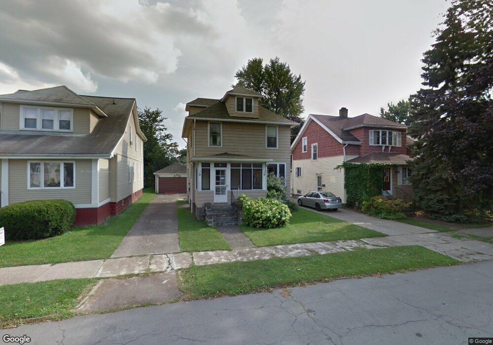
113 Bloomfield Ave Buffalo, NY 14220
South Park NeighborhoodEstimated Value: $190,000 - $254,000
3
Beds
1
Bath
1,248
Sq Ft
$182/Sq Ft
Est. Value
About This Home
This home is located at 113 Bloomfield Ave, Buffalo, NY 14220 and is currently estimated at $226,667, approximately $181 per square foot. 113 Bloomfield Ave is a home located in Erie County with nearby schools including Western New York Maritime Charter School, Bishop Timon-St. Jude High School, and Mount Mercy Academy.
Ownership History
Date
Name
Owned For
Owner Type
Purchase Details
Closed on
Mar 21, 2019
Sold by
Picone David M
Bought by
Picone David M and Sullivan Daniel F
Current Estimated Value
Purchase Details
Closed on
Jul 23, 2018
Sold by
Sullivan Joan
Bought by
Picone David
Purchase Details
Closed on
May 24, 2018
Sold by
Spinelli Bernard
Bought by
Sullivan Joan
Purchase Details
Closed on
Nov 9, 2012
Sold by
Spinelli Congie G and Spinelli W
Bought by
Spinelli Congie
Create a Home Valuation Report for This Property
The Home Valuation Report is an in-depth analysis detailing your home's value as well as a comparison with similar homes in the area
Home Values in the Area
Average Home Value in this Area
Purchase History
| Date | Buyer | Sale Price | Title Company |
|---|---|---|---|
| Picone David M | -- | None Available | |
| Picone David | $400,000 | None Available | |
| Sullivan Joan | $39,604 | None Available | |
| Spinelli Congie | -- | -- |
Source: Public Records
Tax History
| Year | Tax Paid | Tax Assessment Tax Assessment Total Assessment is a certain percentage of the fair market value that is determined by local assessors to be the total taxable value of land and additions on the property. | Land | Improvement |
|---|---|---|---|---|
| 2024 | $589 | $128,000 | $10,700 | $117,300 |
| 2023 | $1,912 | $128,000 | $10,700 | $117,300 |
| 2022 | $0 | $128,000 | $10,700 | $117,300 |
| 2021 | $0 | $128,000 | $10,700 | $117,300 |
| 2020 | $0 | $128,000 | $10,700 | $117,300 |
| 2019 | $1,912 | $69,700 | $6,600 | $63,100 |
| 2018 | $1,288 | $69,700 | $6,600 | $63,100 |
| 2017 | $0 | $69,700 | $6,600 | $63,100 |
| 2016 | $464 | $69,700 | $6,600 | $63,100 |
| 2015 | -- | $69,700 | $6,600 | $63,100 |
| 2014 | -- | $69,700 | $6,600 | $63,100 |
Source: Public Records
Map
Nearby Homes
- 66 Choate Ave
- 1077 Tifft St
- 53 Choate Ave
- 28 Bloomfield Ave
- 15 Edgewood Ave
- 95 Sheffield Ave
- 95 Columbus Ave
- 32 Richfield Ave
- 37 Alsace Ave
- 66 Woodside Ave
- 36 Edgewood Ave
- 179 Columbus Ave
- 70 Alsace Ave
- 81 Como Ave
- 166 Amber St
- 165 Lockwood Ave
- 189 W Woodside Ave
- 155 Altruria St
- 479 Abbott Rd
- 29 Allegany St
- 109 Bloomfield Ave
- 117 Bloomfield Ave Unit 3
- 105 Bloomfield Ave
- 121 Bloomfield Ave
- 101 Bloomfield Ave
- 114 Choate Ave
- 125 Bloomfield Ave
- 110 Choate Ave
- 118 Choate Ave
- 120 Choate Ave
- 106 Choate Ave
- 124 Choate Ave
- 97 Bloomfield Ave
- 129 Bloomfield Ave
- 102 Choate Ave
- 126 Choate Ave
- 114 Bloomfield Ave
- 118 Bloomfield Ave
- 110 Bloomfield Ave
- 122 Bloomfield Ave
Your Personal Tour Guide
Ask me questions while you tour the home.