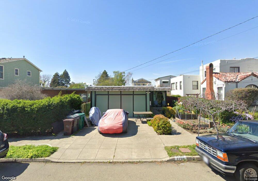
1130 Curtis St Albany, CA 94706
Albany Terrace NeighborhoodEstimated Value: $984,000 - $1,405,000
3
Beds
2
Baths
1,252
Sq Ft
$1,007/Sq Ft
Est. Value
About This Home
This home is located at 1130 Curtis St, Albany, CA 94706 and is currently estimated at $1,260,318, approximately $1,006 per square foot. 1130 Curtis St is a home located in Alameda County with nearby schools including Albany Middle School, Albany High School, and The Crowden School.
Ownership History
Date
Name
Owned For
Owner Type
Purchase Details
Closed on
Jan 2, 2014
Sold by
Okawachi Stanley K
Bought by
Okawachi Stanley Kikuo and Okawachi Yuka
Current Estimated Value
Purchase Details
Closed on
Dec 20, 2013
Sold by
Okawachi David H
Bought by
The Okawachi Family Trust
Purchase Details
Closed on
Oct 22, 2013
Sold by
Okawachi Stanley K and The Jewel M Okawachi Trust
Bought by
Okawachi David H and Okawachi Stanley K
Purchase Details
Closed on
May 17, 2001
Sold by
Okawachi Jewel and Okawachi Jewel M
Bought by
Okawachi Jewel M and The Jewel M Okawachi Trust
Create a Home Valuation Report for This Property
The Home Valuation Report is an in-depth analysis detailing your home's value as well as a comparison with similar homes in the area
Home Values in the Area
Average Home Value in this Area
Purchase History
We collect this data history from publicly available records. To have your information removed, we recommend requesting removal directly through your county’s website.
| Date | Buyer | Sale Price | Title Company |
|---|---|---|---|
| Okawachi Stanley Kikuo | -- | None Available | |
| The Okawachi Family Trust | -- | None Available | |
| Okawachi David H | -- | None Available | |
| Okawachi Jewel M | -- | -- |
Source: Public Records
Tax History
| Year | Tax Paid | Tax Assessment Tax Assessment Total Assessment is a certain percentage of the fair market value that is determined by local assessors to be the total taxable value of land and additions on the property. | Land | Improvement |
|---|---|---|---|---|
| 2025 | $4,242 | $85,812 | $32,363 | $53,449 |
| 2024 | $4,242 | $84,130 | $31,729 | $52,401 |
| 2023 | $3,993 | $82,479 | $31,106 | $51,373 |
| 2022 | $3,755 | $80,863 | $30,497 | $50,366 |
| 2021 | $3,670 | $79,277 | $29,899 | $49,378 |
| 2020 | $3,505 | $78,464 | $29,592 | $48,872 |
| 2019 | $3,420 | $76,926 | $29,012 | $47,914 |
| 2018 | $3,338 | $75,418 | $28,443 | $46,975 |
| 2017 | $3,250 | $73,940 | $27,886 | $46,054 |
| 2016 | $3,110 | $72,490 | $27,339 | $45,151 |
| 2015 | $3,015 | $71,401 | $26,928 | $44,473 |
| 2014 | $2,891 | $70,002 | $26,401 | $43,601 |
Source: Public Records
Map
Nearby Homes
- 1059 Talbot Ave
- 1330 Northside Ave
- 1034 Evelyn Ave
- 1418 #2 Northside Ave
- 922 Carmel Ave
- 1037 Stannage Ave
- 1192 Kains Ave
- 1213 San Pablo Ave
- 1626 Hopkins St
- 844 Ramona Ave
- 1229 Hopkins St
- 858 Neilson St
- 986 Kains Ave
- 840 Key Route Blvd
- 946 Kains Ave
- 848 Stannage Ave Unit 11
- 816 Talbot Ave
- 936 Camelia St
- 955 Jackson St
- 875 Colusa Ave Unit 4
- 1111 Curtis St Unit B
- 1111 Curtis St
- 1109 Curtis St
- 1113 Curtis St
- 1115 Curtis St
- 1107 Curtis St
- 1117 Curtis St
- 1102 Neilson St
- 1100 Neilson St
- 1108 Curtis St
- 1112 Curtis St
- 1106 Curtis St
- 1104 Neilson St
- 1114 Curtis St
- 1104 Curtis St
- 1498 Francis St
- 1106 Neilson St
- 1102 Curtis St
- 1116 Curtis St
- 1121 Curtis St
Your Personal Tour Guide
Ask me questions while you tour the home.