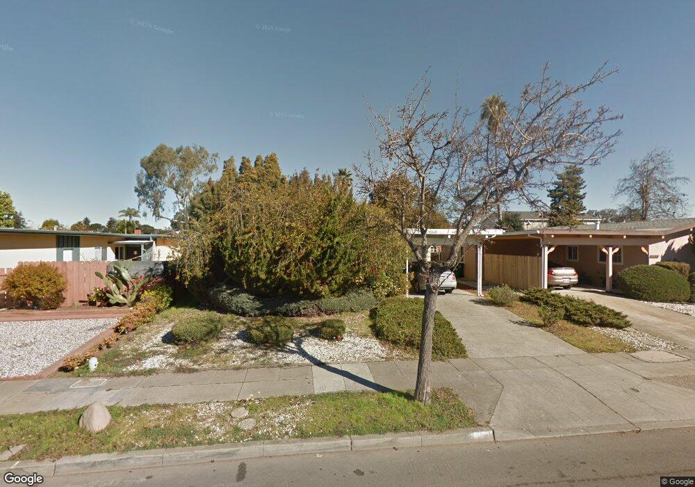
1133 Rosewood Way Alameda, CA 94501
South Shore NeighborhoodEstimated Value: $1,045,820 - $1,196,000
3
Beds
2
Baths
1,246
Sq Ft
$905/Sq Ft
Est. Value
About This Home
This home is located at 1133 Rosewood Way, Alameda, CA 94501 and is currently estimated at $1,128,205, approximately $905 per square foot. 1133 Rosewood Way is a home located in Alameda County with nearby schools including William G. Paden Elementary School, Will C. Wood Middle School, and Encinal Junior/Senior High.
Ownership History
Date
Name
Owned For
Owner Type
Purchase Details
Closed on
Jun 25, 2014
Sold by
Gregorian Rouben M and Gregorian Family Trust
Bought by
Gregorian Rouben M and Rouben M Gregorian Survivor Tr
Current Estimated Value
Purchase Details
Closed on
Dec 13, 2010
Sold by
Gregorian Rouben M and Gregorian Laoura M
Bought by
The Rouben M Gregorian & Laoura M Gregor
Purchase Details
Closed on
Sep 27, 2010
Sold by
Gregorian Rouben M and Gregorian Laoura M
Bought by
Gregorian Rouben M and Gregorian Laoura M
Create a Home Valuation Report for This Property
The Home Valuation Report is an in-depth analysis detailing your home's value as well as a comparison with similar homes in the area
Home Values in the Area
Average Home Value in this Area
Purchase History
| Date | Buyer | Sale Price | Title Company |
|---|---|---|---|
| Gregorian Rouben M | -- | None Available | |
| The Rouben M Gregorian & Laoura M Gregor | -- | None Available | |
| Gregorian Rouben M | -- | None Available |
Source: Public Records
Tax History Compared to Growth
Tax History
| Year | Tax Paid | Tax Assessment Tax Assessment Total Assessment is a certain percentage of the fair market value that is determined by local assessors to be the total taxable value of land and additions on the property. | Land | Improvement |
|---|---|---|---|---|
| 2025 | $3,087 | $96,845 | $47,319 | $49,526 |
| 2024 | $3,087 | $94,946 | $46,391 | $48,555 |
| 2023 | $3,010 | $93,085 | $45,482 | $47,603 |
| 2022 | $2,957 | $91,259 | $44,590 | $46,669 |
| 2021 | $2,907 | $89,470 | $43,716 | $45,754 |
| 2020 | $2,877 | $88,553 | $43,268 | $45,285 |
| 2019 | $2,451 | $86,816 | $42,419 | $44,397 |
| 2018 | $2,404 | $85,115 | $41,588 | $43,527 |
| 2017 | $2,337 | $83,446 | $40,772 | $42,674 |
| 2016 | $2,316 | $81,810 | $39,973 | $41,837 |
| 2015 | $2,301 | $80,581 | $39,372 | $41,209 |
| 2014 | $2,241 | $79,002 | $38,601 | $40,401 |
Source: Public Records
Map
Nearby Homes
- 955 Shorepoint Ct Unit 110
- 955 Shorepoint Ct Unit 200
- 404 Coral Reef Rd
- 965 Shorepoint Ct
- 950 Shorepoint Ct Unit 100
- 1001 Shoreline Dr Unit 301
- 933 Shoreline Dr Unit 203
- 608 Fortress Isle
- 325 Kitty Hawk Rd Unit 207
- 325 Kitty Hawk Rd Unit 304
- 901 San Antonio Ave
- 1220 9th St
- 1203 Benton St
- 1941 Franciscan Way
- 1301 9th St
- 610 Grand St
- 1812 San Antonio Ave
- 2031 Otis Dr Unit H
- 1059 Santa Clara Ave
- 1512 Mozart St
- 1129 Rosewood Way
- 1137 Rosewood Way
- 1125 Rosewood Way
- 1141 Rosewood Way
- 1130 Otis Dr
- 1136 Otis Dr
- 1124 Otis Dr
- 1142 Otis Dr
- 1121 Rosewood Way
- 1132 Rosewood Way
- 1118 Otis Dr
- 1128 Rosewood Way
- 1136 Rosewood Way
- 1124 Rosewood Way
- 1140 Rosewood Way
- 1148 Otis Dr
- 1117 Rosewood Way
- 1149 Rosewood Way
- 1112 Otis Dr
- 1120 Rosewood Way