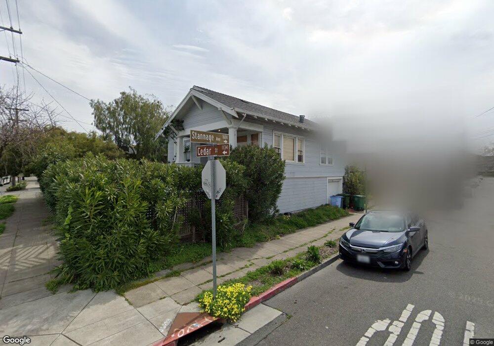
1134 Cedar St Unit 1134 Berkeley, CA 94702
West Berkeley NeighborhoodEstimated Value: $730,000 - $920,000
2
Beds
1
Bath
908
Sq Ft
$892/Sq Ft
Est. Value
About This Home
This home is located at 1134 Cedar St Unit 1134, Berkeley, CA 94702 and is currently estimated at $810,092, approximately $892 per square foot. 1134 Cedar St Unit 1134 is a home located in Alameda County with nearby schools including Ruth Acty Elementary, Rosa Parks Elementary School, and Berkeley Arts Magnet at Whittier School.
Ownership History
Date
Name
Owned For
Owner Type
Purchase Details
Closed on
Sep 3, 1999
Sold by
Swain Alan C and Swain Aleyda A
Bought by
Hanke John V and Hanke Holly S
Current Estimated Value
Home Financials for this Owner
Home Financials are based on the most recent Mortgage that was taken out on this home.
Original Mortgage
$210,600
Outstanding Balance
$61,669
Interest Rate
7.66%
Mortgage Type
Purchase Money Mortgage
Estimated Equity
$748,423
Create a Home Valuation Report for This Property
The Home Valuation Report is an in-depth analysis detailing your home's value as well as a comparison with similar homes in the area
Home Values in the Area
Average Home Value in this Area
Purchase History
| Date | Buyer | Sale Price | Title Company |
|---|---|---|---|
| Hanke John V | $263,500 | First American Title Guarant |
Source: Public Records
Mortgage History
| Date | Status | Borrower | Loan Amount |
|---|---|---|---|
| Open | Hanke John V | $210,600 | |
| Closed | Hanke John V | $39,450 |
Source: Public Records
Tax History
| Year | Tax Paid | Tax Assessment Tax Assessment Total Assessment is a certain percentage of the fair market value that is determined by local assessors to be the total taxable value of land and additions on the property. | Land | Improvement |
|---|---|---|---|---|
| 2025 | $10,017 | $595,015 | $178,593 | $416,422 |
| 2024 | $10,017 | $583,350 | $175,092 | $408,258 |
| 2023 | $9,801 | $571,914 | $171,659 | $400,255 |
| 2022 | $9,606 | $560,701 | $168,294 | $392,407 |
| 2021 | $9,616 | $549,708 | $164,994 | $384,714 |
| 2020 | $9,049 | $544,073 | $163,303 | $380,770 |
| 2019 | $8,638 | $533,407 | $160,101 | $373,306 |
| 2018 | $8,483 | $522,950 | $156,963 | $365,987 |
| 2017 | $8,184 | $512,699 | $153,886 | $358,813 |
| 2016 | $7,885 | $502,649 | $150,869 | $351,780 |
| 2015 | $7,775 | $495,101 | $148,604 | $346,497 |
| 2014 | $7,707 | $485,406 | $145,694 | $339,712 |
Source: Public Records
Map
Nearby Homes
- 1609 Kains Ave
- 1450 Curtis St
- 1447 Kains Ave
- 1207 Francisco St
- 1207 Francisco St Unit 2
- 1728 Curtis St
- 1504 10th St
- 1128 Delaware St
- 1322 Virginia St
- 1400 Santa fe Ave
- 998 Virginia St
- 921 Jones St
- 940 Delaware St
- 1919 Curtis St
- 817 Jones St
- 1482 Lincoln St
- 1213 San Pablo Ave
- 1207 Cornell Ave
- 1411 Hearst Ave Unit 2
- 817 Delaware St
- 1605 Stannage Ave
- 1140 Cedar St
- 1609 Stannage Ave
- 1132 Cedar St
- 1144 Cedar St
- 1602 Stannage Ave
- 1611 Stannage Ave
- 1604 Stannage Ave
- 1139 Cedar St
- 1128 Cedar St
- 1145 Cedar St
- 1148 Cedar St
- 1612 Cornell Ave
- 1560 Stannage Ave
- 1615 Stannage Ave
- 1149 Cedar St
- 1610 Stannage Ave
- 1131 Cedar St
- 1614 Cornell Ave
- 1617 Stannage Ave
Your Personal Tour Guide
Ask me questions while you tour the home.