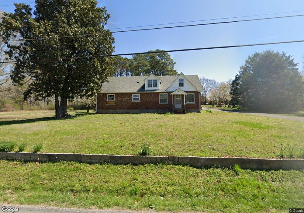
114 1st Ave N Loretto, TN 38469
Estimated Value: $151,000 - $217,000
--
Bed
1
Bath
1,484
Sq Ft
$118/Sq Ft
Est. Value
About This Home
This home is located at 114 1st Ave N, Loretto, TN 38469 and is currently estimated at $175,474, approximately $118 per square foot. 114 1st Ave N is a home located in Lawrence County with nearby schools including South Lawrence Elementary School, Lawrenceburg Public Elementary School, and Ingram Sowell Elementary School.
Ownership History
Date
Name
Owned For
Owner Type
Purchase Details
Closed on
Jul 5, 2022
Sold by
Henkel Perry Nell
Bought by
Meyer George Thomas and Meyer Millie K
Current Estimated Value
Purchase Details
Closed on
Sep 23, 2003
Sold by
Perry Kristen Denise
Bought by
Perry Andrew Joseph
Purchase Details
Closed on
Feb 22, 2001
Sold by
Estelle Henkel
Bought by
Andy Perry
Purchase Details
Closed on
Feb 1, 1945
Bought by
Henkel Raymond and Henkel Estelle
Create a Home Valuation Report for This Property
The Home Valuation Report is an in-depth analysis detailing your home's value as well as a comparison with similar homes in the area
Home Values in the Area
Average Home Value in this Area
Purchase History
| Date | Buyer | Sale Price | Title Company |
|---|---|---|---|
| Meyer George Thomas | $85,000 | Plant Paul B | |
| Meyer George Thomas | $85,000 | Plant Paul B | |
| Perry Andrew Joseph | -- | -- | |
| Andy Perry | $5,000 | -- | |
| Henkel Raymond | -- | -- |
Source: Public Records
Tax History Compared to Growth
Tax History
| Year | Tax Paid | Tax Assessment Tax Assessment Total Assessment is a certain percentage of the fair market value that is determined by local assessors to be the total taxable value of land and additions on the property. | Land | Improvement |
|---|---|---|---|---|
| 2024 | $738 | $31,525 | $775 | $30,750 |
| 2023 | $738 | $31,525 | $775 | $30,750 |
| 2022 | $725 | $31,000 | $250 | $30,750 |
| 2021 | $637 | $18,975 | $1,875 | $17,100 |
| 2020 | $637 | $18,975 | $1,875 | $17,100 |
| 2019 | $637 | $18,975 | $1,875 | $17,100 |
| 2018 | $627 | $18,975 | $1,875 | $17,100 |
| 2017 | $608 | $18,975 | $1,875 | $17,100 |
| 2016 | $608 | $18,975 | $1,875 | $17,100 |
| 2015 | $556 | $18,975 | $1,875 | $17,100 |
| 2014 | $567 | $19,375 | $1,875 | $17,500 |
Source: Public Records
Map
Nearby Homes
- 110 W Commerce St
- 219 Vine Cir
- 110 4th Ave
- 402 W Commerce St
- 308 Spring St
- 119 Horn Ave
- 0 Henkle Rd Unit RTC2592696
- 0 Henkle Rd Unit RTC2592694
- 0 Henkle Rd Unit RTC2452834
- 411 2nd Ave S
- 502 N Main St
- 191 Rigling Rd
- 163 Rigling Rd
- 24 Henkle Ln
- 2 Beartown Rd
- 1 Beartown Rd
- 624 2nd Ave S
- 110 Kitty Meyer Ln
- 0 Kitty Meyer Ln
- 0 Dixon Branch Rd
- 116 1st Ave N
- 123 Blueberry Ln
- 122 1st Ave N
- 115 N Main St
- 205 W Commerce St
- 205 W Commerce St Unit 6
- 209 W Commerce St
- 207 W Commerce St
- 124 1st Ave N
- 201 W Commerce St
- 201 W Commerce St Unit 201 & 203
- 125 1st Ave N
- 111 2nd Ave N
- 115 2nd Ave N
- 219 W Commerce St
- 105 2nd Ave N
- 117 2nd Ave N
- 212 W Commerce St
- 208 W Commerce St
- 106 N Main St