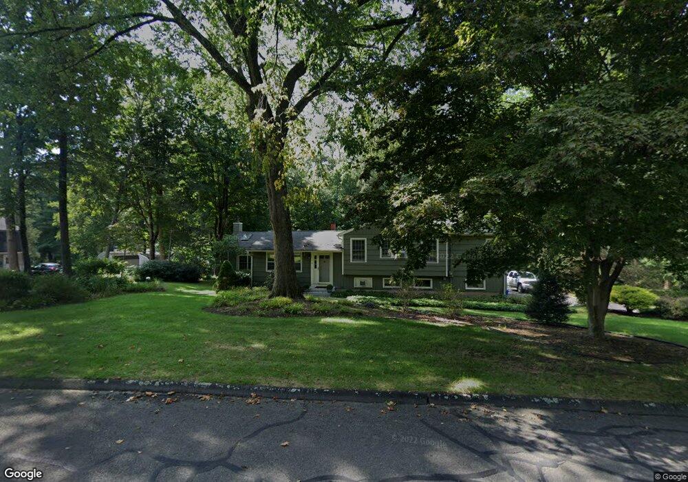
114 Flint Ridge Rd Monroe, CT 06468
Estimated Value: $598,000 - $647,583
4
Beds
3
Baths
2,165
Sq Ft
$288/Sq Ft
Est. Value
About This Home
This home is located at 114 Flint Ridge Rd, Monroe, CT 06468 and is currently estimated at $624,146, approximately $288 per square foot. 114 Flint Ridge Rd is a home located in Fairfield County with nearby schools including Fawn Hollow Elementary School, Jockey Hollow Middle School, and Masuk High School.
Ownership History
Date
Name
Owned For
Owner Type
Purchase Details
Closed on
Jun 30, 1989
Sold by
Mcbride John
Bought by
Pyrch Christine
Current Estimated Value
Purchase Details
Closed on
Sep 29, 1987
Sold by
Facer Robert
Bought by
Mcbride Joseph
Create a Home Valuation Report for This Property
The Home Valuation Report is an in-depth analysis detailing your home's value as well as a comparison with similar homes in the area
Home Values in the Area
Average Home Value in this Area
Purchase History
| Date | Buyer | Sale Price | Title Company |
|---|---|---|---|
| Pyrch Christine | $192,000 | -- | |
| Mcbride Joseph | $194,000 | -- |
Source: Public Records
Mortgage History
| Date | Status | Borrower | Loan Amount |
|---|---|---|---|
| Open | Mcbride Joseph | $130,285 | |
| Closed | Mcbride Joseph | $152,402 | |
| Closed | Mcbride Joseph | $160,000 | |
| Closed | Mcbride Joseph | $123,000 |
Source: Public Records
Tax History Compared to Growth
Tax History
| Year | Tax Paid | Tax Assessment Tax Assessment Total Assessment is a certain percentage of the fair market value that is determined by local assessors to be the total taxable value of land and additions on the property. | Land | Improvement |
|---|---|---|---|---|
| 2025 | $10,838 | $378,040 | $119,140 | $258,900 |
| 2024 | $9,594 | $250,700 | $103,700 | $147,000 |
| 2023 | $9,414 | $250,700 | $103,700 | $147,000 |
| 2022 | $9,241 | $250,700 | $103,700 | $147,000 |
| 2021 | $9,115 | $250,700 | $103,700 | $147,000 |
| 2020 | $8,895 | $250,700 | $103,700 | $147,000 |
| 2019 | $8,194 | $230,300 | $103,700 | $126,600 |
| 2018 | $8,116 | $230,300 | $103,700 | $126,600 |
| 2017 | $8,236 | $230,300 | $103,700 | $126,600 |
| 2016 | $8,061 | $230,300 | $103,700 | $126,600 |
| 2015 | $7,911 | $230,300 | $103,700 | $126,600 |
| 2014 | $7,956 | $256,550 | $131,040 | $125,510 |
Source: Public Records
Map
Nearby Homes
- 59 Flint Ridge Rd
- 6 Crossbow Ln
- 108 Wells Rd
- 36 Turkey Roost Rd
- 91 Harvester Rd
- 161 Jockey Hollow Rd
- 67 Hidden Knolls Cir
- 41 Alpine Rd
- 107 Hidden Knolls Cir Unit 107
- 132 Old Tannery Rd
- 13 Jeanette St
- 2 Great Oak Farm Rd Unit 2
- 26 Edgehill Cir
- 549 Cutler's Farm Rd
- 238 Turkey Roost Rd
- 102 Wild Horse Ct
- 80 Woodlawn Rd
- 13 Shadowwood Cir
- 77 Bart Rd
- 999 Monroe Turnpike
- 115 Flint Ridge Rd
- 108 Flint Ridge Rd
- 109 Flint Ridge Rd
- 120 Flint Ridge Rd
- 121 Flint Ridge Rd
- 102 Flint Ridge Rd
- 103 Flint Ridge Rd
- 58 Redcoat Ln
- 51 Redcoat Ln
- 34 Redcoat Ln
- 94 Flint Ridge Rd
- 41 Redcoat Ln
- 59 Redcoat Ln
- 16 Carriage Dr
- 33 Redcoat Ln
- 6 Carriage Dr
- 28 Redcoat Ln
- 67 Redcoat Ln
- 73 Redcoat Ln
- 15 Carriage Dr