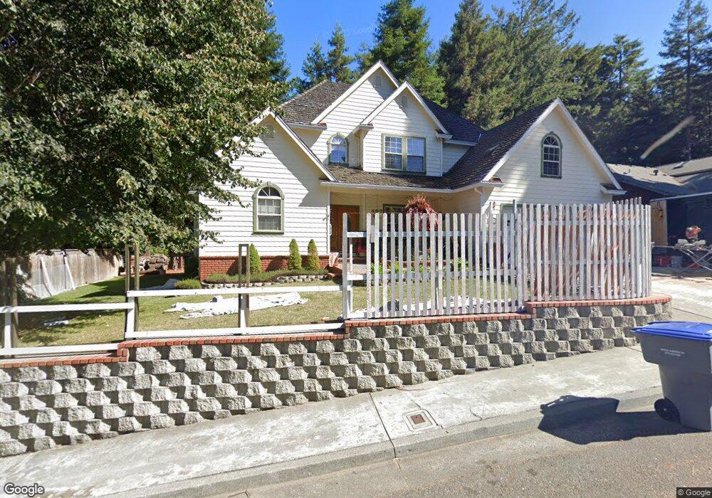
1142 Diamond Dr Arcata, CA 95521
Curtis Heights-Woodland Heights NeighborhoodEstimated Value: $718,317 - $1,025,000
4
Beds
3
Baths
2,925
Sq Ft
$287/Sq Ft
Est. Value
About This Home
This home is located at 1142 Diamond Dr, Arcata, CA 95521 and is currently estimated at $839,329, approximately $286 per square foot. 1142 Diamond Dr is a home located in Humboldt County with nearby schools including Arcata Elementary School, Sunny Brae Middle School, and Arcata High School.
Ownership History
Date
Name
Owned For
Owner Type
Purchase Details
Closed on
Jul 16, 2002
Sold by
Ghaffari Safar A and Ghaffari Lori S
Bought by
Ghaffari Safar A and Ghaffari Lori S
Current Estimated Value
Home Financials for this Owner
Home Financials are based on the most recent Mortgage that was taken out on this home.
Original Mortgage
$285,000
Interest Rate
6.7%
Purchase Details
Closed on
Jan 14, 2002
Sold by
Ingersoll Norman and Ingersoll Judy
Bought by
Ghaffari Safar A and Ghaffari Lori S
Home Financials for this Owner
Home Financials are based on the most recent Mortgage that was taken out on this home.
Original Mortgage
$288,750
Interest Rate
7.08%
Purchase Details
Closed on
Oct 19, 1999
Sold by
Coombs Tree Farms Inc
Bought by
Ingersoll Norman and Ingersoll Judy
Create a Home Valuation Report for This Property
The Home Valuation Report is an in-depth analysis detailing your home's value as well as a comparison with similar homes in the area
Home Values in the Area
Average Home Value in this Area
Purchase History
| Date | Buyer | Sale Price | Title Company |
|---|---|---|---|
| Ghaffari Safar A | -- | First American Title Ins Co | |
| Ghaffari Safar A | $385,000 | Fidelity National Title Co | |
| Ingersoll Norman | $67,500 | Fidelity National Title Co |
Source: Public Records
Mortgage History
| Date | Status | Borrower | Loan Amount |
|---|---|---|---|
| Closed | Ghaffari Safar A | $285,000 | |
| Previous Owner | Ghaffari Safar A | $288,750 |
Source: Public Records
Tax History
| Year | Tax Paid | Tax Assessment Tax Assessment Total Assessment is a certain percentage of the fair market value that is determined by local assessors to be the total taxable value of land and additions on the property. | Land | Improvement |
|---|---|---|---|---|
| 2025 | $6,260 | $568,735 | $140,329 | $428,406 |
| 2024 | $6,260 | $557,584 | $137,578 | $420,006 |
| 2023 | $6,125 | $546,652 | $134,881 | $411,771 |
| 2022 | $6,241 | $535,935 | $132,237 | $403,698 |
| 2021 | $5,936 | $525,428 | $129,645 | $395,783 |
| 2020 | $5,943 | $520,041 | $128,316 | $391,725 |
| 2019 | $5,747 | $509,845 | $125,800 | $384,045 |
| 2018 | $5,612 | $499,849 | $123,334 | $376,515 |
| 2017 | $5,504 | $490,049 | $120,916 | $369,133 |
| 2016 | $5,341 | $480,442 | $118,546 | $361,896 |
| 2015 | $5,281 | $473,226 | $116,766 | $356,460 |
| 2014 | $5,182 | $463,957 | $114,479 | $349,478 |
Source: Public Records
Map
Nearby Homes
- 1096 Diamond Dr
- 1346 Diamond Dr
- 113 Sylva St
- 119 Sylva St
- 812 Diamond Dr
- 330 California Ave
- 3122 St Louis Rd
- 2700 Meadow Creek Way
- 3028 Alliance Rd
- 1254 Mccallum Cir
- 3030 Alliance Rd
- 120 & 120a 13th St
- 3301 Antoinette Ct
- 1666 Stewart Ave
- 632 9th St
- 3659 Spear Ave
- 1082 Cedar Dr
- 4965 Monterey Dr
- 970 Courtyard Cir
- 753 Shirley Blvd
- 1154 Diamond Dr
- 1132 Diamond Dr
- 1137 Diamond Dr
- 1166 Diamond Dr
- 1161 Diamond Dr
- 2906 Woodland Ct
- 2918 Woodland Ct
- 1108 Diamond Dr
- 2865 Woodland Ct
- 1171 Diamond Dr
- 2877 Woodland Ct
- 2901 Woodland Ct
- 2930 Woodland Ct
- 2889 Woodland Ct
- 2913 Woodland Ct
- 1183 Diamond Dr
- 2942 Woodland Ct
- 1298 Diamond Dr
- 1310 Diamond Dr
- 1322 Diamond Dr
Your Personal Tour Guide
Ask me questions while you tour the home.