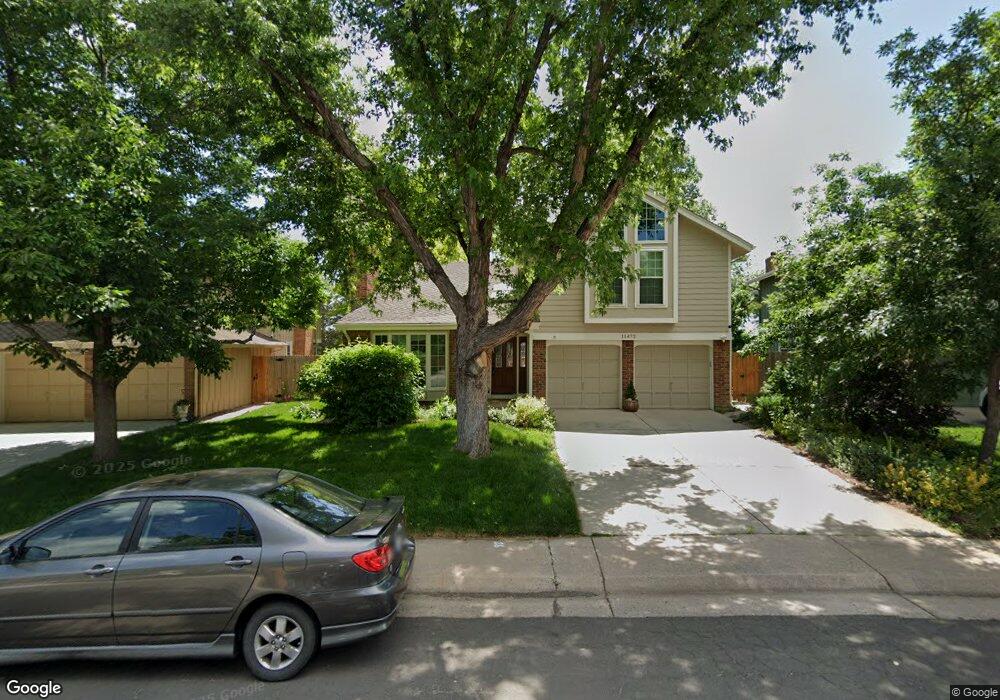
11472 Main Range Trail Littleton, CO 80127
Ken Caryl Ranch NeighborhoodEstimated Value: $818,820 - $911,000
4
Beds
4
Baths
3,876
Sq Ft
$225/Sq Ft
Est. Value
About This Home
This home is located at 11472 Main Range Trail, Littleton, CO 80127 and is currently estimated at $871,705, approximately $224 per square foot. 11472 Main Range Trail is a home located in Jefferson County with nearby schools including Shaffer Elementary School, Falcon Bluffs Middle School, and Chatfield High School.
Ownership History
Date
Name
Owned For
Owner Type
Purchase Details
Closed on
Jul 17, 2020
Sold by
Solis Amelia Fernandez
Bought by
Amelia F Solis Trust
Current Estimated Value
Purchase Details
Closed on
Nov 9, 2012
Sold by
Linton Robert J and Linton Sally J
Bought by
Solis Amelia Fernandez
Home Financials for this Owner
Home Financials are based on the most recent Mortgage that was taken out on this home.
Original Mortgage
$200,000
Outstanding Balance
$138,073
Interest Rate
3.37%
Mortgage Type
New Conventional
Estimated Equity
$733,632
Purchase Details
Closed on
Sep 8, 1993
Sold by
Detwiler Michael F and Detwiler Joyce E
Bought by
Linton Robert J and Linton Sally J
Home Financials for this Owner
Home Financials are based on the most recent Mortgage that was taken out on this home.
Original Mortgage
$159,700
Interest Rate
7.23%
Create a Home Valuation Report for This Property
The Home Valuation Report is an in-depth analysis detailing your home's value as well as a comparison with similar homes in the area
Home Values in the Area
Average Home Value in this Area
Purchase History
| Date | Buyer | Sale Price | Title Company |
|---|---|---|---|
| Amelia F Solis Trust | -- | None Available | |
| Solis Amelia Fernandez | $375,000 | Ats | |
| Linton Robert J | $174,000 | -- |
Source: Public Records
Mortgage History
| Date | Status | Borrower | Loan Amount |
|---|---|---|---|
| Open | Solis Amelia Fernandez | $200,000 | |
| Previous Owner | Linton Robert J | $159,700 |
Source: Public Records
Tax History Compared to Growth
Tax History
| Year | Tax Paid | Tax Assessment Tax Assessment Total Assessment is a certain percentage of the fair market value that is determined by local assessors to be the total taxable value of land and additions on the property. | Land | Improvement |
|---|---|---|---|---|
| 2024 | $5,143 | $48,041 | $10,484 | $37,557 |
| 2023 | $5,143 | $48,041 | $10,484 | $37,557 |
| 2022 | $4,235 | $38,685 | $8,571 | $30,114 |
| 2021 | $4,300 | $39,798 | $8,818 | $30,980 |
| 2020 | $3,867 | $35,907 | $7,502 | $28,405 |
| 2019 | $3,821 | $35,907 | $7,502 | $28,405 |
| 2018 | $3,631 | $32,951 | $8,315 | $24,636 |
| 2017 | $3,376 | $32,951 | $8,315 | $24,636 |
| 2016 | $3,476 | $32,102 | $8,851 | $23,251 |
| 2015 | $3,153 | $32,102 | $8,851 | $23,251 |
| 2014 | $3,153 | $27,444 | $7,353 | $20,091 |
Source: Public Records
Map
Nearby Homes
- 11617 Elk Head Range Rd
- 7747 Gunsight Pass
- 11703 Elk Head Range Rd
- 11804 Elk Head Range Rd
- 11781 Elk Head Range Rd
- 11104 W San Juan Range Rd
- 7825 Sand Mountain
- 10791 Trailrider Pass
- 10866 W Half Moon Pass
- 7474 S Alkire St Unit 203
- 7413 S Quail Cir Unit 1417
- 7418 S Quail Cir Unit 1315
- Willow Plan at Ken-Caryl Ranch - Luxury Villas at Deer Creek
- Ponderosa Plan at Ken-Caryl Ranch - Luxury Villas at Deer Creek
- 10494 W Turtle Mountain
- 7415 S Alkire St Unit 203
- 10567 W Chautauga Mountain
- 11341 W Alder Dr
- 8287 S Quail St
- 12013 W Hornsilver Mountain
- 11482 Main Range Trail
- 11462 Main Range Trail
- 11452 Main Range Trail
- 11492 Main Range Trail
- 11510 Homestake Peak
- 11471 W Cimarrona Peak
- 11461 W Cimarrona Peak
- 11481 W Cimarrona Peak
- 11491 W Cimarrona Peak
- 11520 Homestake Peak
- 11501 Homestake Peak
- 11451 W Cimarrona Peak
- 11530 Homestake Peak
- 11511 Homestake Peak
- 11386 San Joaquin Ridge
- 11396 San Joaquin Ridge
- 11452 W Cimarrona Peak
- 8050 S Sunlight Peak
- 11376 San Joaquin Ridge
- 8060 S Sunlight Peak