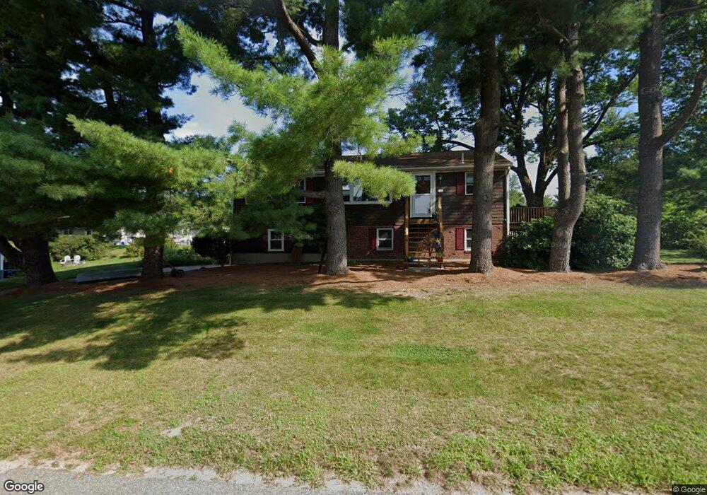
115 Hadde Ave Cumberland, RI 02864
Cumberland Hill NeighborhoodEstimated Value: $421,000 - $500,000
3
Beds
1
Bath
1,144
Sq Ft
$394/Sq Ft
Est. Value
About This Home
This home is located at 115 Hadde Ave, Cumberland, RI 02864 and is currently estimated at $450,901, approximately $394 per square foot. 115 Hadde Ave is a home located in Providence County with nearby schools including Ashton Elementary School, North Cumberland Middle School, and Cumberland High School.
Ownership History
Date
Name
Owned For
Owner Type
Purchase Details
Closed on
Jun 16, 2020
Sold by
Easterbrooks William E
Bought by
Easterbrooks Adam L and Heuer Erin L
Current Estimated Value
Purchase Details
Closed on
Dec 24, 1991
Sold by
Bertrand Raymond J
Bought by
Easterbrooks William E
Home Financials for this Owner
Home Financials are based on the most recent Mortgage that was taken out on this home.
Original Mortgage
$77,000
Interest Rate
8.68%
Mortgage Type
Purchase Money Mortgage
Create a Home Valuation Report for This Property
The Home Valuation Report is an in-depth analysis detailing your home's value as well as a comparison with similar homes in the area
Home Values in the Area
Average Home Value in this Area
Purchase History
| Date | Buyer | Sale Price | Title Company |
|---|---|---|---|
| Easterbrooks Adam L | -- | None Available | |
| Easterbrooks William E | $115,000 | -- |
Source: Public Records
Mortgage History
| Date | Status | Borrower | Loan Amount |
|---|---|---|---|
| Previous Owner | Easterbrooks William E | $77,000 |
Source: Public Records
Tax History Compared to Growth
Tax History
| Year | Tax Paid | Tax Assessment Tax Assessment Total Assessment is a certain percentage of the fair market value that is determined by local assessors to be the total taxable value of land and additions on the property. | Land | Improvement |
|---|---|---|---|---|
| 2025 | $4,097 | $333,900 | $157,000 | $176,900 |
| 2024 | $3,990 | $333,900 | $157,000 | $176,900 |
| 2023 | $3,880 | $333,900 | $157,000 | $176,900 |
| 2022 | $3,932 | $262,300 | $124,000 | $138,300 |
| 2021 | $3,866 | $262,300 | $124,000 | $138,300 |
| 2020 | $3,756 | $262,300 | $124,000 | $138,300 |
| 2019 | $3,595 | $226,400 | $105,700 | $120,700 |
| 2018 | $3,491 | $226,400 | $105,700 | $120,700 |
| 2017 | $3,444 | $226,400 | $105,700 | $120,700 |
| 2016 | $3,489 | $204,300 | $105,700 | $98,600 |
| 2015 | $3,489 | $204,300 | $105,700 | $98,600 |
| 2014 | $16,867 | $204,300 | $105,700 | $98,600 |
| 2013 | $3,232 | $204,800 | $105,700 | $99,100 |
Source: Public Records
Map
Nearby Homes
- 96 Evergreen St
- 11 Secluded Ct
- 2970 Mendon Rd Unit 139
- 2970 Mendon Rd Unit 84
- 2970 Mendon Rd Unit 154
- 33 Sandy Way
- 2894 Mendon Rd
- 50 Circledale Dr
- 11 Southbury Rd
- 12 Dulles St
- 15 New Clark Rd
- 86 Forestdale Dr
- 2 School St Unit 403
- 2 Main St Unit 15
- 2 School St Unit 241
- 2 School St Unit 311
- 2 School St Unit 130
- 2 School St Unit 108
- 1302 Hunting Hill Dr
- 45 Rose Ln