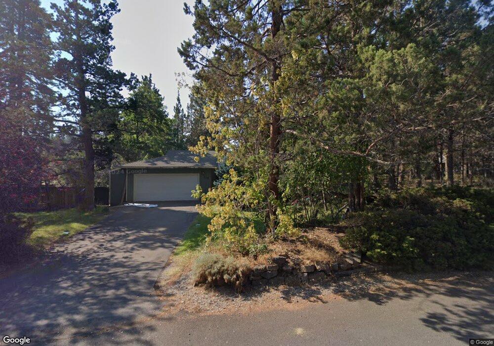
115 SE Craven Rd Bend, OR 97702
Larkspur NeighborhoodEstimated Value: $535,000 - $595,000
3
Beds
2
Baths
1,650
Sq Ft
$340/Sq Ft
Est. Value
About This Home
This home is located at 115 SE Craven Rd, Bend, OR 97702 and is currently estimated at $561,220, approximately $340 per square foot. 115 SE Craven Rd is a home located in Deschutes County with nearby schools including Bear Creek Elementary School, Bend Senior High School, and Eastmont Community School.
Ownership History
Date
Name
Owned For
Owner Type
Purchase Details
Closed on
Aug 26, 2024
Sold by
Waller Michel T and Waller Gwen A
Bought by
Waller Michel T
Current Estimated Value
Purchase Details
Closed on
Mar 20, 2017
Sold by
Lewis Matthew C and Lewis Cheryl L
Bought by
Waller Michel T and Waller Gwen A
Home Financials for this Owner
Home Financials are based on the most recent Mortgage that was taken out on this home.
Original Mortgage
$267,900
Interest Rate
4.3%
Mortgage Type
New Conventional
Create a Home Valuation Report for This Property
The Home Valuation Report is an in-depth analysis detailing your home's value as well as a comparison with similar homes in the area
Home Values in the Area
Average Home Value in this Area
Purchase History
| Date | Buyer | Sale Price | Title Company |
|---|---|---|---|
| Waller Michel T | -- | None Listed On Document | |
| Waller Michel T | $282,000 | First American Title |
Source: Public Records
Mortgage History
| Date | Status | Borrower | Loan Amount |
|---|---|---|---|
| Previous Owner | Waller Michel T | $267,900 |
Source: Public Records
Tax History Compared to Growth
Tax History
| Year | Tax Paid | Tax Assessment Tax Assessment Total Assessment is a certain percentage of the fair market value that is determined by local assessors to be the total taxable value of land and additions on the property. | Land | Improvement |
|---|---|---|---|---|
| 2025 | $3,291 | $194,760 | -- | -- |
| 2024 | $3,166 | $189,090 | -- | -- |
| 2023 | $2,935 | $183,590 | $0 | $0 |
| 2022 | $2,738 | $173,060 | $0 | $0 |
| 2021 | $2,743 | $168,020 | $0 | $0 |
| 2020 | $2,602 | $168,020 | $0 | $0 |
| 2019 | $2,529 | $163,130 | $0 | $0 |
| 2018 | $2,458 | $158,380 | $0 | $0 |
| 2017 | $2,386 | $153,770 | $0 | $0 |
| 2016 | $2,275 | $149,300 | $0 | $0 |
| 2015 | $2,213 | $144,960 | $0 | $0 |
| 2014 | $2,147 | $140,740 | $0 | $0 |
Source: Public Records
Map
Nearby Homes
- 98 NE Telima Ln
- 62001 NE Nates Place
- 62025 NE Nate's Place
- 21019 Carl St
- 20960 Gardenia Ave
- 61635 Pettigrew Rd Unit 12
- 61807 SE Rolo Ct
- 21035 Clairaway Ave
- 61839 Avonlea Cir
- 61969 SE 27th St
- 1033 SE Laurelwood Place
- 61730 Joan Ct
- 61847 SE 27th St
- 61839 SE 27th St
- 1001 SE 15th St Unit 56
- 1001 SE 15th St Unit 77
- 1001 SE 15th St Unit 110
- 1001 SE 15th St Unit 92
- 1001 SE 15th St Unit 109
- 1001 SE 15th St Unit 126
- 127 SE Craven Rd
- 96 SE Craven Rd
- 122 SE Craven Rd
- 94 SE Myrtlewood St
- 80 SE Craven Rd
- 105 SE Craven Rd
- 141 SE Craven Rd
- 71 SE Myrtlewood St
- 80 SE Myrtlewood St
- 107 SE Cessna Dr
- 121 SE Cessna Dr
- 110 SE Rice Way
- 95 SE Cessna Dr
- 128 SE Rice Way
- 148 SE Craven Rd
- 135 SE Cessna Dr
- 157 SE Craven Rd
- 81 SE Cessna Dr
- 85 SE Craven Rd
- 140 SE Rice Way