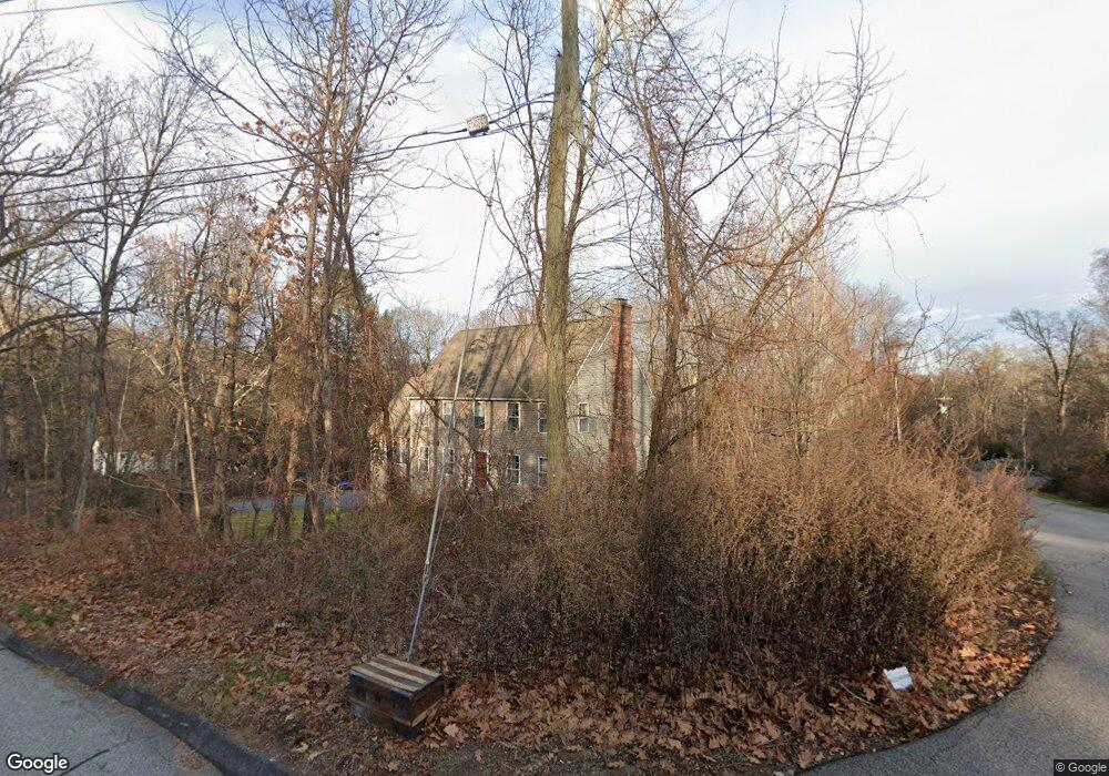
1150 Flanders Rd Coventry, CT 06238
Estimated Value: $379,000 - $532,000
3
Beds
3
Baths
1,780
Sq Ft
$265/Sq Ft
Est. Value
About This Home
This home is located at 1150 Flanders Rd, Coventry, CT 06238 and is currently estimated at $471,908, approximately $265 per square foot. 1150 Flanders Rd is a home located in Tolland County with nearby schools including George Hersey Robertson School, Coventry Grammar School, and Capt. Nathan Hale School.
Ownership History
Date
Name
Owned For
Owner Type
Purchase Details
Closed on
Jun 10, 2011
Sold by
Antunez Lessy
Bought by
Lavria Michael
Current Estimated Value
Purchase Details
Closed on
Aug 3, 2006
Sold by
Country Way Dev Inc
Bought by
Lauria Michael and Antunez Lessie
Home Financials for this Owner
Home Financials are based on the most recent Mortgage that was taken out on this home.
Original Mortgage
$283,900
Interest Rate
6.7%
Create a Home Valuation Report for This Property
The Home Valuation Report is an in-depth analysis detailing your home's value as well as a comparison with similar homes in the area
Home Values in the Area
Average Home Value in this Area
Purchase History
| Date | Buyer | Sale Price | Title Company |
|---|---|---|---|
| Lavria Michael | -- | -- | |
| Lauria Michael | $343,816 | -- | |
| Lavria Michael | -- | -- | |
| Lauria Michael | $343,816 | -- |
Source: Public Records
Mortgage History
| Date | Status | Borrower | Loan Amount |
|---|---|---|---|
| Previous Owner | Lauria Michael | $54,000 | |
| Previous Owner | Lauria Michael | $283,900 |
Source: Public Records
Tax History Compared to Growth
Tax History
| Year | Tax Paid | Tax Assessment Tax Assessment Total Assessment is a certain percentage of the fair market value that is determined by local assessors to be the total taxable value of land and additions on the property. | Land | Improvement |
|---|---|---|---|---|
| 2025 | $6,800 | $286,200 | $65,400 | $220,800 |
| 2024 | $6,356 | $190,800 | $58,100 | $132,700 |
| 2023 | $6,056 | $190,800 | $58,100 | $132,700 |
| 2022 | $5,943 | $190,800 | $58,100 | $132,700 |
| 2021 | $5,943 | $190,800 | $58,100 | $132,700 |
| 2020 | $5,947 | $190,800 | $58,100 | $132,700 |
| 2019 | $6,147 | $190,900 | $58,100 | $132,800 |
| 2018 | $5,864 | $182,100 | $58,100 | $124,000 |
| 2017 | $5,827 | $182,100 | $58,100 | $124,000 |
| 2016 | $5,682 | $182,100 | $58,100 | $124,000 |
| 2015 | $5,682 | $182,100 | $58,100 | $124,000 |
| 2014 | $5,982 | $210,100 | $72,700 | $137,400 |
Source: Public Records
Map
Nearby Homes
- 259 High St
- 0 South St Unit 24134981
- 122 High St
- 103 S Street Extension
- 106 S Street Extension
- 94 Stonehouse Rd Unit 10
- 1365 Main St
- 39 Wood Trail
- 198 Forest Rd
- 457 Stafford Rd
- 59 Woodland Rd
- 35 Birch Trail
- 0 Sheffield Dr
- 00 Sheffield Dr
- 35 Wyllys Farm Rd
- 36 Cooper Ln
- 31 Wyllys Farm Rd
- 43 Wyllys Farm Rd
- 37 Wyllys Farm Rd
- 131 Lakewood Dr
- 1146 Flanders Rd
- 1154 Flanders Rd
- 1160 Flanders Rd
- 1124 Flanders Rd
- 1174 Flanders Rd
- 1118 Flanders Rd
- 1112 Flanders Rd
- 35 Nathan Hale Dr
- 49 Nathan Hale Dr
- 1104 Flanders Rd
- 1143 Flanders Rd
- 168 Snake Hill Rd
- 1169 Flanders Rd
- 65 Nathan Hale Dr
- 547 High St
- 1117 Flanders Rd
- 1096 Flanders Rd
- 265 Snake Hill Rd
- 1205 Flanders Rd
- 73 Nathan Hale Dr