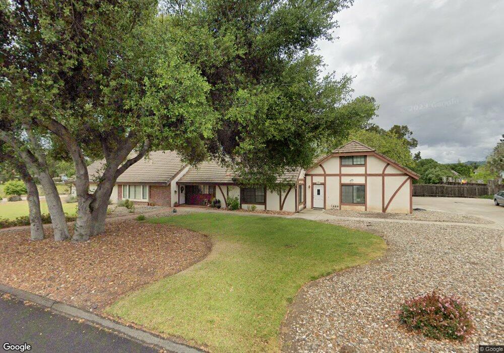
1171 Onstott Rd Lompoc, CA 93436
Mission Hills NeighborhoodEstimated Value: $924,690 - $974,000
5
Beds
2
Baths
2,808
Sq Ft
$335/Sq Ft
Est. Value
About This Home
This home is located at 1171 Onstott Rd, Lompoc, CA 93436 and is currently estimated at $940,673, approximately $334 per square foot. 1171 Onstott Rd is a home located in Santa Barbara County with nearby schools including Los Berros Visual and Performing Arts Academy, Cabrillo High School, and Olive Grove Charter - Lompoc.
Ownership History
Date
Name
Owned For
Owner Type
Purchase Details
Closed on
Aug 15, 2019
Sold by
Fay Courtney Elizabeth and Warnstrom Susan
Bought by
Fay Courtney Elizabeth and Warnstrom Susan
Current Estimated Value
Purchase Details
Closed on
Jan 30, 2013
Sold by
Courtney Sarah Margaret and Courtney Elizabeth Fay
Bought by
Courtney Elizabeth Fay and Courtney Sarah Margaret
Home Financials for this Owner
Home Financials are based on the most recent Mortgage that was taken out on this home.
Original Mortgage
$230,500
Interest Rate
2.61%
Mortgage Type
New Conventional
Purchase Details
Closed on
Jun 5, 2002
Sold by
Courtney Sarah Margaret
Bought by
Courtney Sarah Margaret and Courtney Elizabeth Fay
Purchase Details
Closed on
Apr 1, 2002
Sold by
Edwards Kathleen Gene Lewis and Lansdock Marcia Joan Lewis Bailey
Bought by
Courtney Sarah Margaret
Home Financials for this Owner
Home Financials are based on the most recent Mortgage that was taken out on this home.
Original Mortgage
$247,000
Interest Rate
6.94%
Purchase Details
Closed on
Apr 12, 1999
Sold by
Lewis Donald L and Lewis Barbara B
Bought by
Lewis Donald L and Lewis Barbara B
Home Financials for this Owner
Home Financials are based on the most recent Mortgage that was taken out on this home.
Original Mortgage
$245,000
Interest Rate
7%
Purchase Details
Closed on
Feb 22, 1999
Sold by
Lewis Donald L
Bought by
Lewis Donald L and Lewis Barbara B
Home Financials for this Owner
Home Financials are based on the most recent Mortgage that was taken out on this home.
Original Mortgage
$245,000
Interest Rate
7%
Purchase Details
Closed on
Dec 18, 1996
Sold by
Lewis Donald L and 11-13-86 Barbara Fam
Bought by
Lewis Donald L and Lewis Barbara B
Home Financials for this Owner
Home Financials are based on the most recent Mortgage that was taken out on this home.
Original Mortgage
$180,000
Interest Rate
7.46%
Create a Home Valuation Report for This Property
The Home Valuation Report is an in-depth analysis detailing your home's value as well as a comparison with similar homes in the area
Home Values in the Area
Average Home Value in this Area
Purchase History
| Date | Buyer | Sale Price | Title Company |
|---|---|---|---|
| Fay Courtney Elizabeth | -- | None Available | |
| Warnstrom Susan | -- | None Available | |
| Fay Courtney Elizabeth | -- | None Available | |
| Courtney Elizabeth Fay | -- | Fidelity National Title Co | |
| Courtney Sarah Margaret | -- | -- | |
| Courtney Sarah Margaret | -- | Chicago Title Co | |
| Lewis Donald L | -- | -- | |
| Lewis Donald L | -- | First American Title | |
| Lewis Donald L | -- | Chicago Title |
Source: Public Records
Mortgage History
| Date | Status | Borrower | Loan Amount |
|---|---|---|---|
| Previous Owner | Courtney Elizabeth Fay | $230,500 | |
| Previous Owner | Courtney Sarah Margaret | $247,000 | |
| Previous Owner | Lewis Donald L | $245,000 | |
| Previous Owner | Lewis Donald L | $180,000 |
Source: Public Records
Tax History
| Year | Tax Paid | Tax Assessment Tax Assessment Total Assessment is a certain percentage of the fair market value that is determined by local assessors to be the total taxable value of land and additions on the property. | Land | Improvement |
|---|---|---|---|---|
| 2025 | $5,473 | $507,063 | $187,820 | $319,243 |
| 2023 | $5,473 | $487,376 | $180,528 | $306,848 |
| 2022 | $5,382 | $477,821 | $176,989 | $300,832 |
| 2021 | $5,445 | $468,453 | $173,519 | $294,934 |
| 2020 | $5,386 | $463,650 | $171,740 | $291,910 |
| 2019 | $5,299 | $454,560 | $168,373 | $286,187 |
| 2018 | $5,219 | $445,648 | $165,072 | $280,576 |
| 2017 | $5,125 | $436,911 | $161,836 | $275,075 |
| 2016 | $5,032 | $428,345 | $158,663 | $269,682 |
| 2014 | $4,926 | $413,648 | $153,219 | $260,429 |
Source: Public Records
Map
Nearby Homes
- 892 Onstott Rd
- 972 Pellham Dr
- 832 Onstott Rd
- 757 Onstott Rd
- 778 Tamarisk Dr
- 2655 Adobe Falls Rd
- 1588 Calle Portos
- 3578 Via Lato
- 3770 Rucker Rd
- 3838 Via Mitad
- 1445 Calle Marana
- 549 Palomar Cir
- 3725 Jupiter Ave
- 3825 Saturn Ave Unit 1
- 731 Voyager Rd
- 372 Falcon Crest Dr
- 384 Falcon Crest Dr
- 3843 Cassini Cir Unit 3
- 728 Pluto Ave
- 250 Saint Andrews Way
- 3118 Oak Pointe Dr
- 3060 Oak Pointe Dr
- 1181 Onstott Rd
- 3050 Oak Pointe Dr
- 3119 Oak Pointe Dr
- 1192 Pellham Dr
- 1180 Onstott Rd
- 1152 Onstott Rd
- 1182 Pellham Dr
- 3040 Oak Pointe Dr
- 3051 Oak Pointe Dr
- 1146 Pellham Dr
- 3041 Oak Pointe Dr
- 3142 Courtney Dr
- 1069 Onstott Rd
- 3030 Oak Pointe Dr
- 3152 Courtney Dr
- 3122 Courtney Dr
- 1220 Onstott Rd
Your Personal Tour Guide
Ask me questions while you tour the home.