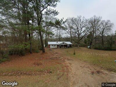
11769 Highway 488 Walnut Grove, MS 39189
Estimated Value: $140,000 - $161,000
3
Beds
3
Baths
1,535
Sq Ft
$96/Sq Ft
Est. Value
About This Home
This home is located at 11769 Highway 488, Walnut Grove, MS 39189 and is currently estimated at $147,839, approximately $96 per square foot. 11769 Highway 488 is a home located in Leake County with nearby schools including Leake County Elementary School, Leake County High School, and Leake Academy.
Ownership History
Date
Name
Owned For
Owner Type
Purchase Details
Closed on
Aug 30, 2022
Sold by
Murphy Carrie
Bought by
Murphy Carrie
Current Estimated Value
Purchase Details
Closed on
Oct 10, 2008
Sold by
Gunn Thomas and Hamilton Roxie
Bought by
Doty Oscar and Doty Shanna
Home Financials for this Owner
Home Financials are based on the most recent Mortgage that was taken out on this home.
Original Mortgage
$88,341
Interest Rate
5.96%
Create a Home Valuation Report for This Property
The Home Valuation Report is an in-depth analysis detailing your home's value as well as a comparison with similar homes in the area
Home Values in the Area
Average Home Value in this Area
Purchase History
| Date | Buyer | Sale Price | Title Company |
|---|---|---|---|
| Murphy Carrie | -- | Attorney Only | |
| Doty Oscar | -- | -- |
Source: Public Records
Mortgage History
| Date | Status | Borrower | Loan Amount |
|---|---|---|---|
| Previous Owner | Doty Oscar | $88,341 |
Source: Public Records
Tax History Compared to Growth
Tax History
| Year | Tax Paid | Tax Assessment Tax Assessment Total Assessment is a certain percentage of the fair market value that is determined by local assessors to be the total taxable value of land and additions on the property. | Land | Improvement |
|---|---|---|---|---|
| 2024 | $582 | $6,373 | $590 | $5,783 |
| 2023 | $582 | $7,242 | $590 | $6,652 |
| 2022 | $582 | $7,242 | $590 | $6,652 |
| 2021 | $371 | $4,875 | $590 | $4,285 |
| 2020 | $371 | $4,875 | $590 | $4,285 |
| 2019 | $405 | $5,707 | $590 | $5,117 |
| 2018 | $382 | $5,707 | $590 | $5,117 |
| 2017 | $373 | $5,508 | $620 | $4,888 |
| 2016 | $0 | $5,508 | $620 | $4,888 |
| 2015 | $364 | $5,864 | $620 | $5,244 |
| 2014 | $364 | $5,864 | $620 | $5,244 |
Source: Public Records
Map
Nearby Homes
- 2385 Mowdy Rd
- 00 Mississippi 488
- 7326 Mississippi 488
- 0 Galilee Rd
- 494 Purvis Rd
- 10010 Mississippi 427
- 333 Hudson Rd
- 48.5 Acres Bufkin Rd
- 10671 Hwy 427
- 10671 Mississippi 427
- 0 Lewis Rd
- 0 Freeny Rd
- 10380 Road 1105
- 0 Thrash Rd
- 3011 Crowder Creek Rd
- 786 Clyde B Rd
- 15991 Mississippi 21
- - Mississippi 492
- 111 Lewis Ave
- 11769 Highway 488
- 11769 Highway 488
- 11755 Highway 488
- 11755 Highway 488
- 11756 Highway 488
- 11651 Highway 488
- 11648 Highway 488
- 11770 Highway 488
- 11789 Highway 488
- 11612 Highway 488
- 11592 Highway 488
- 11794 Highway 488
- 11602 Highway 488
- 12210 Highway 488
- 0 Hwy 488 Hwy Unit 229194
- 0 Hwy 488 Hwy Unit 245886
- 0 Highway 488 Hwy Unit 260985
- 0 Highway 488 Hwy Unit 1229194
- 0 Highway 488 Hwy Unit 1245886
- 0 Highway 488 Hwy Unit 1260985