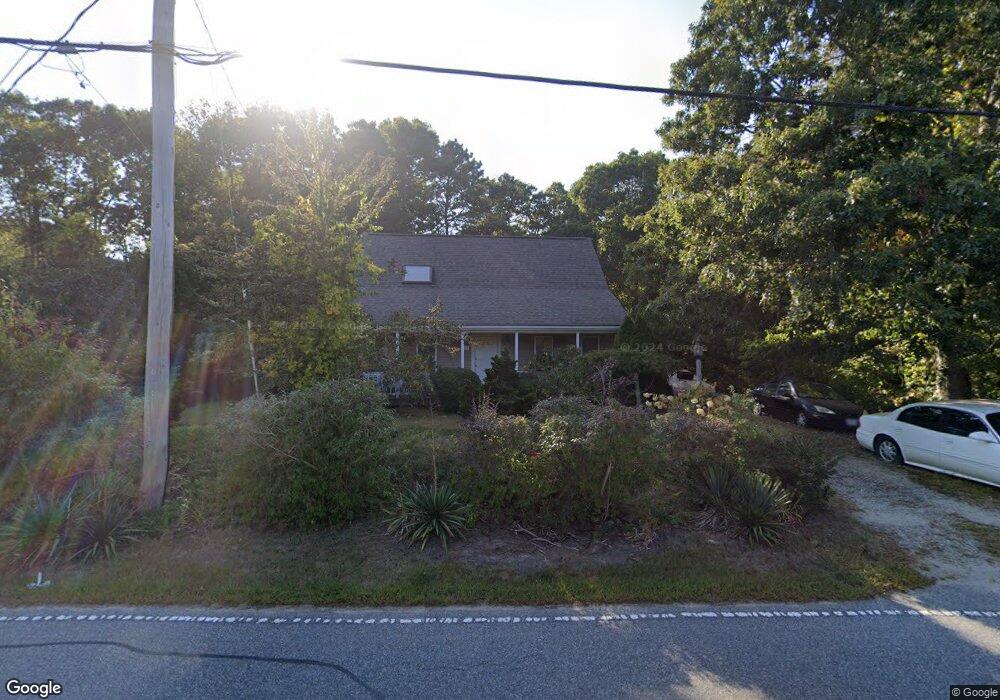
118 Algonquin Ave Mashpee, MA 02649
Estimated Value: $554,840 - $707,000
3
Beds
2
Baths
1,547
Sq Ft
$393/Sq Ft
Est. Value
About This Home
This home is located at 118 Algonquin Ave, Mashpee, MA 02649 and is currently estimated at $608,710, approximately $393 per square foot. 118 Algonquin Ave is a home located in Barnstable County with nearby schools including Kenneth C. Coombs School, Quashnet School, and Mashpee Middle School.
Ownership History
Date
Name
Owned For
Owner Type
Purchase Details
Closed on
Sep 10, 1996
Sold by
Dream Dev Of Cape Cod
Bought by
Koslow Donald A
Current Estimated Value
Home Financials for this Owner
Home Financials are based on the most recent Mortgage that was taken out on this home.
Original Mortgage
$97,000
Outstanding Balance
$8,263
Interest Rate
8.11%
Mortgage Type
Purchase Money Mortgage
Estimated Equity
$600,447
Purchase Details
Closed on
Feb 28, 1996
Sold by
Labute Adele F
Bought by
Dream Dev Cape Cod
Create a Home Valuation Report for This Property
The Home Valuation Report is an in-depth analysis detailing your home's value as well as a comparison with similar homes in the area
Purchase History
| Date | Buyer | Sale Price | Title Company |
|---|---|---|---|
| Koslow Donald A | $108,000 | -- | |
| Dream Dev Cape Cod | $18,500 | -- |
Source: Public Records
Mortgage History
| Date | Status | Borrower | Loan Amount |
|---|---|---|---|
| Open | Koslow Donald A | $97,000 |
Source: Public Records
Tax History
| Year | Tax Paid | Tax Assessment Tax Assessment Total Assessment is a certain percentage of the fair market value that is determined by local assessors to be the total taxable value of land and additions on the property. | Land | Improvement |
|---|---|---|---|---|
| 2025 | $3,329 | $502,900 | $203,600 | $299,300 |
| 2024 | $3,062 | $476,200 | $185,100 | $291,100 |
| 2023 | $2,911 | $415,200 | $176,300 | $238,900 |
| 2022 | $2,766 | $338,600 | $143,300 | $195,300 |
| 2021 | $2,701 | $297,800 | $129,100 | $168,700 |
| 2020 | $2,624 | $288,700 | $124,200 | $164,500 |
| 2019 | $2,522 | $278,700 | $124,200 | $154,500 |
| 2018 | $2,404 | $269,500 | $124,200 | $145,300 |
| 2017 | $2,352 | $255,900 | $124,200 | $131,700 |
| 2016 | $2,292 | $248,100 | $124,200 | $123,900 |
| 2015 | $2,212 | $242,800 | $124,200 | $118,600 |
| 2014 | $2,101 | $223,700 | $105,300 | $118,400 |
Source: Public Records
Map
Nearby Homes
- 44 Twin Oaks Dr Unit 44
- 44 Twin Oaks Dr
- 20 Twin Oaks Dr
- 20 Twin Oaks Dr Unit 20
- 17 Twin Oaks Dr Unit 17
- 160 Algonquin Ave
- 23 Sea Spray Ave Unit 563
- 23 Sea Spray Ave
- 54 Sassacus Rd
- 300 Nathan Ellis Hwy Unit 50
- 22 Grey Hawk Dr Unit 645
- 16 Grey Hawk Dr Unit 16
- 168 Ninigret Ave
- 15 Pebble Beach Ave Unit 2005-103
- 15 Pebble Beach Ave
- 153 Leisure Green Dr
- 153 Leisure Green Dr Unit 749
- 10 Kettle Ln
- 5 Kettle Ln Unit 38
- 6 Masters Ct
- 112 Algonquin Ave
- 124 Algonquin Ave
- 31 Mohican Ave
- 35 Mohican Ave
- 25 Mohican Ave
- 108 Algonquin Ave
- 128 Algonquin Ave
- 10 Nohono Rd
- 4 Nohono Rd
- 44 Twin Oaks Dr Unit 700
- 46 Twin Oaks Dr Unit 701
- 46 Twin Oaks Dr
- 19 Mohican Ave
- 120 Grey Hawk Dr Unit 694
- 122 Grey Hawk Dr Unit 695
- 120 Grey Hawk Dr Unit 698
- 126 Grey Hawk Dr Unit 697
- 124 Grey Hawk Dr Unit 696
- 120 Grey Hawk Dr
- 126 Grey Hawk Dr
Your Personal Tour Guide
Ask me questions while you tour the home.