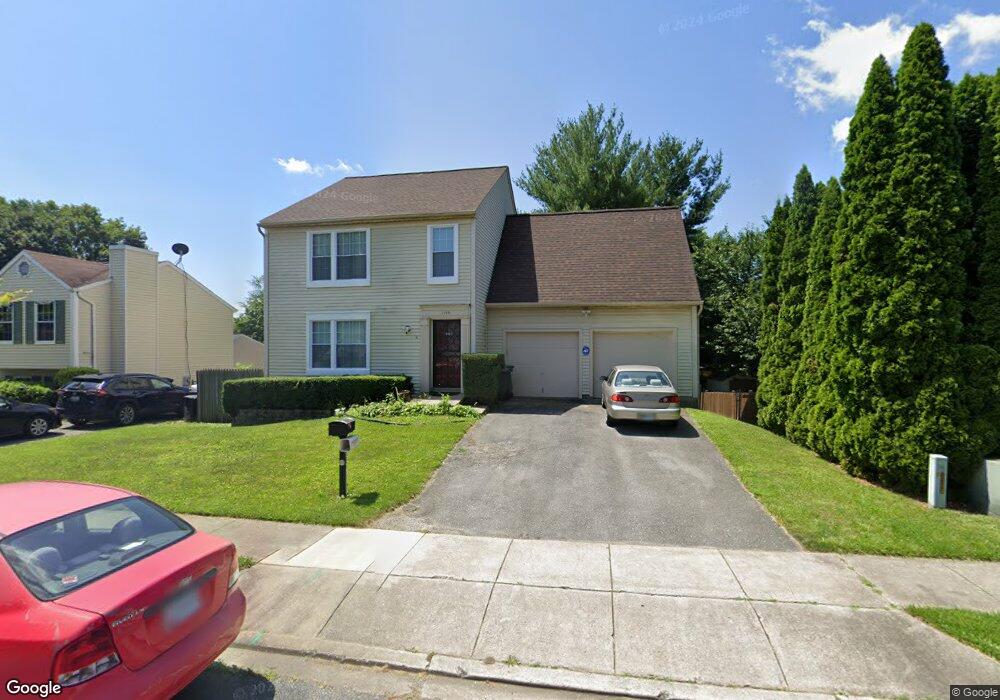
1196 Codorus St Frederick, MD 21702
Taskers Chance NeighborhoodEstimated Value: $397,943 - $492,000
Studio
2
Baths
1,818
Sq Ft
$243/Sq Ft
Est. Value
About This Home
This home is located at 1196 Codorus St, Frederick, MD 21702 and is currently estimated at $442,486, approximately $243 per square foot. 1196 Codorus St is a home located in Frederick County with nearby schools including Butterfly Ridge Elementary School, Monocacy Middle School, and Gov. Thomas Johnson High School.
Ownership History
Date
Name
Owned For
Owner Type
Purchase Details
Closed on
Oct 9, 1987
Sold by
Castle Homes Ltd
Bought by
Simon Nelson and Simon Ruby L
Current Estimated Value
Home Financials for this Owner
Home Financials are based on the most recent Mortgage that was taken out on this home.
Original Mortgage
$113,400
Interest Rate
11.21%
Purchase Details
Closed on
Jul 6, 1987
Sold by
Crosby Betty M
Bought by
Castle Homes Ltd
Create a Home Valuation Report for This Property
The Home Valuation Report is an in-depth analysis detailing your home's value as well as a comparison with similar homes in the area
Home Values in the Area
Average Home Value in this Area
Purchase History
| Date | Buyer | Sale Price | Title Company |
|---|---|---|---|
| Simon Nelson | $114,600 | -- | |
| Castle Homes Ltd | $76,000 | -- |
Source: Public Records
Mortgage History
| Date | Status | Borrower | Loan Amount |
|---|---|---|---|
| Closed | Simon Nelson | $113,400 |
Source: Public Records
Tax History
| Year | Tax Paid | Tax Assessment Tax Assessment Total Assessment is a certain percentage of the fair market value that is determined by local assessors to be the total taxable value of land and additions on the property. | Land | Improvement |
|---|---|---|---|---|
| 2025 | $6,232 | $370,800 | $116,200 | $254,600 |
| 2024 | $6,232 | $336,100 | $0 | $0 |
| 2023 | $5,455 | $301,400 | $0 | $0 |
| 2022 | $4,820 | $266,700 | $81,000 | $185,700 |
| 2021 | $4,430 | $256,067 | $0 | $0 |
| 2020 | $4,430 | $245,433 | $0 | $0 |
| 2019 | $4,239 | $234,800 | $70,100 | $164,700 |
| 2018 | $3,226 | $228,167 | $0 | $0 |
| 2017 | $4,000 | $234,800 | $0 | $0 |
| 2016 | $3,937 | $214,900 | $0 | $0 |
| 2015 | $3,937 | $214,200 | $0 | $0 |
| 2014 | $3,937 | $213,500 | $0 | $0 |
Source: Public Records
Map
Nearby Homes
- 1191 Codorus St
- 214 Savage Rd
- 1204 Conewago Dr
- 47 Vienna Ct
- 56 Victoria Square
- 120 Burgess Hill Way Unit 207
- 92 Victoria Square
- 1318 Hampshire Dr
- 1330 Hampshire Dr
- 342 Marquis St
- 195 Bel Aire Ln
- 1311 Sandoval Ct
- 1310 Marsalis Place
- 330 Furgeson Ln
- 196 Key Pkwy
- 1736 Atlas Dr
- 1848 Murdock Ct
- 1864 Murdock Ct
- 1016 Dulaney Mill Dr
- 1716 Atlas Dr
- 1194 Codorus St
- 1198 Codorus St
- 1195 Avondale Ct
- 1193 Avondale Ct
- 1192 Codorus St
- 1197 Codorus St
- 1199 Codorus St
- 1195 Codorus St
- 1191 Avondale Ct
- 1197 Avondale Ct
- 1190 Codorus St
- 1193 Codorus St
- 1189 Avondale Ct
- 1205 Markel Cir
- 1188 Codorus St
- 1199 Avondale Ct
- 1199 Willoughby Ct
- 1198 Willoughby Ct
- 1207 Markel Cir
- 1204 Markel Cir
Your Personal Tour Guide
Ask me questions while you tour the home.