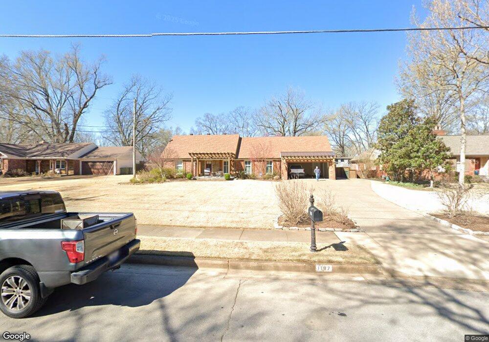
1197 Hayne Rd Memphis, TN 38119
Colonial Acres NeighborhoodEstimated Value: $332,000 - $373,046
4
Beds
3
Baths
3,017
Sq Ft
$119/Sq Ft
Est. Value
About This Home
This home is located at 1197 Hayne Rd, Memphis, TN 38119 and is currently estimated at $359,512, approximately $119 per square foot. 1197 Hayne Rd is a home located in Shelby County with nearby schools including Sea Isle Elementary School, Colonial Middle, and Overton High.
Ownership History
Date
Name
Owned For
Owner Type
Purchase Details
Closed on
Mar 28, 2002
Sold by
Varnell Dexter Lewis
Bought by
Griffin Howard K and Griffin Donna
Current Estimated Value
Home Financials for this Owner
Home Financials are based on the most recent Mortgage that was taken out on this home.
Original Mortgage
$135,100
Outstanding Balance
$55,965
Interest Rate
6.8%
Estimated Equity
$303,547
Purchase Details
Closed on
Dec 6, 2001
Sold by
Varnell Sandra
Bought by
Varnell Dexter Lewis
Purchase Details
Closed on
Sep 15, 1999
Sold by
Whitten Nathaniel M and Whitten Miriam L
Bought by
Varnell Dexter L and Varnell Sandra
Home Financials for this Owner
Home Financials are based on the most recent Mortgage that was taken out on this home.
Original Mortgage
$120,000
Interest Rate
8.22%
Create a Home Valuation Report for This Property
The Home Valuation Report is an in-depth analysis detailing your home's value as well as a comparison with similar homes in the area
Home Values in the Area
Average Home Value in this Area
Purchase History
| Date | Buyer | Sale Price | Title Company |
|---|---|---|---|
| Griffin Howard K | $182,500 | Lawyers Title Insurance Corp | |
| Varnell Dexter Lewis | -- | -- | |
| Varnell Dexter L | $170,000 | -- |
Source: Public Records
Mortgage History
| Date | Status | Borrower | Loan Amount |
|---|---|---|---|
| Open | Griffin Howard K | $135,100 | |
| Previous Owner | Varnell Dexter L | $120,000 |
Source: Public Records
Tax History Compared to Growth
Tax History
| Year | Tax Paid | Tax Assessment Tax Assessment Total Assessment is a certain percentage of the fair market value that is determined by local assessors to be the total taxable value of land and additions on the property. | Land | Improvement |
|---|---|---|---|---|
| 2025 | -- | $88,700 | $14,500 | $74,200 |
| 2024 | -- | $82,600 | $11,075 | $71,525 |
| 2023 | $5,032 | $82,600 | $11,075 | $71,525 |
| 2022 | $5,032 | $82,600 | $11,075 | $71,525 |
| 2021 | $5,091 | $82,600 | $11,075 | $71,525 |
| 2020 | $4,849 | $66,925 | $11,075 | $55,850 |
| 2019 | $4,849 | $66,925 | $11,075 | $55,850 |
| 2018 | $4,849 | $66,925 | $11,075 | $55,850 |
| 2017 | $2,751 | $66,925 | $11,075 | $55,850 |
| 2016 | $2,413 | $55,225 | $0 | $0 |
| 2014 | $2,413 | $55,225 | $0 | $0 |
Source: Public Records
Map
Nearby Homes
- 5362 Knollwood Cove
- 1190 Estate Dr
- 1149 E Irvin Dr
- 1220 E Irvin Dr
- 1261 Wesleyan Place
- 1111 Hayne Rd
- 5323 Dee Rd
- 5478 N Rolling Oaks Dr
- 1121 Park Green Cove
- 1090 Estate Dr
- 5287 Seneca Ave
- 5283 Dee Rd
- 5482 Park Ave
- 5480 Park Ave
- 5392 Pavillion Green S
- 1279 W Crestwood Dr
- 5476 E East End Village Dr
- 1130 Wheaton St
- 5367 Shady Breeze Cove
- 5474 Park Ave
- 1187 Hayne Rd
- 1207 Hayne Rd
- 5367 Knollwood Dr
- 5369 Knollwood Dr
- 5355 Knollwood Dr
- 1217 Hayne Rd
- 1200 Hayne Rd
- 1177 Hayne Rd
- 5353 Knollwood Dr
- 5373 Knollwood Dr
- 1212 Hayne Rd
- 1190 Hayne Rd
- 5351 Knollwood Dr
- 1182 Hayne Rd
- 1225 Hayne Rd
- 5366 Knollwood Cove
- 1226 Hayne Rd
- 5354 Knollwood Cove
- 5365 S Irvin Dr
- 5390 S Irvin Dr