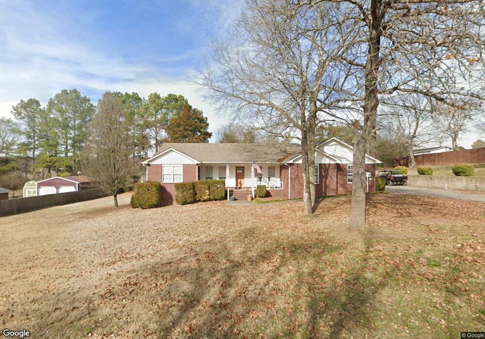
12 Fairbrook Ln Clarksville, AR 72830
Estimated Value: $255,000 - $320,000
3
Beds
3
Baths
2,110
Sq Ft
$134/Sq Ft
Est. Value
About This Home
This home is located at 12 Fairbrook Ln, Clarksville, AR 72830 and is currently estimated at $281,978, approximately $133 per square foot. 12 Fairbrook Ln is a home located in Johnson County with nearby schools including Clarksville Primary School, Clarksville Elementary School, and Clarksville Middle School.
Ownership History
Date
Name
Owned For
Owner Type
Purchase Details
Closed on
Aug 24, 2022
Sold by
Morgan Theresa A and Morgan Alton E
Bought by
Stepp Benjamin and Stepp Whitney
Current Estimated Value
Home Financials for this Owner
Home Financials are based on the most recent Mortgage that was taken out on this home.
Original Mortgage
$225,834
Outstanding Balance
$215,909
Interest Rate
5.51%
Mortgage Type
FHA
Estimated Equity
$66,069
Purchase Details
Closed on
Oct 26, 2018
Sold by
Goodner Donzel and Landon Shana
Bought by
Morgan Theresa A and Morgan Alton E
Home Financials for this Owner
Home Financials are based on the most recent Mortgage that was taken out on this home.
Original Mortgage
$193,000
Interest Rate
4.6%
Mortgage Type
VA
Purchase Details
Closed on
May 1, 1999
Bought by
Banning Michael W
Create a Home Valuation Report for This Property
The Home Valuation Report is an in-depth analysis detailing your home's value as well as a comparison with similar homes in the area
Home Values in the Area
Average Home Value in this Area
Purchase History
| Date | Buyer | Sale Price | Title Company |
|---|---|---|---|
| Stepp Benjamin | $230,000 | Currans Abstract & Title | |
| Morgan Theresa A | $193,000 | Currans Abstract & Title | |
| Banning Michael W | -- | -- |
Source: Public Records
Mortgage History
| Date | Status | Borrower | Loan Amount |
|---|---|---|---|
| Open | Stepp Benjamin | $225,834 | |
| Previous Owner | Morgan Theresa A | $193,000 |
Source: Public Records
Tax History Compared to Growth
Tax History
| Year | Tax Paid | Tax Assessment Tax Assessment Total Assessment is a certain percentage of the fair market value that is determined by local assessors to be the total taxable value of land and additions on the property. | Land | Improvement |
|---|---|---|---|---|
| 2024 | $1,522 | $39,020 | $3,000 | $36,020 |
| 2023 | $1,596 | $39,020 | $3,000 | $36,020 |
| 2022 | $1,570 | $39,020 | $3,000 | $36,020 |
| 2021 | $1,486 | $39,020 | $3,000 | $36,020 |
| 2020 | $1,776 | $39,020 | $3,000 | $36,020 |
| 2019 | $1,692 | $32,660 | $3,000 | $29,660 |
| 2018 | $1,342 | $32,660 | $3,000 | $29,660 |
| 2017 | $1,692 | $32,660 | $3,000 | $29,660 |
| 2015 | $1,185 | $32,660 | $3,000 | $29,660 |
| 2014 | $1,804 | $0 | $0 | $0 |
| 2013 | $1,804 | $39,220 | $3,000 | $36,220 |
Source: Public Records
Map
Nearby Homes
- 8 Mockingbird Ln
- 800 Ray Rd
- 252 Private Rd
- 315 Private Road 3393
- 10 Killane St
- 102 Buffalo St
- 725 N Montgomery St
- 300 Cherokee Ln
- 108 Sioux St
- 715 N Montgomery St
- 111 Sioux St
- 1207 N Harmony Rd
- 1113 N Harmony Rd
- 205 Misty Ln
- 812 N Johnson St
- 504 N Montgomery St
- 116 Stegall Rd
- 1202 N College Ave
- 1711 W Cline St
- 1107 Reynolds St