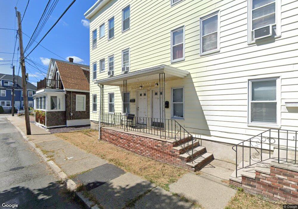
12 Forrest St Unit 14 Winthrop, MA 02152
Winthrop Beach NeighborhoodEstimated Value: $880,000 - $1,134,000
5
Beds
3
Baths
4,500
Sq Ft
$220/Sq Ft
Est. Value
About This Home
This home is located at 12 Forrest St Unit 14, Winthrop, MA 02152 and is currently estimated at $990,000, approximately $220 per square foot. 12 Forrest St Unit 14 is a home located in Suffolk County with nearby schools including William P. Gorman/Fort Banks Elementary School, Arthur T. Cummings Elementary School, and Winthrop Middle School.
Ownership History
Date
Name
Owned For
Owner Type
Purchase Details
Closed on
Jul 25, 2017
Sold by
Tape Frederick H
Bought by
Tape Rt
Current Estimated Value
Purchase Details
Closed on
Sep 27, 1988
Sold by
Vadnais Carol
Bought by
Tape Frederick H
Create a Home Valuation Report for This Property
The Home Valuation Report is an in-depth analysis detailing your home's value as well as a comparison with similar homes in the area
Home Values in the Area
Average Home Value in this Area
Purchase History
| Date | Buyer | Sale Price | Title Company |
|---|---|---|---|
| Tape Rt | -- | -- | |
| Tape Frederick H | $35,400 | -- |
Source: Public Records
Mortgage History
| Date | Status | Borrower | Loan Amount |
|---|---|---|---|
| Previous Owner | Tape Frederick H | $225,000 | |
| Previous Owner | Tape Frederick H | $140,000 |
Source: Public Records
Tax History Compared to Growth
Tax History
| Year | Tax Paid | Tax Assessment Tax Assessment Total Assessment is a certain percentage of the fair market value that is determined by local assessors to be the total taxable value of land and additions on the property. | Land | Improvement |
|---|---|---|---|---|
| 2025 | $9,689 | $938,900 | $317,800 | $621,100 |
| 2024 | $9,621 | $923,300 | $305,500 | $617,800 |
| 2023 | $9,261 | $865,500 | $279,600 | $585,900 |
| 2022 | $9,040 | $768,700 | $249,700 | $519,000 |
| 2021 | $8,858 | $698,600 | $223,000 | $475,600 |
| 2020 | $8,014 | $635,000 | $223,000 | $412,000 |
| 2019 | $7,698 | $584,100 | $205,500 | $378,600 |
| 2018 | $7,622 | $538,300 | $176,400 | $361,900 |
| 2017 | $7,084 | $491,600 | $156,400 | $335,200 |
| 2016 | $6,984 | $454,400 | $136,000 | $318,400 |
| 2015 | $6,076 | $423,700 | $132,000 | $291,700 |
| 2014 | $6,354 | $407,800 | $122,800 | $285,000 |
Source: Public Records
Map
Nearby Homes
- 28 Pearl Ave Unit 3
- 32 Pearl Ave
- 51 Cutler St Unit 3
- 148 Winthrop Shore Dr Unit 5
- 279 Shirley St Unit 2
- 37 Trident Ave
- 23 Trident Ave Unit 2
- 53 Trident Ave Unit 103
- 53 Trident Ave Unit 303
- 10 Beach Rd Unit 1
- 130 Shirley St Unit 204
- 130 Shirley St Unit 202
- 600 Shirley St Unit 3
- 600 Shirley St Unit 15
- 600 Shirley St Unit 1
- 80 Shirley St
- 249 Winthrop Shore Dr Unit 6
- 100 Cottage Ave
- 3 Buckthorn Terrace Unit 2
- 174 Winthrop St Unit 2
- 12 Forrest St Unit 1
- 12 Forrest St Unit 2
- 16 Forrest St Unit 3
- 12 Forrest St Unit 12
- 8 Forrest St
- 18 Forrest St
- 19 Dolphin Ave
- 15 Dolphin Ave
- 15 Dolphin Ave Unit 2
- 362 Shirley St
- 11 Forrest St
- 11 Forrest St Unit 2
- 17 Forrest St
- 17 Forrest St Unit 1
- 370 Shirley St
- 5 Dolphin Ave
- 352 Shirley St Unit 2
- 24 Forrest St
- 23-25 Dolphin Ave
- 23-25 Dolphin Ave Unit 3