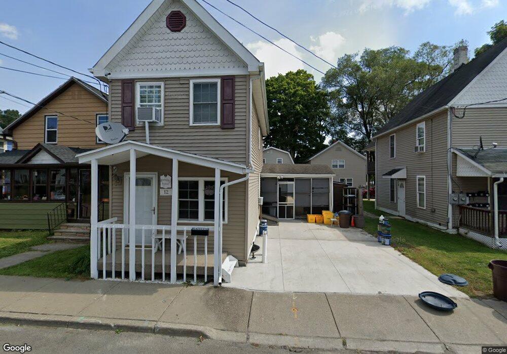
12 N Loder Ave Endicott, NY 13760
Estimated Value: $99,000 - $131,000
2
Beds
1
Bath
858
Sq Ft
$129/Sq Ft
Est. Value
About This Home
This home is located at 12 N Loder Ave, Endicott, NY 13760 and is currently estimated at $110,424, approximately $128 per square foot. 12 N Loder Ave is a home located in Broome County with nearby schools including Union-Endicott High School, All Saints School, and All Saints.
Ownership History
Date
Name
Owned For
Owner Type
Purchase Details
Closed on
Jul 29, 2021
Sold by
Manchester Brett
Bought by
Manchester Brett and Manchester Stacey Lynne
Current Estimated Value
Home Financials for this Owner
Home Financials are based on the most recent Mortgage that was taken out on this home.
Original Mortgage
$62,000
Outstanding Balance
$45,268
Interest Rate
2.3%
Mortgage Type
New Conventional
Estimated Equity
$65,156
Purchase Details
Closed on
May 17, 2003
Sold by
Constance Manchester
Bought by
Manchester Brett
Create a Home Valuation Report for This Property
The Home Valuation Report is an in-depth analysis detailing your home's value as well as a comparison with similar homes in the area
Home Values in the Area
Average Home Value in this Area
Purchase History
| Date | Buyer | Sale Price | Title Company |
|---|---|---|---|
| Manchester Brett | -- | None Listed On Document | |
| Manchester Brett | -- | Frederick J Meagher Jr |
Source: Public Records
Mortgage History
| Date | Status | Borrower | Loan Amount |
|---|---|---|---|
| Open | Manchester Brett | $62,000 |
Source: Public Records
Tax History
| Year | Tax Paid | Tax Assessment Tax Assessment Total Assessment is a certain percentage of the fair market value that is determined by local assessors to be the total taxable value of land and additions on the property. | Land | Improvement |
|---|---|---|---|---|
| 2025 | $2,190 | $2,300 | $400 | $1,900 |
| 2024 | $2,190 | $2,300 | $400 | $1,900 |
| 2023 | $2,145 | $2,300 | $400 | $1,900 |
| 2022 | $2,141 | $2,300 | $400 | $1,900 |
| 2021 | $2,088 | $2,300 | $400 | $1,900 |
| 2020 | $2,239 | $2,300 | $400 | $1,900 |
| 2019 | $0 | $2,300 | $400 | $1,900 |
| 2018 | $1,237 | $2,300 | $400 | $1,900 |
| 2017 | $1,214 | $2,300 | $400 | $1,900 |
| 2016 | $1,194 | $2,300 | $400 | $1,900 |
| 2015 | -- | $2,300 | $400 | $1,900 |
| 2014 | -- | $2,300 | $400 | $1,900 |
Source: Public Records
Map
Nearby Homes
- 305 E Franklin St
- 307 E Franklin St
- 9 S Liberty Ave
- 304 Groats St
- 117 Carden St
- 103 S Liberty Ave
- 108 S Loder Ave
- 413 Groats St
- 501 E Franklin St Unit 503
- 515 Woodford Ave
- 701 E Franklin St
- 111 W Union St
- 106 Fillmore Ave
- 313 Jennings St
- 117 Badger Ave
- 322 W Franklin St
- 708 Monroe St
- 105 Prospect St
- 107 Cleveland Ave
- 105 W Edwards St
- 12 1/2 N Loder Ave
- 10 N Loder Ave
- 14 N Loder Ave
- 302 E Franklin St
- 8 N Loder Ave
- 6 N Loder Ave
- 210 E Franklin St
- 11 N Loder Ave
- 9 N Oak Ave
- 208 E Franklin St
- 206 E Franklin St
- 309 E Franklin St
- 301 E Franklin St
- 311 E Franklin St
- 211 E Franklin St
- 313 E Franklin St
- 209 E Franklin St
- 6 N Oak Ave
- 8 N Oak Ave
- 207 E Franklin St
Your Personal Tour Guide
Ask me questions while you tour the home.