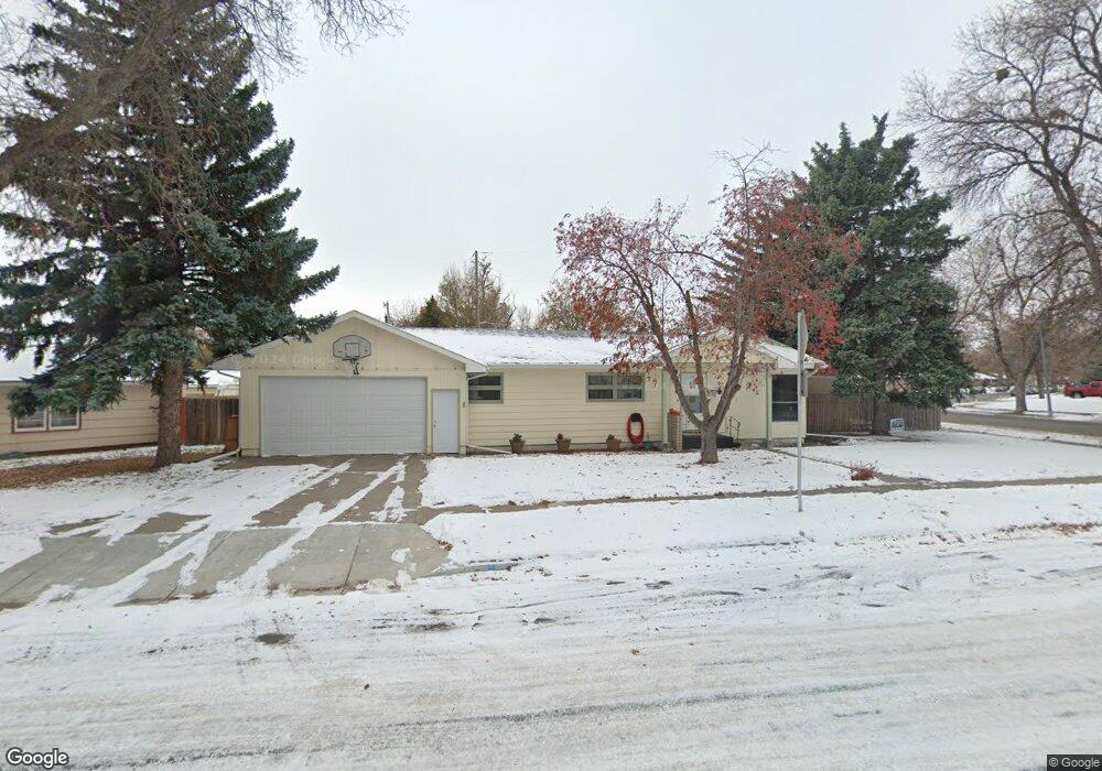
12 S Crestwood Dr Billings, MT 59102
West End NeighborhoodEstimated Value: $318,000 - $350,879
4
Beds
2
Baths
2,184
Sq Ft
$151/Sq Ft
Est. Value
About This Home
This home is located at 12 S Crestwood Dr, Billings, MT 59102 and is currently estimated at $328,970, approximately $150 per square foot. 12 S Crestwood Dr is a home located in Yellowstone County with nearby schools including Central Heights School, Will James Junior High School, and Billings West High School.
Ownership History
Date
Name
Owned For
Owner Type
Purchase Details
Closed on
Oct 10, 2016
Sold by
Federal Home Loan Mortgage Corporation
Bought by
Meyer Mary K
Current Estimated Value
Home Financials for this Owner
Home Financials are based on the most recent Mortgage that was taken out on this home.
Original Mortgage
$133,600
Outstanding Balance
$107,241
Interest Rate
3.5%
Mortgage Type
New Conventional
Estimated Equity
$221,729
Purchase Details
Closed on
Nov 30, 2015
Sold by
First American Title Insurance Company
Bought by
Federal Home Loan Mortgage Corp
Purchase Details
Closed on
Jan 11, 2008
Sold by
Welch Jerry Roy and Welch Beth S
Bought by
Ybarra Victor O
Home Financials for this Owner
Home Financials are based on the most recent Mortgage that was taken out on this home.
Original Mortgage
$148,500
Interest Rate
6.04%
Mortgage Type
Purchase Money Mortgage
Create a Home Valuation Report for This Property
The Home Valuation Report is an in-depth analysis detailing your home's value as well as a comparison with similar homes in the area
Home Values in the Area
Average Home Value in this Area
Purchase History
| Date | Buyer | Sale Price | Title Company |
|---|---|---|---|
| Meyer Mary K | -- | None Available | |
| Federal Home Loan Mortgage Corp | $145,565 | American Title & Escrow | |
| Ybarra Victor O | -- | None Available |
Source: Public Records
Mortgage History
| Date | Status | Borrower | Loan Amount |
|---|---|---|---|
| Open | Meyer Mary K | $133,600 | |
| Previous Owner | Ybarra Victor O | $148,500 |
Source: Public Records
Tax History Compared to Growth
Tax History
| Year | Tax Paid | Tax Assessment Tax Assessment Total Assessment is a certain percentage of the fair market value that is determined by local assessors to be the total taxable value of land and additions on the property. | Land | Improvement |
|---|---|---|---|---|
| 2025 | $3,434 | $338,600 | $52,533 | $286,067 |
| 2024 | $3,434 | $315,900 | $48,867 | $267,033 |
| 2023 | $3,432 | $315,900 | $48,867 | $267,033 |
| 2022 | $2,144 | $227,100 | $0 | $0 |
| 2021 | $2,755 | $227,100 | $0 | $0 |
| 2020 | $2,673 | $208,500 | $0 | $0 |
| 2019 | $2,576 | $208,500 | $0 | $0 |
| 2018 | $2,457 | $193,000 | $0 | $0 |
| 2017 | $1,786 | $193,000 | $0 | $0 |
| 2016 | $2,339 | $189,900 | $0 | $0 |
| 2015 | $2,038 | $185,300 | $0 | $0 |
| 2014 | $1,829 | $87,185 | $0 | $0 |
Source: Public Records
Map
Nearby Homes
- 16 19th St W
- 28 19th St W
- 126 Ardmore Dr
- 2150 Eldorado Dr
- 102 S Santa fe Dr
- 240 Birchwood Dr
- 2207 Central Ave
- 2016 Monad Rd
- 305 17th St W
- 2109 George St
- 2 Mcbride St
- 1532 Howard Ave
- 621 Nelson Dr
- 2509 Cook Ave
- 1604 Wyoming Ave
- 2013 Clark Ave
- 0 Wyatt Cir Unit 356022
- 1815 Clark Ave
- 2124 Lewis Ave
- 669 S 22nd St W
- 20 S Crestwood Dr
- 19 Birchwood Dr
- 30 S Crestwood Dr
- 29 Birchwood Dr
- 9 S Crestwood Dr
- 15 S Crestwood Dr
- 10 Birchwood Dr
- 2009 Concord Dr
- 35 Birchwood Dr
- 36 S Crestwood Dr
- 19 S Crestwood Dr
- 5 S Crestwood Dr
- 29 S Crestwood Dr
- 26 Birchwood Dr
- 4 Birchwood Dr
- 2017 Concord Dr
- 35 S Crestwood Dr
- 43 Birchwood Dr
- 2008 Central Ave
- 42 S Crestwood Dr