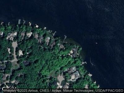
1200 Highway 7 Excelsior, MN 55331
Estimated Value: $3,480,527 - $4,003,000
3
Beds
4
Baths
4,472
Sq Ft
$843/Sq Ft
Est. Value
About This Home
This home is located at 1200 Highway 7, Excelsior, MN 55331 and is currently estimated at $3,769,509, approximately $842 per square foot. 1200 Highway 7 is a home located in Carver County with nearby schools including Minnewashta Elementary School, Minnetonka West Middle School, and Minnetonka Senior High School.
Ownership History
Date
Name
Owned For
Owner Type
Purchase Details
Closed on
Jul 10, 2019
Sold by
Kalla Robert M and Kalla Sharon R
Bought by
Gerling Mark W and Gerling Barbara M
Current Estimated Value
Purchase Details
Closed on
Apr 21, 2015
Sold by
Kalla Robert M and Kalla Sharon R
Bought by
Robert Kalla Revocable Trust
Create a Home Valuation Report for This Property
The Home Valuation Report is an in-depth analysis detailing your home's value as well as a comparison with similar homes in the area
Home Values in the Area
Average Home Value in this Area
Purchase History
| Date | Buyer | Sale Price | Title Company |
|---|---|---|---|
| Gerling Mark W | $2,700,000 | Custom Home Builders Title | |
| Robert Kalla Revocable Trust | -- | None Available |
Source: Public Records
Mortgage History
| Date | Status | Borrower | Loan Amount |
|---|---|---|---|
| Previous Owner | Kalla Robert M | $760,000 |
Source: Public Records
Tax History Compared to Growth
Tax History
| Year | Tax Paid | Tax Assessment Tax Assessment Total Assessment is a certain percentage of the fair market value that is determined by local assessors to be the total taxable value of land and additions on the property. | Land | Improvement |
|---|---|---|---|---|
| 2025 | $44,290 | $3,369,700 | $2,596,000 | $773,700 |
| 2024 | $42,482 | $3,373,400 | $2,596,000 | $777,400 |
| 2023 | $41,546 | $3,360,300 | $2,596,000 | $764,300 |
| 2022 | $34,880 | $3,319,100 | $2,336,400 | $982,700 |
| 2021 | $32,074 | $2,250,500 | $1,620,600 | $629,900 |
| 2020 | $29,874 | $2,250,500 | $1,620,600 | $629,900 |
| 2019 | $26,670 | $1,827,300 | $1,275,500 | $551,800 |
| 2018 | $10,792 | $1,827,300 | $1,275,500 | $551,800 |
| 2017 | $23,476 | $1,765,500 | $1,213,700 | $551,800 |
| 2016 | $37,042 | $2,474,200 | $0 | $0 |
| 2015 | -- | $2,471,000 | $0 | $0 |
| 2014 | -- | $2,041,900 | $0 | $0 |
Source: Public Records
Map
Nearby Homes
- 6460 Hawks Pointe Ln
- 6425 Virginia Dr
- 6480 Hawks Pointe Ln
- 6420 Thornberry Curve
- 4750 Baycliffe Dr
- 4714 Baycliffe Dr
- 5461 Zumbra Cir
- 780 Virginia Shores Cir
- 745 Virginia Shores Cir
- 5435 Yellowstone Trail
- 4680 Palmer Ct
- 27865 Brynmawr Place
- 780 Saint Moritz
- 4590 Sunset Ln
- 4526 Sunset Ln
- 4167 Hallgren Ln
- 6444 Yosemite Ln
- 3931 Crestview Dr
- 3941 White Oak Ln
- 3941x White Oak Ln
- 1200 Highway 7
- 1200 Highway 7
- 1150 Highway 7
- 6485 Virginia Dr
- 6455 Virginia Dr
- 6445 Virginia Dr
- xxxx Hawkes Pointe
- xxxxx Hawkes Pointe
- 6435 Virginia Dr
- 6435 6435 Virginia-Drive-
- 6455 Hawks Pointe Ln
- 6417 Virginia Dr
- 6475 Hawks Pointe Ln
- 6397 6397 Cliffwood-Circle-
- XXX Hawks Ridge Ln
- 6387 6387 Cliffwood Cir
- 6387 Cliffwood Cir
- 6397 Cliffwood Cir
- 6485 Hawks Pointe Ln
- 6420 Bayview Place
