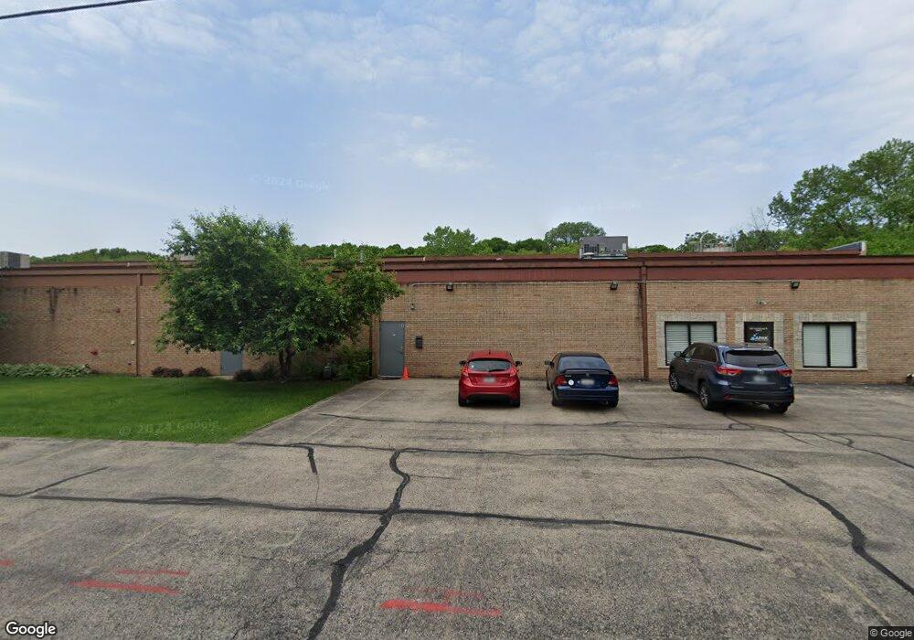
1201 Armstrong St Algonquin, IL 60102
Studio
--
Bath
--
Sq Ft
96,268
Sq Ft Lot
About This Home
This home is located at 1201 Armstrong St, Algonquin, IL 60102. 1201 Armstrong St is a home located in McHenry County with nearby schools including Westfield Community School, Kenneth E Neubert Elementary School, and Harry D Jacobs High School.
Ownership History
Date
Name
Owned For
Owner Type
Purchase Details
Closed on
May 6, 2025
Sold by
Twelve-O-One Armstrong Llc
Bought by
Kamp Park Holding Llc
Home Financials for this Owner
Home Financials are based on the most recent Mortgage that was taken out on this home.
Original Mortgage
$1,600,000
Outstanding Balance
$1,594,301
Interest Rate
6.62%
Mortgage Type
New Conventional
Purchase Details
Closed on
Sep 12, 2013
Sold by
Schiffmayer Tina
Bought by
Twelve O One Armstrong Llc
Purchase Details
Closed on
Nov 5, 2009
Sold by
Schiffmayer Karl F
Bought by
Schiffmayer Tina and Tina Schiffmayer Trust
Create a Home Valuation Report for This Property
The Home Valuation Report is an in-depth analysis detailing your home's value as well as a comparison with similar homes in the area
Purchase History
| Date | Buyer | Sale Price | Title Company |
|---|---|---|---|
| Kamp Park Holding Llc | $2,100,000 | Fidelity National Title | |
| Twelve O One Armstrong Llc | -- | None Available | |
| Schiffmayer Tina | -- | None Available |
Source: Public Records
Mortgage History
| Date | Status | Borrower | Loan Amount |
|---|---|---|---|
| Open | Kamp Park Holding Llc | $1,600,000 |
Source: Public Records
Tax History
| Year | Tax Paid | Tax Assessment Tax Assessment Total Assessment is a certain percentage of the fair market value that is determined by local assessors to be the total taxable value of land and additions on the property. | Land | Improvement |
|---|---|---|---|---|
| 2024 | $43,401 | $554,812 | $65,183 | $489,629 |
| 2023 | $41,668 | $497,763 | $78,474 | $419,289 |
| 2022 | $38,527 | $449,245 | $70,825 | $378,420 |
| 2021 | $37,137 | $418,525 | $65,982 | $352,543 |
| 2020 | $36,250 | $403,709 | $63,646 | $340,063 |
| 2019 | $35,481 | $386,398 | $60,917 | $325,481 |
| 2018 | $38,887 | $407,978 | $56,274 | $351,704 |
| 2017 | $38,273 | $384,341 | $53,014 | $331,327 |
| 2016 | $40,179 | $382,080 | $49,722 | $332,358 |
| 2013 | -- | $391,497 | $46,384 | $345,113 |
Source: Public Records
Map
Nearby Homes
- 313 Bayberry Dr
- 909 Roger St
- 944 Cynthia Ln
- 298 Apache Trail
- 906 Cynthia Ln
- 1410 Essex St
- 1431 Essex St
- 1 Grandview Ct Unit 8
- LOT 3 Blackhawk Dr
- 615 Harper Dr
- 311 Briarwood Ln
- 7 Elizabeth Ct
- 108 La Fox Dr
- 871 Brandt Dr
- 0 River Dr N Unit MRD12473279
- 7 Falcon Ridge Ct
- 658 Anderson Dr
- 128 Hickory Rd
- 621 Kirkland Dr
- 1920 Jester Ln
- 210 Dowdle St Unit 3-4
- 210 Dowdle St Unit 4
- 210 Dowdle St Unit 5
- 210 Dowdle St Unit 1
- 210 Dowdle St Unit 2
- 202 Berg St
- 204 Berg St
- 1220 Armstrong St
- 210 Berg St
- 200 Berg St
- 1115 Isabel Dr
- 1113 Isabel Dr
- 1117 Isabel Dr
- 1111 Isabel Dr
- 1107 Isabel Dr
- Lot 3 Armstrong St
- 1103 Isabel Dr
- 1101 Isabel Dr
- 201 Berg St
- 1108 Isabel Dr
Your Personal Tour Guide
Ask me questions while you tour the home.