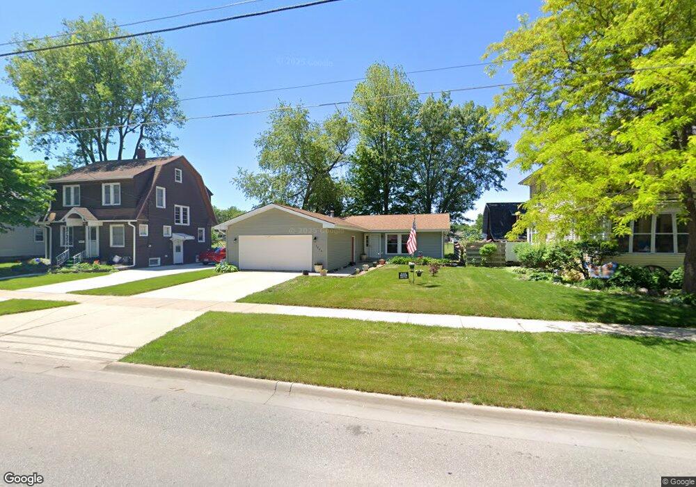
1204 Baltimore St Waterloo, IA 50702
West Central NeighborhoodEstimated Value: $172,000 - $195,000
2
Beds
2
Baths
1,368
Sq Ft
$136/Sq Ft
Est. Value
About This Home
This home is located at 1204 Baltimore St, Waterloo, IA 50702 and is currently estimated at $186,657, approximately $136 per square foot. 1204 Baltimore St is a home located in Black Hawk County with nearby schools including Kingsley Elementary School, Hoover Middle School, and West High School.
Ownership History
Date
Name
Owned For
Owner Type
Purchase Details
Closed on
Jun 5, 2008
Sold by
Nelson Jason D and Nelson Karen M
Bought by
Lane Charles L and Lane Debbie J
Current Estimated Value
Home Financials for this Owner
Home Financials are based on the most recent Mortgage that was taken out on this home.
Original Mortgage
$99,200
Interest Rate
6.01%
Mortgage Type
New Conventional
Purchase Details
Closed on
May 16, 2005
Sold by
Robinson William H and Robinson Marjorie L
Bought by
Nelson Jason D and Nelson Karen M
Home Financials for this Owner
Home Financials are based on the most recent Mortgage that was taken out on this home.
Original Mortgage
$92,800
Interest Rate
5.25%
Mortgage Type
Adjustable Rate Mortgage/ARM
Create a Home Valuation Report for This Property
The Home Valuation Report is an in-depth analysis detailing your home's value as well as a comparison with similar homes in the area
Home Values in the Area
Average Home Value in this Area
Purchase History
We collect this data history from publicly available records. To have your information removed, we recommend requesting removal directly through your county’s website.
| Date | Buyer | Sale Price | Title Company |
|---|---|---|---|
| Lane Charles L | $124,000 | None Available | |
| Nelson Jason D | $116,000 | None Available |
Source: Public Records
Mortgage History
We collect this data history from publicly available records. To have your information removed, we recommend requesting removal directly through your county’s website.
| Date | Status | Borrower | Loan Amount |
|---|---|---|---|
| Closed | Lane Charles L | $99,200 | |
| Previous Owner | Nelson Jason D | $92,800 |
Source: Public Records
Tax History
| Year | Tax Paid | Tax Assessment Tax Assessment Total Assessment is a certain percentage of the fair market value that is determined by local assessors to be the total taxable value of land and additions on the property. | Land | Improvement |
|---|---|---|---|---|
| 2025 | $3,170 | $194,540 | $17,880 | $176,660 |
| 2024 | $3,170 | $178,480 | $17,880 | $160,600 |
| 2023 | $2,744 | $178,480 | $17,880 | $160,600 |
| 2022 | $2,668 | $137,170 | $17,880 | $119,290 |
| 2021 | $2,714 | $137,170 | $17,880 | $119,290 |
| 2020 | $2,664 | $131,730 | $13,750 | $117,980 |
| 2019 | $2,664 | $131,730 | $13,750 | $117,980 |
| 2018 | $2,668 | $131,730 | $13,750 | $117,980 |
| 2017 | $2,754 | $131,730 | $13,750 | $117,980 |
| 2016 | $2,716 | $131,730 | $13,750 | $117,980 |
| 2015 | $2,716 | $131,730 | $13,750 | $117,980 |
| 2014 | $2,616 | $125,180 | $13,750 | $111,430 |
Source: Public Records
Map
Nearby Homes
- Lot #10 Denver St
- 1712 W 7th St
- 151 Hawthorne Ave
- 814 E Mitchell Ave
- 826 Williston Ave
- 925 Forest Ave
- 2012 W 7th St
- 1228 Kimball Ave
- 426 Cornwall Ave
- 1017 Forest Ave
- 922 E Mitchell Ave
- 524 Vermont St
- 1219 W 7th St
- 903 Kimball Ave
- 610 Baltimore St
- 701 Lorraine Ave
- 131 Rosebud Ave
- 145 Cornwall Ave
- 171 Lovejoy Ave
- 314 W Mitchell Ave
- 1208 Baltimore St
- 1200 Baltimore St
- 1218 Baltimore St
- 1228 Baltimore St
- 1128 Baltimore St
- 1207 Baltimore St
- 1122 Baltimore St
- 1205 Baltimore St
- 1227 Baltimore St
- 1201 Baltimore St
- 1125 Baltimore St
- 1229 Baltimore St
- 1112 Baltimore St
- 1300 Baltimore St
- 1119 Baltimore St
- 1301 Baltimore St
- 1104 Baltimore St
- 512 Eureka St
- 1310 Baltimore St
- 1115 Baltimore St
Your Personal Tour Guide
Ask me questions while you tour the home.