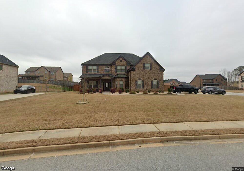
1204 Mottled Ct Unit 151 Stockbridge, GA 30281
Estimated Value: $501,626 - $542,000
5
Beds
4
Baths
3,886
Sq Ft
$136/Sq Ft
Est. Value
About This Home
This home is located at 1204 Mottled Ct Unit 151, Stockbridge, GA 30281 and is currently estimated at $530,157, approximately $136 per square foot. 1204 Mottled Ct Unit 151 is a home located in Henry County with nearby schools including Pleasant Grove Elementary School, Woodland Middle School, and Woodland High School.
Ownership History
Date
Name
Owned For
Owner Type
Purchase Details
Closed on
Sep 24, 2020
Sold by
Love Cami E
Bought by
Brittian Taria T and Brittian Andrew C
Current Estimated Value
Purchase Details
Closed on
Jul 27, 2018
Sold by
Dr Horton Crown Llc
Bought by
Love Cami E and White Cedric O
Create a Home Valuation Report for This Property
The Home Valuation Report is an in-depth analysis detailing your home's value as well as a comparison with similar homes in the area
Home Values in the Area
Average Home Value in this Area
Purchase History
| Date | Buyer | Sale Price | Title Company |
|---|---|---|---|
| Brittian Taria T | $382,900 | -- | |
| Love Cami E | $335,329 | -- |
Source: Public Records
Tax History Compared to Growth
Tax History
| Year | Tax Paid | Tax Assessment Tax Assessment Total Assessment is a certain percentage of the fair market value that is determined by local assessors to be the total taxable value of land and additions on the property. | Land | Improvement |
|---|---|---|---|---|
| 2025 | $6,831 | $212,880 | $20,000 | $192,880 |
| 2024 | $6,831 | $201,680 | $20,000 | $181,680 |
| 2023 | $6,033 | $201,040 | $16,000 | $185,040 |
| 2022 | $5,544 | $158,960 | $16,000 | $142,960 |
| 2021 | $5,154 | $142,480 | $16,000 | $126,480 |
| 2020 | $5,265 | $135,680 | $14,000 | $121,680 |
| 2019 | $5,054 | $130,200 | $12,000 | $118,200 |
| 2018 | $520 | $12,000 | $12,000 | $0 |
Source: Public Records
Map
Nearby Homes
- 1205 Mill Creek Ln
- 176 Northmill Pkwy
- Henry II Plan at Grandview at Millers Mill
- Isabella V Plan at Grandview at Millers Mill
- Meridian II Plan at Grandview at Millers Mill
- Rosemary II Plan at Grandview at Millers Mill
- Clarity Plan at Grandview at Millers Mill
- Stonefield Plan at Grandview at Millers Mill
- Rainier Plan at Grandview at Millers Mill
- 605 Sidney Ct
- 609 Sidney Ct
- 613 Sidney Ct
- 617 Sidney Ct
- 621 Sidney Ct
- 425 Sheridan Dr
- 316 Moab Ct
- 55 Gill Ln
- 187 Buffalo Trace
- 400 Moseley Rd
- 0 Highway 155 N Unit 10380875
- 1204 Mottled Ct
- 150 Northmill Pkwy
- 160 Northmill Pkwy
- 155 Northmill Pkwy
- 145 Northmill Pkwy
- 145 Northmill Pkwy Unit 35
- 166 N Mill Pkwy
- 140 Northmill Pkwy
- 166 Northmill Pkwy
- 165 Northmill Pkwy
- 135 Northmill Pkwy
- 170 N Mill Pkwy
- 1301 Pickett Place
- 1207 Mill Creek Ln
- 170 Northmill Pkwy
- 1305 Pickett Place
- 130 Northmill Pkwy
- 175 Northmill Pkwy
- 176 N Mill Pkwy
- 200 W Mill Dr