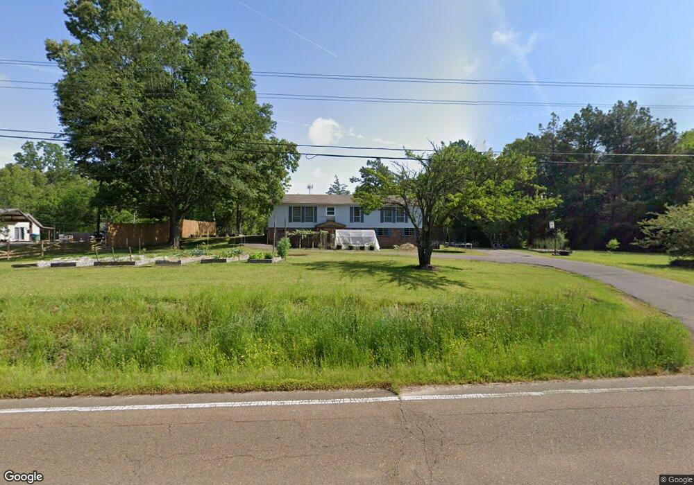
12040 Highway 178 Olive Branch, MS 38654
Center Hill NeighborhoodEstimated Value: $254,000 - $289,692
4
Beds
1
Bath
2,508
Sq Ft
$109/Sq Ft
Est. Value
About This Home
This home is located at 12040 Highway 178, Olive Branch, MS 38654 and is currently estimated at $272,673, approximately $108 per square foot. 12040 Highway 178 is a home located in DeSoto County with nearby schools including Center Hill Elementary School, Center Hill High School, and Desoto Christian Academy.
Ownership History
Date
Name
Owned For
Owner Type
Purchase Details
Closed on
Jan 29, 2021
Sold by
Paseur Edwin E and Paseur Colean
Bought by
Paseur Darren Andrew and Paseur Alison Marie
Current Estimated Value
Home Financials for this Owner
Home Financials are based on the most recent Mortgage that was taken out on this home.
Original Mortgage
$25,000
Interest Rate
2.67%
Mortgage Type
Seller Take Back
Purchase Details
Closed on
Nov 5, 2010
Sold by
Jackson Joseph W
Bought by
Paseur Edwin E and Paseur Colean
Create a Home Valuation Report for This Property
The Home Valuation Report is an in-depth analysis detailing your home's value as well as a comparison with similar homes in the area
Home Values in the Area
Average Home Value in this Area
Purchase History
| Date | Buyer | Sale Price | Title Company |
|---|---|---|---|
| Paseur Darren Andrew | -- | None Available | |
| Paseur Edwin E | -- | Lenders Title & Escrow Llc |
Source: Public Records
Mortgage History
| Date | Status | Borrower | Loan Amount |
|---|---|---|---|
| Closed | Paseur Darren Andrew | $25,000 |
Source: Public Records
Tax History Compared to Growth
Tax History
| Year | Tax Paid | Tax Assessment Tax Assessment Total Assessment is a certain percentage of the fair market value that is determined by local assessors to be the total taxable value of land and additions on the property. | Land | Improvement |
|---|---|---|---|---|
| 2024 | $617 | $9,168 | $1,600 | $7,568 |
| 2023 | $617 | $9,168 | $0 | $0 |
| 2022 | $617 | $9,168 | $1,600 | $7,568 |
| 2021 | $917 | $9,168 | $1,600 | $7,568 |
| 2020 | $856 | $8,564 | $1,600 | $6,964 |
| 2019 | $856 | $8,564 | $1,600 | $6,964 |
| 2017 | $836 | $15,006 | $8,303 | $6,703 |
| 2016 | $836 | $8,303 | $1,600 | $6,703 |
| 2015 | $836 | $15,006 | $8,303 | $6,703 |
| 2014 | $836 | $8,303 | $0 | $0 |
| 2013 | $836 | $8,303 | $0 | $0 |
Source: Public Records
Map
Nearby Homes
- 10890 Mississippi 178
- 9490 Mississippi 178
- 12780 Myrtle Bend Loop
- 4253 Lakecrest Cove
- 12860 Pine Crest Dr
- 2 Bethel Rd
- 1 Bethel Rd
- 4140 Three Hawks Dr
- 12821 Whispering Pines Dr
- 10865 Paul Coleman Dr
- 5480 Polk Ln
- 12965 Whispering Pines Dr
- 4289 Becky Sue Cove
- 5155 Rolling Pine Cir
- 13377 Berkstone Loop
- 4103 W Dearden Dr
- 12190 Whispering Pines Dr
- 11258 Vicki's Ln
- 4213 Sidlehill Dr
- 13518 Broadmore Ln
- 12040 Highway 178
- 12006 Highway 178
- 12006 Highway 178
- 30 Polk Ln
- 4331 Polk Ln
- 4400 Polk Ln
- 12126 Highway 178
- 11929 Highway 178
- 4351 Polk Ln
- 4442 Polk Ln
- 12130 Highway 178 Unit 178
- 12130 Highway 178
- 4450 Polk Ln
- 12117 Highway 178
- 4436 Polk Ln
- 11905 Highway 178
- 11930 Highway 78 Unit 178
- 11930 Highway 178
- 12130 Highway Unit 178
- 12063 Highway 178