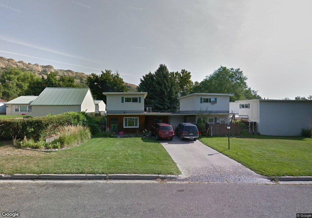
1205 N 25th St Billings, MT 59101
North Side Billings NeighborhoodEstimated Value: $200,000 - $276,000
3
Beds
2
Baths
1,184
Sq Ft
$196/Sq Ft
Est. Value
About This Home
This home is located at 1205 N 25th St, Billings, MT 59101 and is currently estimated at $231,823, approximately $195 per square foot. 1205 N 25th St is a home located in Yellowstone County with nearby schools including McKinley School, Riverside Junior High School, and Billings Senior High School.
Ownership History
Date
Name
Owned For
Owner Type
Purchase Details
Closed on
Jan 30, 2018
Sold by
Sayer Joshua P and Sayer Coral A
Bought by
Moody Misti
Current Estimated Value
Purchase Details
Closed on
Mar 9, 2015
Sold by
Iverson Roland and Iverson Todd
Bought by
Sayer Joshuwa P and Sayer Coral A
Home Financials for this Owner
Home Financials are based on the most recent Mortgage that was taken out on this home.
Original Mortgage
$73,500
Interest Rate
3.57%
Mortgage Type
New Conventional
Create a Home Valuation Report for This Property
The Home Valuation Report is an in-depth analysis detailing your home's value as well as a comparison with similar homes in the area
Home Values in the Area
Average Home Value in this Area
Purchase History
| Date | Buyer | Sale Price | Title Company |
|---|---|---|---|
| Moody Misti | -- | -- | |
| Sayer Joshuwa P | -- | St |
Source: Public Records
Mortgage History
| Date | Status | Borrower | Loan Amount |
|---|---|---|---|
| Previous Owner | Sayer Joshuwa P | $73,500 |
Source: Public Records
Tax History Compared to Growth
Tax History
| Year | Tax Paid | Tax Assessment Tax Assessment Total Assessment is a certain percentage of the fair market value that is determined by local assessors to be the total taxable value of land and additions on the property. | Land | Improvement |
|---|---|---|---|---|
| 2025 | $1,398 | $205,600 | $25,040 | $180,560 |
| 2024 | $1,398 | $145,700 | $20,074 | $125,626 |
| 2023 | $1,398 | $145,700 | $20,074 | $125,626 |
| 2022 | $1,195 | $126,500 | $0 | $0 |
| 2021 | $1,308 | $126,500 | $0 | $0 |
| 2020 | $1,213 | $111,300 | $0 | $0 |
| 2019 | $1,159 | $111,300 | $0 | $0 |
| 2018 | $1,054 | $98,800 | $0 | $0 |
| 2017 | $1,024 | $98,800 | $0 | $0 |
| 2016 | $921 | $89,500 | $0 | $0 |
| 2015 | $901 | $89,500 | $0 | $0 |
| 2014 | $945 | $50,403 | $0 | $0 |
Source: Public Records
Map
Nearby Homes
- 1143 N 24th St
- 1114 N 24th St
- 1121 N 24th St
- 1130 N 23rd St
- 945 N 23rd St
- 2415 Ash St
- 715 N 24th St
- 2004 9th Ave N
- 901 N 19th St
- 310 Beverly Hill Blvd
- 607 26th St W
- 2207 Pine St
- 823 N 18th St
- 2214 6th Ave N
- TBD Tumbleweed Dr
- 722 N 17th St
- 307 Moccasin Trail
- 125 Avenue B
- 300 N 25th St Unit 401
- 135 Grand Ave
- 1205 N 25th St Unit 1
- 1203 N 25th St
- 1215 N 25th St
- 2429 12th Ave N
- 2427 12th Ave N
- 1219 N 25th St
- 1223 N 25th St
- 1212 N 24th St
- 1206 N 24th St
- 1204 N 25th St
- 1202 N 24th St
- 1218 N 24th St
- 1212 N 25th St
- 1147 N 25th St
- 1216 N 25th St
- 1222 N 24th St
- 1227 N 25th St
- 2511 12th Ave N
- 1236 N 24th St
- 1224 N 25th St