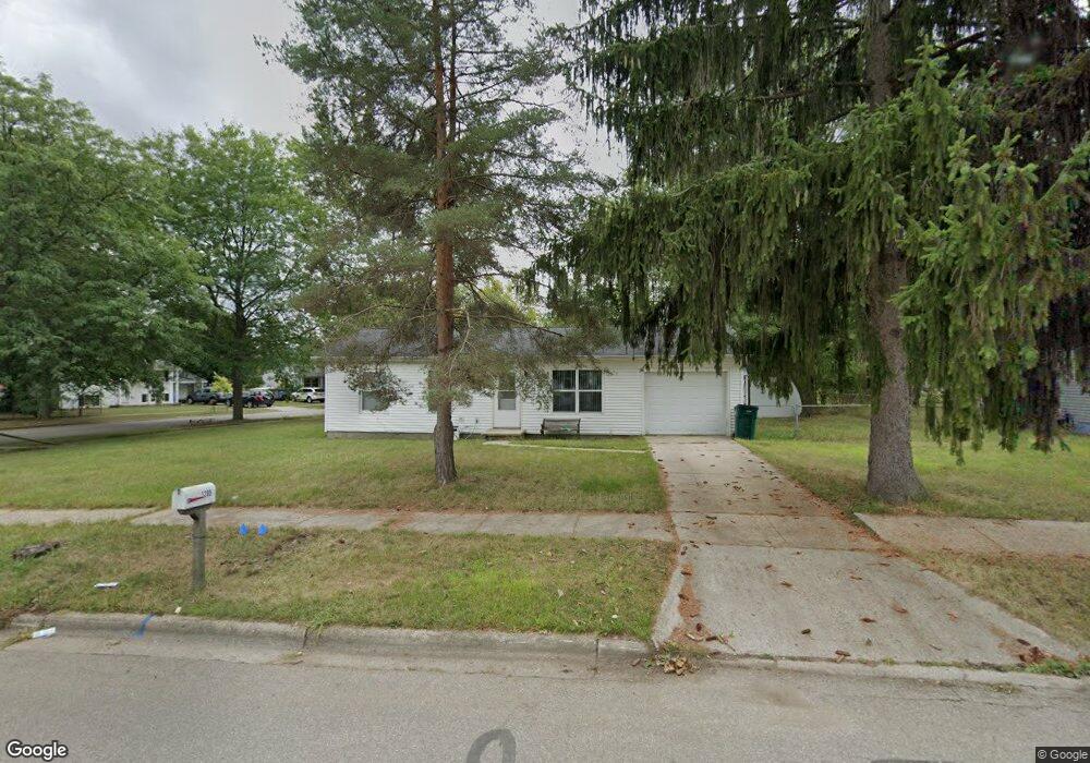
1205 W Northrup St Lansing, MI 48911
Southern Lansing NeighborhoodEstimated Value: $136,000 - $147,000
3
Beds
1
Bath
888
Sq Ft
$157/Sq Ft
Est. Value
About This Home
This home is located at 1205 W Northrup St, Lansing, MI 48911 and is currently estimated at $139,213, approximately $156 per square foot. 1205 W Northrup St is a home located in Ingham County with nearby schools including Reo Elementary School, Attwood School, and Everett High School.
Ownership History
Date
Name
Owned For
Owner Type
Purchase Details
Closed on
Jan 8, 2003
Sold by
Reiner Erik J and Reiner Suzanne L
Bought by
Guardiola Sandro A
Current Estimated Value
Home Financials for this Owner
Home Financials are based on the most recent Mortgage that was taken out on this home.
Original Mortgage
$74,390
Interest Rate
6%
Mortgage Type
FHA
Purchase Details
Closed on
Aug 1, 1997
Bought by
Reiner Eric J and Reiner Suzanne
Create a Home Valuation Report for This Property
The Home Valuation Report is an in-depth analysis detailing your home's value as well as a comparison with similar homes in the area
Home Values in the Area
Average Home Value in this Area
Purchase History
| Date | Buyer | Sale Price | Title Company |
|---|---|---|---|
| Guardiola Sandro A | $75,000 | Landamerica Transnation | |
| Reiner Eric J | $31,200 | -- |
Source: Public Records
Mortgage History
| Date | Status | Borrower | Loan Amount |
|---|---|---|---|
| Previous Owner | Guardiola Sandro A | $74,390 |
Source: Public Records
Tax History Compared to Growth
Tax History
| Year | Tax Paid | Tax Assessment Tax Assessment Total Assessment is a certain percentage of the fair market value that is determined by local assessors to be the total taxable value of land and additions on the property. | Land | Improvement |
|---|---|---|---|---|
| 2025 | $3,074 | $62,700 | $10,800 | $51,900 |
| 2024 | $25 | $53,200 | $10,800 | $42,400 |
| 2023 | $2,893 | $48,900 | $10,800 | $38,100 |
| 2022 | $2,641 | $42,900 | $9,900 | $33,000 |
| 2021 | $2,580 | $40,700 | $8,200 | $32,500 |
| 2020 | $2,687 | $39,100 | $8,200 | $30,900 |
| 2019 | $2,475 | $34,800 | $8,200 | $26,600 |
| 2018 | $1,799 | $32,300 | $8,200 | $24,100 |
| 2017 | $1,722 | $32,300 | $8,200 | $24,100 |
| 2016 | $1,693 | $30,100 | $8,200 | $21,900 |
| 2015 | $1,693 | $29,300 | $16,361 | $12,939 |
| 2014 | $1,693 | $29,700 | $24,541 | $5,159 |
Source: Public Records
Map
Nearby Homes
- 1014 W Northrup St
- 5750 Ashley Dr
- 1020 R G Curtiss Ave
- 5838 S Martin Luther King Junior Blvd
- 6037 Hughes Rd
- 0 W Jolly Rd
- 1119 W Miller Rd
- 5026 Delray Dr Unit A
- 0 Midwood St
- 5006 Delbrook Ave
- 4916 Tressa Dr
- 5902 Hilliard Rd
- 4935 Delray Dr
- 2045 Moffitt St
- 1324 N Briarfield Dr
- 5636 Ellendale Dr
- 833 Dornell Ave
- 6270 S Washington Ave
- 129 Village Dr
- 218 Raritan Rd
- 5614 Ashley Dr
- 1213 W Northrup St
- 1217 W Northrup St
- 1117 W Northrup St
- 5613 Ashley Dr
- 5622 Ashley Dr
- 1310 Mark Twain Dr
- 5619 Ashley Dr
- 1204 W Northrup St
- 1212 W Northrup St
- 1225 W Northrup St
- 1118 W Northrup St
- 5625 Ashley Dr
- 1316 Mark Twain Dr
- 1218 W Northrup St
- 1111 W Northrup St
- 1110 W Northrup St
- 1233 W Northrup St
- 1224 W Northrup St
- 5635 Ashley Dr