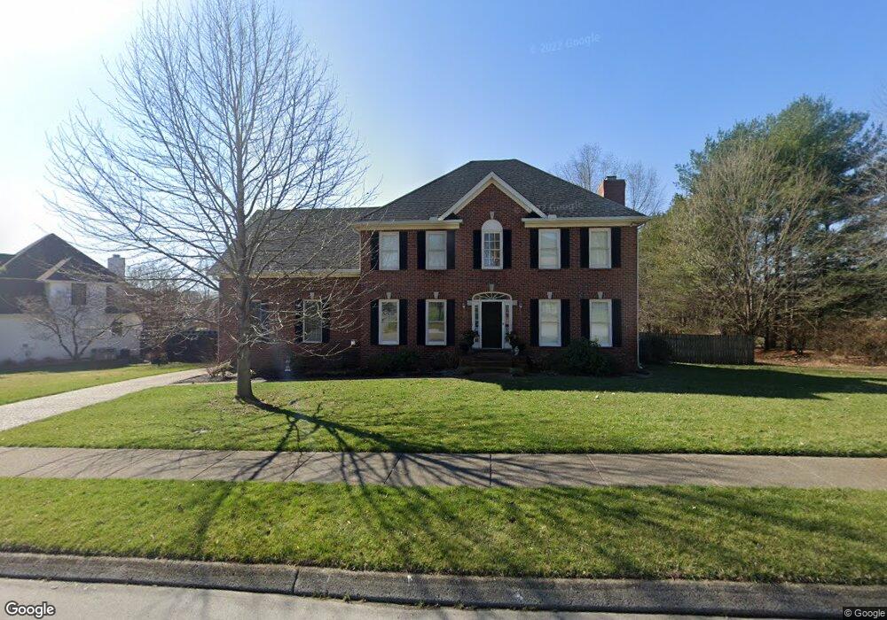
1208 Glenbrook Dr Franklin, TN 37064
Central Franklin NeighborhoodEstimated Value: $810,789 - $1,066,000
--
Bed
4
Baths
3,052
Sq Ft
$289/Sq Ft
Est. Value
About This Home
This home is located at 1208 Glenbrook Dr, Franklin, TN 37064 and is currently estimated at $883,197, approximately $289 per square foot. 1208 Glenbrook Dr is a home located in Williamson County with nearby schools including Liberty Elementary School, Freedom Intermediate School, and Freedom Middle School.
Ownership History
Date
Name
Owned For
Owner Type
Purchase Details
Closed on
Oct 1, 2025
Sold by
Scribner Allison R and Barnett Allison Ruth
Bought by
Allison R Barnett Revocable Trust
Current Estimated Value
Purchase Details
Closed on
Mar 19, 2021
Sold by
Jones Ronald B and Jones Alicia R
Bought by
Scribner Allison R
Home Financials for this Owner
Home Financials are based on the most recent Mortgage that was taken out on this home.
Original Mortgage
$363,300
Interest Rate
2.7%
Mortgage Type
New Conventional
Purchase Details
Closed on
May 24, 1995
Bought by
Jones Ronald B
Create a Home Valuation Report for This Property
The Home Valuation Report is an in-depth analysis detailing your home's value as well as a comparison with similar homes in the area
Home Values in the Area
Average Home Value in this Area
Purchase History
| Date | Buyer | Sale Price | Title Company |
|---|---|---|---|
| Allison R Barnett Revocable Trust | -- | None Listed On Document | |
| Scribner Allison R | $560,000 | Limestone Title & Escrow Llc | |
| Jones Ronald B | $215,900 | -- |
Source: Public Records
Mortgage History
| Date | Status | Borrower | Loan Amount |
|---|---|---|---|
| Previous Owner | Scribner Allison R | $363,300 |
Source: Public Records
Tax History Compared to Growth
Tax History
| Year | Tax Paid | Tax Assessment Tax Assessment Total Assessment is a certain percentage of the fair market value that is determined by local assessors to be the total taxable value of land and additions on the property. | Land | Improvement |
|---|---|---|---|---|
| 2025 | $3,610 | $202,625 | $60,000 | $142,625 |
| 2024 | $3,610 | $127,500 | $30,000 | $97,500 |
| 2023 | $3,470 | $127,500 | $30,000 | $97,500 |
| 2022 | $3,470 | $127,500 | $30,000 | $97,500 |
| 2021 | $3,470 | $127,500 | $30,000 | $97,500 |
| 2020 | $3,137 | $97,225 | $20,000 | $77,225 |
| 2019 | $3,137 | $97,225 | $20,000 | $77,225 |
| 2018 | $3,069 | $97,225 | $20,000 | $77,225 |
| 2017 | $3,020 | $97,225 | $20,000 | $77,225 |
| 2016 | $3,011 | $97,225 | $20,000 | $77,225 |
| 2015 | -- | $80,275 | $18,750 | $61,525 |
| 2014 | -- | $80,275 | $18,750 | $61,525 |
Source: Public Records
Map
Nearby Homes
- 433 Dragonfly Ct
- 1 Pinewood Rd
- 1143 Buckingham Cir
- 1183 Buckingham Cir
- 801 Murfreesboro Rd
- 100 Basil Ct
- 224 Hickory Dr
- 217 Maple Dr
- 1011 Murfreesboro Rd Unit B2
- 521 Maplegrove Dr
- 320 Liberty Pike Unit 212
- 135 Grenadier Dr
- 423 Knob Ct
- 229 Cambridge Place
- 215 Ash Dr
- 0102 Tbd
- 0104 Tbd
- 0101 Tbd
- 2741 Kennedy Ct Unit 2741
- 624 Burghley Ln
- 209 Scotsman Ln
- 205 Scotsman Ln
- 213 Scotsman Ln
- 1303 King William Ct
- 402 Dragonfly Ct
- 1205 Glenbrook Dr
- 217 Scotsman Ln
- 409 Dragonfly Ct
- 409 Dragonfly Ct Unit 2
- 408 408 Dragonfly Ct Lot 13
- 408 Dragonfly Ct
- 408 Dragonfly Ct
- 408 Dragonfly Ct
- 408 Dragonfly Ct Unit 13
- 1201 Glenbrook Dr
- 415 Dragonfly Ct
- 415 Dragonfly Ct
- 415 Dragonfly Ct Unit 3
- 1305 King William Ct
- 416 Dragonfly Ct
