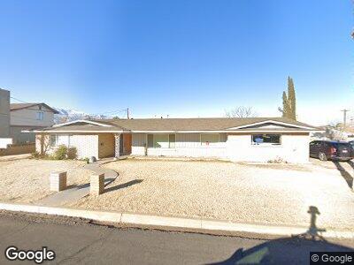
1208 S 7th Ave Safford, AZ 85546
Estimated Value: $280,631 - $350,000
--
Bed
--
Bath
2,432
Sq Ft
$132/Sq Ft
Est. Value
About This Home
This home is located at 1208 S 7th Ave, Safford, AZ 85546 and is currently estimated at $319,908, approximately $131 per square foot. 1208 S 7th Ave is a home located in Graham County with nearby schools including Ruth Powell Elementary School, Dorothy Stinson School, and Lafe Nelson School.
Ownership History
Date
Name
Owned For
Owner Type
Purchase Details
Closed on
May 3, 2021
Sold by
Huntsman Aaron R and Huntsman Janet F
Bought by
Badger Paul and Badger Carrie
Current Estimated Value
Home Financials for this Owner
Home Financials are based on the most recent Mortgage that was taken out on this home.
Original Mortgage
$199,500
Outstanding Balance
$182,706
Interest Rate
3.1%
Mortgage Type
New Conventional
Estimated Equity
$138,619
Purchase Details
Closed on
Jul 13, 2016
Sold by
Gunderson Swen and Gunderson Jennilyn B
Bought by
Huntsman Aaron R and Huntsman Janet F
Home Financials for this Owner
Home Financials are based on the most recent Mortgage that was taken out on this home.
Original Mortgage
$159,600
Interest Rate
3.6%
Mortgage Type
New Conventional
Create a Home Valuation Report for This Property
The Home Valuation Report is an in-depth analysis detailing your home's value as well as a comparison with similar homes in the area
Home Values in the Area
Average Home Value in this Area
Purchase History
| Date | Buyer | Sale Price | Title Company |
|---|---|---|---|
| Badger Paul | $210,000 | Stewart Ttl & Tr Of Phoenix | |
| Huntsman Aaron R | $168,000 | Stewart Title & Trust Saffor |
Source: Public Records
Mortgage History
| Date | Status | Borrower | Loan Amount |
|---|---|---|---|
| Open | Badger Paul | $199,500 | |
| Previous Owner | Huntsman Aaron R | $159,600 | |
| Previous Owner | Gunderson Swen B | $180,000 |
Source: Public Records
Tax History Compared to Growth
Tax History
| Year | Tax Paid | Tax Assessment Tax Assessment Total Assessment is a certain percentage of the fair market value that is determined by local assessors to be the total taxable value of land and additions on the property. | Land | Improvement |
|---|---|---|---|---|
| 2026 | $1,259 | -- | -- | -- |
| 2025 | $1,259 | $23,890 | $2,204 | $21,686 |
| 2024 | $1,309 | $22,648 | $2,204 | $20,444 |
| 2023 | $1,309 | $19,076 | $2,031 | $17,045 |
| 2022 | $1,285 | $16,793 | $2,031 | $14,762 |
| 2021 | $1,418 | $0 | $0 | $0 |
| 2020 | $1,364 | $0 | $0 | $0 |
| 2019 | $1,436 | $0 | $0 | $0 |
| 2018 | $1,366 | $0 | $0 | $0 |
| 2017 | $1,224 | $0 | $0 | $0 |
| 2016 | $1,124 | $0 | $0 | $0 |
| 2015 | $1,026 | $0 | $0 | $0 |
Source: Public Records
Map
Nearby Homes
- 1206 S 6th Ave
- 1204 S 5th Ave
- 816 W 11th St
- 1309 S Bingham Place
- 115 W 15th St
- 1105 S 1st Ave
- 401 W Bonita St
- 630 S 10th Ave
- 1609 S 12th Ave
- 1785 Camilla Cir
- 403 S 7th Ave
- 402 & 404 7th
- 2107 S 10th Ave
- 1670 W Relation St
- 2215 S Lamonica Way
- 545 W Keisha Ln
- 199 E Heliograph St
- 117 E 2nd St
- 417 E 20th St
- 130 E Montana Way