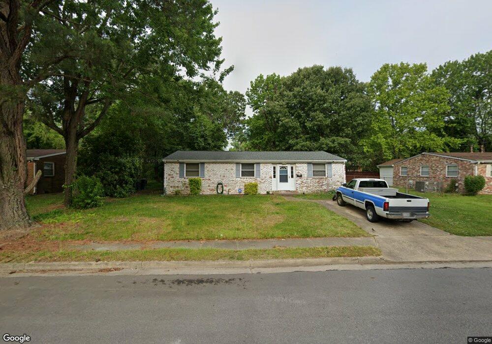
1209 Hale Dr Hampton, VA 23663
Buckroe Beach NeighborhoodEstimated Value: $275,000 - $314,000
3
Beds
2
Baths
1,474
Sq Ft
$197/Sq Ft
Est. Value
About This Home
This home is located at 1209 Hale Dr, Hampton, VA 23663 and is currently estimated at $290,245, approximately $196 per square foot. 1209 Hale Dr is a home located in Hampton City with nearby schools including Capt. John Smith Elementary School, Benjamin Syms Middle School, and Kecoughtan High School.
Ownership History
Date
Name
Owned For
Owner Type
Purchase Details
Closed on
Jun 14, 2019
Sold by
Collazo Rafael and Collazo Kelly A
Bought by
Gannon Terrance Anthony
Current Estimated Value
Home Financials for this Owner
Home Financials are based on the most recent Mortgage that was taken out on this home.
Original Mortgage
$155,000
Outstanding Balance
$136,007
Interest Rate
4%
Mortgage Type
VA
Estimated Equity
$154,238
Purchase Details
Closed on
Jul 31, 2006
Sold by
Silva Miguel
Bought by
Collazo Rafael
Home Financials for this Owner
Home Financials are based on the most recent Mortgage that was taken out on this home.
Original Mortgage
$132,000
Interest Rate
6.67%
Mortgage Type
New Conventional
Create a Home Valuation Report for This Property
The Home Valuation Report is an in-depth analysis detailing your home's value as well as a comparison with similar homes in the area
Home Values in the Area
Average Home Value in this Area
Purchase History
| Date | Buyer | Sale Price | Title Company |
|---|---|---|---|
| Gannon Terrance Anthony | $155,000 | Closing Edge Title Llc | |
| Collazo Rafael | $165,000 | -- |
Source: Public Records
Mortgage History
| Date | Status | Borrower | Loan Amount |
|---|---|---|---|
| Open | Gannon Terrance Anthony | $155,000 | |
| Previous Owner | Collazo Rafael | $132,000 | |
| Previous Owner | Collazo Rafael | $33,000 |
Source: Public Records
Tax History
| Year | Tax Paid | Tax Assessment Tax Assessment Total Assessment is a certain percentage of the fair market value that is determined by local assessors to be the total taxable value of land and additions on the property. | Land | Improvement |
|---|---|---|---|---|
| 2025 | $3,049 | $253,400 | $55,000 | $198,400 |
| 2024 | $2,914 | $253,400 | $55,000 | $198,400 |
| 2023 | $2,863 | $246,800 | $55,000 | $191,800 |
| 2022 | $2,293 | $194,300 | $50,000 | $144,300 |
| 2021 | $2,457 | $187,700 | $42,000 | $145,700 |
| 2020 | $1,954 | $157,600 | $38,300 | $119,300 |
| 2019 | $1,830 | $147,600 | $38,300 | $109,300 |
| 2018 | $1,960 | $150,500 | $38,300 | $112,200 |
| 2017 | $1,960 | $0 | $0 | $0 |
| 2016 | $1,960 | $150,500 | $0 | $0 |
| 2015 | $1,960 | $0 | $0 | $0 |
| 2014 | $2,204 | $150,500 | $38,300 | $112,200 |
Source: Public Records
Map
Nearby Homes
- 1810 Beall Dr
- 54 George Ct
- 1814 Somerville Dr
- 1841 Kensington Dr
- 304 Woodland Rd
- 1908 Hurst Dr
- 1445 Oakcrest Dr
- 417 Woodland Rd
- 1314 Saxton Dr
- 1530 Morgan Dr
- 413 Elizabeth Lake Dr
- 1923 Rawood Dr
- 1307 Colebrook Dr
- 1909 Long Green Ln
- 1515 Garrow Cir
- 1915 Long Green Ln
- 1504 E Pembroke Ave
- 124 Southerland Dr
- 506 Carters Grove Ct
- 2004 Winfree Rd
Your Personal Tour Guide
Ask me questions while you tour the home.