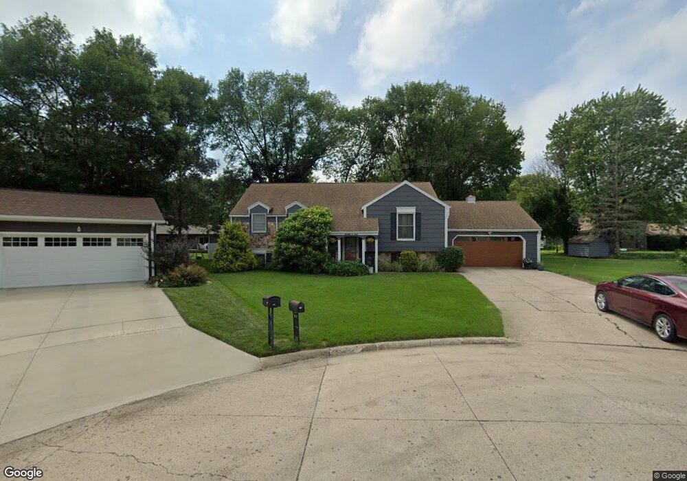
1209 Michaels Ct Spencer, IA 51301
Estimated Value: $216,000 - $243,000
--
Bed
3
Baths
1,294
Sq Ft
$177/Sq Ft
Est. Value
About This Home
This home is located at 1209 Michaels Ct, Spencer, IA 51301 and is currently estimated at $228,621, approximately $176 per square foot. 1209 Michaels Ct is a home located in Clay County with nearby schools including Johnson Elementary School, Fairview Park Elementary School, and Lincoln Elementary School.
Ownership History
Date
Name
Owned For
Owner Type
Purchase Details
Closed on
Apr 14, 2010
Sold by
Hsbc Mortgage Services Inc
Bought by
Carey Joseph M and Carey Kathryn J
Current Estimated Value
Home Financials for this Owner
Home Financials are based on the most recent Mortgage that was taken out on this home.
Original Mortgage
$96,750
Interest Rate
5.03%
Mortgage Type
Purchase Money Mortgage
Create a Home Valuation Report for This Property
The Home Valuation Report is an in-depth analysis detailing your home's value as well as a comparison with similar homes in the area
Home Values in the Area
Average Home Value in this Area
Purchase History
| Date | Buyer | Sale Price | Title Company |
|---|---|---|---|
| Carey Joseph M | $107,500 | -- |
Source: Public Records
Mortgage History
| Date | Status | Borrower | Loan Amount |
|---|---|---|---|
| Closed | Carey Joseph M | $96,750 |
Source: Public Records
Tax History Compared to Growth
Tax History
| Year | Tax Paid | Tax Assessment Tax Assessment Total Assessment is a certain percentage of the fair market value that is determined by local assessors to be the total taxable value of land and additions on the property. | Land | Improvement |
|---|---|---|---|---|
| 2025 | $2,768 | $195,310 | $32,160 | $163,150 |
| 2024 | $2,768 | $183,070 | $28,590 | $154,480 |
| 2023 | $2,670 | $183,070 | $28,590 | $154,480 |
| 2022 | $2,550 | $160,580 | $28,590 | $131,990 |
| 2021 | $2,484 | $151,610 | $28,590 | $123,020 |
| 2020 | $2,484 | $140,520 | $23,580 | $116,940 |
| 2019 | $2,782 | $160,210 | $0 | $0 |
| 2018 | $2,736 | $160,210 | $0 | $0 |
| 2017 | $2,736 | $158,710 | $0 | $0 |
| 2016 | $2,814 | $158,710 | $0 | $0 |
| 2015 | $2,642 | $149,560 | $0 | $0 |
| 2014 | $2,560 | $149,560 | $0 | $0 |
Source: Public Records
Map
Nearby Homes
- 1613 11th Ave W Unit 2
- 1512 17th Ave W
- 1203 W 5th St
- 1305 18th Ave W
- 1423 18th Ave W
- 422 11th Ave W
- 900 W 5th St
- 543 7th Ave W
- 821 Fisher Ct
- 817 Fisher Ct
- 309 12th Ave W
- 623 W 5th St
- 1322 Country Club Dr
- 701 W 4th St
- 1312 4th Ave W
- 807 4th Ave W
- 427 6th Ave W
- 523 4th Ave W
- 1901 20th Ave W
- 2002 20th Ave W
- 1110 13th Ave W
- 1207 Michaels Ct
- 1204 Michaels Ct
- 1200 13th Ave W
- 1106 13th Ave W
- 1204 13th Ave W
- 1200 Michaels Ct
- 1201 Michaels Ct
- 1204 Craigs Ct
- 1215 W 11th St
- 1122 Michaels Ct
- 1203 W 11th St
- 1208 13th Ave W
- 1125 Michaels Ct
- 1237 W 11th St
- 1237 W 11th St Unit Street
- 1200 Craigs Ct
- 1107 13th Ave W
- 1301 W 12th St
- 1116 Michaels Ct