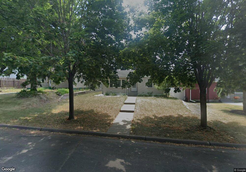
1210 Conway St Saint Paul, MN 55106
Dayton's Bluff NeighborhoodEstimated Value: $254,000 - $288,000
3
Beds
1
Bath
1,440
Sq Ft
$189/Sq Ft
Est. Value
About This Home
This home is located at 1210 Conway St, Saint Paul, MN 55106 and is currently estimated at $272,068, approximately $188 per square foot. 1210 Conway St is a home located in Ramsey County with nearby schools including Dayton's Bluff Achievement Plus Elementary School, Battle Creek Middle School, and Harding Senior High School.
Ownership History
Date
Name
Owned For
Owner Type
Purchase Details
Closed on
Jun 11, 2021
Sold by
Moua Opal
Bought by
New Kel and Yang Christina
Current Estimated Value
Home Financials for this Owner
Home Financials are based on the most recent Mortgage that was taken out on this home.
Original Mortgage
$228,000
Interest Rate
2.8%
Mortgage Type
New Conventional
Purchase Details
Closed on
Aug 18, 2019
Sold by
Moua Opal and Xiong April
Bought by
Moua Chang
Purchase Details
Closed on
Sep 20, 2018
Sold by
Quijada Franklin R Cartagena
Bought by
Moua Opal
Home Financials for this Owner
Home Financials are based on the most recent Mortgage that was taken out on this home.
Original Mortgage
$176,739
Interest Rate
4.5%
Mortgage Type
FHA
Create a Home Valuation Report for This Property
The Home Valuation Report is an in-depth analysis detailing your home's value as well as a comparison with similar homes in the area
Home Values in the Area
Average Home Value in this Area
Purchase History
| Date | Buyer | Sale Price | Title Company |
|---|---|---|---|
| New Kel | $245,000 | Titlesmart Inc | |
| Moua Chang | -- | None Available | |
| Moua Chang | -- | None Available | |
| Moua Opal | $180,000 | Lendserv National Title Inc |
Source: Public Records
Mortgage History
| Date | Status | Borrower | Loan Amount |
|---|---|---|---|
| Previous Owner | New Kel | $228,000 | |
| Previous Owner | Moua Opal | $176,739 |
Source: Public Records
Tax History Compared to Growth
Tax History
| Year | Tax Paid | Tax Assessment Tax Assessment Total Assessment is a certain percentage of the fair market value that is determined by local assessors to be the total taxable value of land and additions on the property. | Land | Improvement |
|---|---|---|---|---|
| 2025 | $3,644 | $254,500 | $30,500 | $224,000 |
| 2023 | $3,644 | $237,400 | $19,500 | $217,900 |
| 2022 | $3,170 | $244,600 | $19,500 | $225,100 |
| 2021 | $2,692 | $199,400 | $19,500 | $179,900 |
| 2020 | $2,986 | $186,900 | $19,500 | $167,400 |
| 2019 | $2,210 | $186,700 | $19,500 | $167,200 |
| 2018 | $1,864 | $138,300 | $19,500 | $118,800 |
| 2017 | $2,000 | $124,400 | $19,500 | $104,900 |
| 2016 | $1,688 | $0 | $0 | $0 |
| 2015 | $1,450 | $103,500 | $17,100 | $86,400 |
| 2014 | $1,288 | $0 | $0 | $0 |
Source: Public Records
Map
Nearby Homes
- 426 Griffith St
- 1183 Hancock St
- 1320 Wilson Ave
- 1076 Wilson Ave
- 1207 5th St E
- 1237 5th St E
- 1323 4th St E
- 1122 6th St E
- 1086 Margaret St
- 277 English St
- 986 Euclid St
- 980 3rd St E
- 449 Birmingham St
- 963 3rd St E
- 1160 Minnehaha Ave E
- 949 Conway St
- 1235 Minnehaha Ave E
- 1063 Burns Ave
- 503 Forest St
- 1150 Reaney Ave
- 1210 1210 Conway-Street-
- 1206 Conway St
- 1214 Conway St
- 1214 1214 Conway-Street-
- 1220 Conway St
- 458 Griffith St
- 1226 Conway St
- 1221 Euclid St
- 454 Griffith St
- 1207 Conway St
- 1203 1203 E Conway-Street-
- 1213 Conway St
- 1219 Conway St
- 1219 Conway St Unit 2
- 465 Griffith St
- 471 Griffith St
- 1215 Conway St
- 1215 1215 Conway-Street-
- 1230 Conway St
- 1230 1230 Conway-Street-