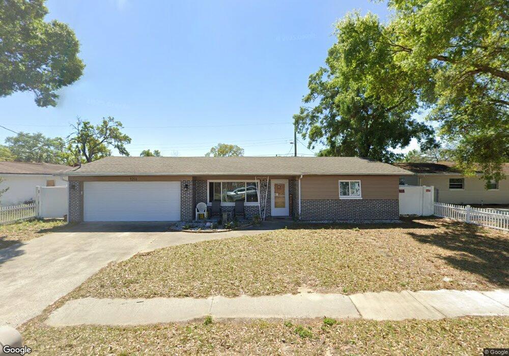
1216 Lorie Cir Brandon, FL 33510
Estimated Value: $278,000 - $352,000
3
Beds
2
Baths
1,952
Sq Ft
$165/Sq Ft
Est. Value
About This Home
This home is located at 1216 Lorie Cir, Brandon, FL 33510 and is currently estimated at $321,854, approximately $164 per square foot. 1216 Lorie Cir is a home located in Hillsborough County with nearby schools including Seffner Elementary School, Mann Middle School, and Brandon High School.
Ownership History
Date
Name
Owned For
Owner Type
Purchase Details
Closed on
Oct 27, 2014
Sold by
Riveiro Paula
Bought by
Marek Dayna
Current Estimated Value
Home Financials for this Owner
Home Financials are based on the most recent Mortgage that was taken out on this home.
Original Mortgage
$94,050
Outstanding Balance
$71,906
Interest Rate
4.26%
Mortgage Type
New Conventional
Estimated Equity
$249,948
Purchase Details
Closed on
Apr 9, 2001
Sold by
Payne Martha
Bought by
Payne Nancy Trust
Create a Home Valuation Report for This Property
The Home Valuation Report is an in-depth analysis detailing your home's value as well as a comparison with similar homes in the area
Home Values in the Area
Average Home Value in this Area
Purchase History
| Date | Buyer | Sale Price | Title Company |
|---|---|---|---|
| Marek Dayna | $99,000 | Insured Title Agency Llc | |
| Payne Nancy Trust | -- | -- |
Source: Public Records
Mortgage History
| Date | Status | Borrower | Loan Amount |
|---|---|---|---|
| Open | Marek Dayna | $94,050 |
Source: Public Records
Tax History
| Year | Tax Paid | Tax Assessment Tax Assessment Total Assessment is a certain percentage of the fair market value that is determined by local assessors to be the total taxable value of land and additions on the property. | Land | Improvement |
|---|---|---|---|---|
| 2025 | $1,545 | $105,211 | -- | -- |
| 2024 | $1,545 | $102,246 | -- | -- |
| 2023 | $1,472 | $99,268 | $0 | $0 |
| 2022 | $1,361 | $97,046 | $0 | $0 |
| 2021 | $1,333 | $94,219 | $0 | $0 |
| 2020 | $1,260 | $92,918 | $0 | $0 |
| 2019 | $1,178 | $90,829 | $0 | $0 |
| 2018 | $1,091 | $87,083 | $0 | $0 |
| 2017 | $1,063 | $103,375 | $0 | $0 |
| 2016 | $1,039 | $83,538 | $0 | $0 |
| 2015 | $1,049 | $82,957 | $0 | $0 |
| 2014 | $1,603 | $71,134 | $0 | $0 |
| 2013 | -- | $64,667 | $0 | $0 |
Source: Public Records
Map
Nearby Homes
- 1233 Lorie Cir
- 1012 N Parsons Ave
- 105 Rosier Rd
- 147 Melanie Ln
- 310 Terrace Dr
- 1001 Alpine Dr
- 401 Greenview Dr
- 1204 Branda Vista Dr
- 115 Morrow Cir
- 1305 Willow Valley Dr
- 310 W Windhorst Rd
- 1109 W Camellia Dr
- 228 Taylor Bay Ln
- 1404 Shadow Creek Place
- 3104 Apricot St
- 908 Skyview Dr
- 1006 Kenmore Dr
- 916 Tangelo Place
- 204 Circle Hill Dr
- 201 Lentz Rd
- 1218 Lorie Cir
- 1214 Lorie Cir
- 210 Terrace Dr
- 212 Terrace Dr
- 208 Terrace Dr
- 1211 Lorie Cir
- 1223 Lorie Cir
- 1220 Lorie Cir
- 214 Terrace Dr
- 206 Terrace Dr
- 1222 Lorie Cir
- 1209 Lorie Cir
- 1225 Lorie Cir
- 1203 N Parsons Ave
- 216 Terrace Dr
- 209 Terrace Dr
- 1224 Lorie Cir
- 211 Terrace Dr
- 1115 N Parsons Ave
- 204 Terrace Dr