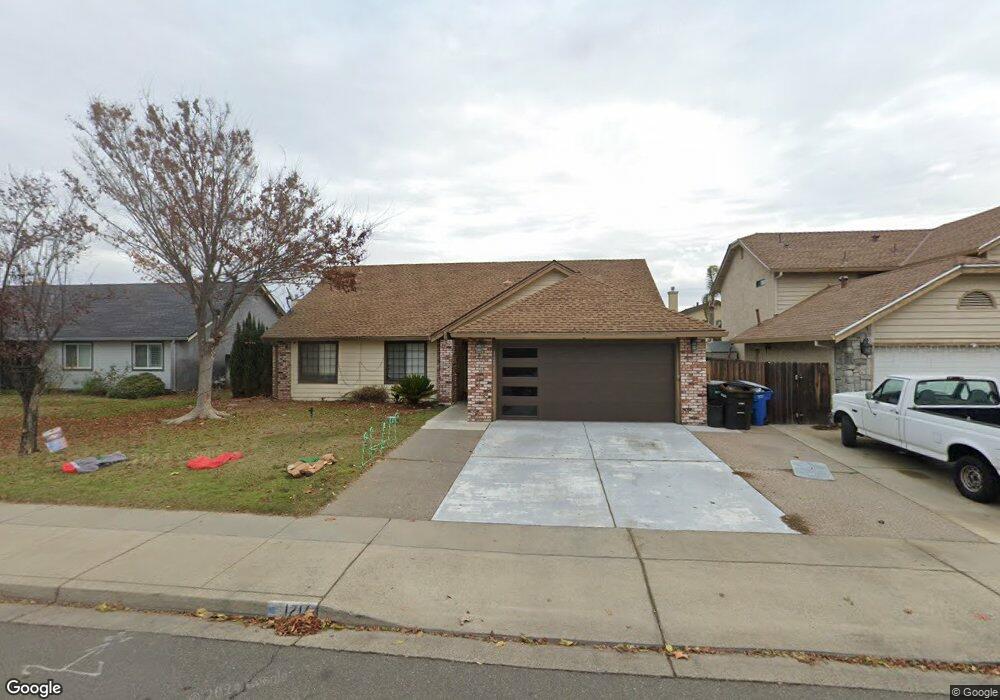
1216 Moffett Rd Modesto, CA 95351
Bystrom NeighborhoodEstimated Value: $340,000 - $492,000
4
Beds
2
Baths
1,893
Sq Ft
$227/Sq Ft
Est. Value
About This Home
This home is located at 1216 Moffett Rd, Modesto, CA 95351 and is currently estimated at $429,302, approximately $226 per square foot. 1216 Moffett Rd is a home located in Stanislaus County with nearby schools including Virginia Parks Elementary School, Mae Hensley Junior High School, and Ceres High School.
Ownership History
Date
Name
Owned For
Owner Type
Purchase Details
Closed on
Jul 31, 2025
Sold by
Sanders Brandi L
Bought by
Sanders Brandi L and Sanders Chuck B
Current Estimated Value
Home Financials for this Owner
Home Financials are based on the most recent Mortgage that was taken out on this home.
Original Mortgage
$92,592
Outstanding Balance
$92,194
Interest Rate
6.81%
Mortgage Type
FHA
Estimated Equity
$337,108
Purchase Details
Closed on
Jul 18, 2025
Sold by
Charles And Bonnie L Armond Family Trust and Imfeld Leslie F
Bought by
Sanders Brandi L
Home Financials for this Owner
Home Financials are based on the most recent Mortgage that was taken out on this home.
Original Mortgage
$92,592
Outstanding Balance
$92,194
Interest Rate
6.81%
Mortgage Type
FHA
Estimated Equity
$337,108
Purchase Details
Closed on
May 5, 2022
Sold by
Charles J And Bonnie L Armond Family Tru
Bought by
Barnett Brandi L
Create a Home Valuation Report for This Property
The Home Valuation Report is an in-depth analysis detailing your home's value as well as a comparison with similar homes in the area
Home Values in the Area
Average Home Value in this Area
Purchase History
| Date | Buyer | Sale Price | Title Company |
|---|---|---|---|
| Sanders Brandi L | -- | First American Title | |
| Sanders Brandi L | -- | First American Title | |
| Barnett Brandi L | -- | Strategic Legal Group Pc |
Source: Public Records
Mortgage History
| Date | Status | Borrower | Loan Amount |
|---|---|---|---|
| Open | Sanders Brandi L | $92,592 |
Source: Public Records
Tax History
| Year | Tax Paid | Tax Assessment Tax Assessment Total Assessment is a certain percentage of the fair market value that is determined by local assessors to be the total taxable value of land and additions on the property. | Land | Improvement |
|---|---|---|---|---|
| 2025 | $5,282 | $270,543 | $90,179 | $180,364 |
| 2024 | $7,479 | $472,341 | $171,666 | $300,675 |
| 2023 | $5,083 | $260,040 | $86,678 | $173,362 |
| 2022 | $5,057 | $254,942 | $84,979 | $169,963 |
| 2021 | $4,949 | $249,944 | $83,313 | $166,631 |
| 2020 | $4,817 | $247,382 | $82,459 | $164,923 |
| 2019 | $4,798 | $242,533 | $80,843 | $161,690 |
| 2018 | $4,736 | $237,778 | $79,258 | $158,520 |
| 2017 | $4,694 | $233,116 | $77,704 | $155,412 |
| 2016 | $4,639 | $228,546 | $76,181 | $152,365 |
| 2015 | $2,572 | $225,114 | $75,037 | $150,077 |
| 2014 | $2,443 | $214,000 | $40,000 | $174,000 |
Source: Public Records
Map
Nearby Homes
- 2511 E Hatch Rd
- 2509 E Hatch Rd
- 1017 Stillwater Ln
- 1409 Villa Way
- 1415 Villa Way
- 2605 Glasgow Dr
- 2845 E Hatch Rd Unit 78
- 2845 E Hatch Rd Unit 86
- 2845 E Hatch Rd Unit 84
- 2816 Canyon Dr
- 1645 Moffett Rd
- 1647 Moffett Rd
- 1210 Snow Ridge Ct
- 2409 Lavon Ln
- 1655 Moffett Rd
- 810 River Raft Ct
- 977 Canyon Dr
- 2644 Parkway
- 2300 Park East Dr
- 0 5th St
- 1212 Moffett Rd
- 1220 Moffett Rd
- 1213 Mcknight Ct
- 1209 Mcknight Ct
- 1217 Mcknight Ct
- 1209 Moffett Rd
- 1301 Moffett Rd
- 1205 Mcknight Ct
- 1205 Mcknight Ct
- 1205 Moffett Rd
- 1204 Moffett Rd
- 1300 Moffett Rd
- 1305 Moffett Rd
- 1303 Mcknight Way
- 1303 Mcknight Way
- 1201 Mcknight Ct
- 1208 Fruitridge Dr
- 1216 Mcknight Ct
- 1300 Fruitridge Dr
- 2524 Canyon Dr
Your Personal Tour Guide
Ask me questions while you tour the home.