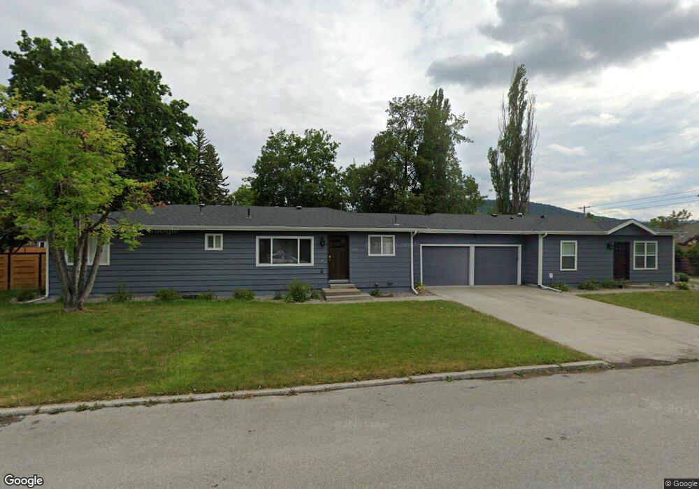
1220 4th St W Unit & 1222 Kalispell, MT 59901
Estimated Value: $489,000 - $647,000
5
Beds
1
Bath
1,984
Sq Ft
$283/Sq Ft
Est. Value
About This Home
This home is located at 1220 4th St W Unit & 1222, Kalispell, MT 59901 and is currently estimated at $562,408, approximately $283 per square foot. 1220 4th St W Unit & 1222 is a home located in Flathead County with nearby schools including Lillian Peterson School, Kalispell Middle School, and Flathead High School.
Ownership History
Date
Name
Owned For
Owner Type
Purchase Details
Closed on
Jan 27, 2022
Sold by
Iar Properties
Bought by
Oreilly Family Trust
Current Estimated Value
Purchase Details
Closed on
May 31, 2013
Sold by
Bogut Jeffrey Scott and Bogut Kary Ann
Bought by
Iar Properties
Home Financials for this Owner
Home Financials are based on the most recent Mortgage that was taken out on this home.
Original Mortgage
$168,000
Interest Rate
3.54%
Mortgage Type
New Conventional
Purchase Details
Closed on
May 9, 2013
Sold by
The Villas Llc
Bought by
Bogut Jeffrey Scott and Bogut Karyn A
Home Financials for this Owner
Home Financials are based on the most recent Mortgage that was taken out on this home.
Original Mortgage
$168,000
Interest Rate
3.54%
Mortgage Type
New Conventional
Purchase Details
Closed on
Mar 15, 2013
Sold by
Mowbray Carmine
Bought by
Gordon Gary N and Gordon Leslie D
Home Financials for this Owner
Home Financials are based on the most recent Mortgage that was taken out on this home.
Original Mortgage
$168,000
Interest Rate
3.54%
Mortgage Type
New Conventional
Purchase Details
Closed on
Mar 12, 2008
Sold by
Bank Of New York
Bought by
Villas Llc
Home Financials for this Owner
Home Financials are based on the most recent Mortgage that was taken out on this home.
Original Mortgage
$241,000
Interest Rate
7%
Mortgage Type
Credit Line Revolving
Purchase Details
Closed on
Sep 26, 2007
Sold by
Maxwell Donald C and Maxwell Allison A
Bought by
Bank Of New York
Purchase Details
Closed on
Nov 21, 2006
Sold by
The Villas Llc
Bought by
Maxwell Donald C and Maxwell Allison A
Home Financials for this Owner
Home Financials are based on the most recent Mortgage that was taken out on this home.
Original Mortgage
$34,400
Interest Rate
6.36%
Mortgage Type
Stand Alone Second
Purchase Details
Closed on
Sep 27, 2005
Sold by
Benson Frances M and Benson Barbara J
Bought by
The Villas Llc
Create a Home Valuation Report for This Property
The Home Valuation Report is an in-depth analysis detailing your home's value as well as a comparison with similar homes in the area
Home Values in the Area
Average Home Value in this Area
Purchase History
| Date | Buyer | Sale Price | Title Company |
|---|---|---|---|
| Oreilly Family Trust | -- | None Listed On Document | |
| Iar Properties | -- | None Available | |
| Bogut Jeffrey Scott | -- | Insured Titles | |
| Gordon Gary N | -- | None Available | |
| Villas Llc | -- | First American Title Company | |
| Bank Of New York | $149,106 | None Available | |
| Maxwell Donald C | -- | Stewart Title Flathead Count | |
| The Villas Llc | -- | None Available |
Source: Public Records
Mortgage History
| Date | Status | Borrower | Loan Amount |
|---|---|---|---|
| Previous Owner | Bogut Jeffrey Scott | $168,000 | |
| Previous Owner | Gordon Gary N | $110,000 | |
| Previous Owner | Villas Llc | $241,000 | |
| Previous Owner | Maxwell Donald C | $34,400 |
Source: Public Records
Tax History Compared to Growth
Tax History
| Year | Tax Paid | Tax Assessment Tax Assessment Total Assessment is a certain percentage of the fair market value that is determined by local assessors to be the total taxable value of land and additions on the property. | Land | Improvement |
|---|---|---|---|---|
| 2025 | $3,046 | $560,000 | $0 | $0 |
| 2024 | $4,196 | $538,800 | $0 | $0 |
| 2023 | $4,942 | $538,800 | $0 | $0 |
| 2022 | $2,973 | $296,000 | $0 | $0 |
| 2021 | $3,792 | $296,000 | $0 | $0 |
| 2020 | $3,604 | $263,800 | $0 | $0 |
| 2019 | $3,614 | $263,800 | $0 | $0 |
| 2018 | $3,466 | $240,000 | $0 | $0 |
| 2017 | $3,393 | $240,000 | $0 | $0 |
| 2016 | $2,885 | $218,300 | $0 | $0 |
| 2015 | $2,882 | $218,300 | $0 | $0 |
| 2014 | $3,017 | $139,040 | $0 | $0 |
Source: Public Records
Map
Nearby Homes
- 444 S Meridian Rd
- 514 9th Ave W
- 446 8th Ave W
- 417 8th Ave W
- 36 9th Ave W
- 446 7th Ave W
- 819 9th Ave W
- 824 8th St W
- 15 & 17 Appleway Dr
- 811 8th Ave W
- 901 7th Ave W
- 1000 W Idaho St
- 5 6th Ave W
- 10856 U S Highway 2 W
- 869 Foys Lake Rd
- 119 5th Ave W
- 132 Peaks View Loop
- 135 Lupine Dr
- 1215 Sunnyside Dr
- 1308 7th Ave W
- 1220 4th St W
- 1220 & 1222 4th St W
- 1222 4th St W
- 420 S Meridian Rd
- 340 S Meridian Rd
- 340 S Meridian Rd
- 430 S Meridian Rd
- 1230 4th St W
- 404 S Meridian Rd
- 415 S Meridian Rd
- 1128 4th St W
- 330 S Meridian Rd
- 1303 4th St W
- 1237 5th St W
- 1135 4th St W
- 1314 4th St W
- 1122 4th St W
- 1235 5th St W
- 0 S Meridian Rd
- NHN S Meridian Rd