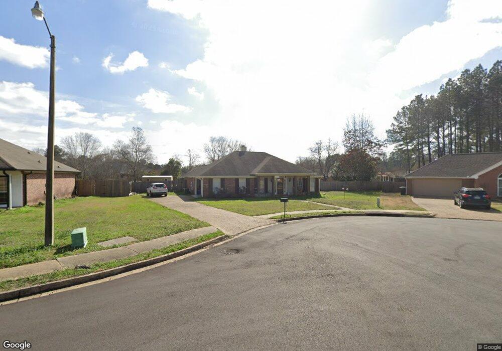
1222 Crossview Ct Brandon, MS 39042
Estimated Value: $245,000 - $279,000
3
Beds
2
Baths
1,592
Sq Ft
$167/Sq Ft
Est. Value
About This Home
This home is located at 1222 Crossview Ct, Brandon, MS 39042 and is currently estimated at $265,848, approximately $166 per square foot. 1222 Crossview Ct is a home located in Rankin County with nearby schools including Rouse Elementary School, Brandon Elementary School, and Stonebridge Elementary School.
Ownership History
Date
Name
Owned For
Owner Type
Purchase Details
Closed on
Feb 11, 2022
Sold by
Booker Leanthony L and Booker Brittney Aylse
Bought by
Whire Chassidy Lucinda
Current Estimated Value
Purchase Details
Closed on
Dec 2, 2019
Sold by
Riverbend Proeprties Llc
Bought by
Perry Brittney J and Perry Charles D
Home Financials for this Owner
Home Financials are based on the most recent Mortgage that was taken out on this home.
Original Mortgage
$177,088
Interest Rate
3.7%
Mortgage Type
New Conventional
Purchase Details
Closed on
Nov 29, 2010
Sold by
Boone
Bought by
Boone
Create a Home Valuation Report for This Property
The Home Valuation Report is an in-depth analysis detailing your home's value as well as a comparison with similar homes in the area
Home Values in the Area
Average Home Value in this Area
Purchase History
| Date | Buyer | Sale Price | Title Company |
|---|---|---|---|
| Whire Chassidy Lucinda | -- | New Title Company Name | |
| Perry Brittney J | -- | None Available | |
| Boone | -- | -- |
Source: Public Records
Mortgage History
| Date | Status | Borrower | Loan Amount |
|---|---|---|---|
| Previous Owner | Perry Brittney J | $177,088 |
Source: Public Records
Tax History Compared to Growth
Tax History
| Year | Tax Paid | Tax Assessment Tax Assessment Total Assessment is a certain percentage of the fair market value that is determined by local assessors to be the total taxable value of land and additions on the property. | Land | Improvement |
|---|---|---|---|---|
| 2024 | $1,916 | $16,981 | $0 | $0 |
| 2023 | $1,889 | $16,772 | $0 | $0 |
| 2022 | $1,864 | $16,772 | $0 | $0 |
| 2021 | $1,864 | $16,772 | $0 | $0 |
| 2020 | $1,864 | $16,772 | $0 | $0 |
| 2019 | $1,682 | $15,041 | $0 | $0 |
| 2018 | $1,652 | $15,041 | $0 | $0 |
| 2017 | $1,652 | $15,041 | $0 | $0 |
| 2016 | $1,476 | $14,706 | $0 | $0 |
| 2015 | $1,476 | $14,706 | $0 | $0 |
| 2014 | $1,445 | $14,706 | $0 | $0 |
| 2013 | -- | $14,706 | $0 | $0 |
Source: Public Records
Map
Nearby Homes
- 225 Burnham Rd
- 0 Asbury Lane Dr Unit 4124886
- 167 Woodgate Dr
- 79 Terrapin Dr
- 126 Asbury Square
- 110 Alex Seals Ln
- 69 Terrapin Dr
- 2022 S Cobblestone Cove
- 60 Summit Ridge Dr
- 446 Piney Dr
- 418 Piney Dr
- 155 Post Hill Rd
- 416 Piney Dr
- 0 Eldorado Cove Unit 4107565
- 406 Piney Dr
- 11 Terrapin Hill Rd S
- 116 Long Meadow Ct
- HOLLY Plan at The Hollows
- IRIS Plan at The Hollows
- DESTIN Plan at The Hollows
- 1224 Crossview Ct
- 1220 Crossview Ct
- 2005 Cross Point Cove
- 2007 Cross Point Cove
- 2003 Cross Point Cove
- 1218 Crossview Ct
- 1226 Crossview Ct
- 2009 Cross Point Cove
- 1223 Crossview Ct
- 2001 Cross Point Cove
- 1216 Crossview Ct
- 1228 Crossview Ct
- 1225 Crossview Ct
- 2011 Cross Point Cove
- 2004 Cross Point Cove
- 2020 Cross Point Cove
- 2002 Cross Point Cove
- 3001 Cross Point Cove
- 2006 Cross Point Cove
- 1227 Crossview Ct